
 Ελληνικά
 简体中文
 Deutsch
 English
 Français
 Español
 Nederlands
 Svenska
 Italiano
 日本語
 Polski
 Português
 Русский
 العربية
 Türkçe

Live
 16:45:23
 17.1°C / 62.8°F
 Καθαρός ουρανός
 59%
 11 χλμ/ώρα / 7 μίλια/ώρα
 06:37
 16:53
Φόρτωση πρόβλεψης…

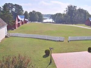
Πάρκο του Κάστρου Γουίνδσορ, Σμίθφιλντ, Βιρτζίνια, ΗΠΑ
 19.6°C / 67.3°F
16:45

King Street, Παλιά Πόλη της Αλεξάνδρειας, Βιρτζίνια, ΗΠΑ
19.5°C / 67.1°F
16:45
Πανεπιστήμιο Κρίστοφερ Νιούπορτ, Νιούπορτ Νιουζ, Βιρτζίνια
20.5°C / 68.9°F
16:45
Χιονοδρομικό Κέντρο Wolf Creek, US 160, Pagosa Springs, CO, ΗΠΑ
5.8°C / 42.4°F
14:45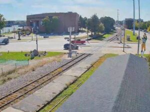
Γκριν Μπέι, Περιοχή Μπρόντγουεϊ, Ουισκόνσιν, ΗΠΑ
 8.7°C / 47.7°F
15:45

Πολιτειακό Πανεπιστήμιο του Όρεγκον, Κορβάλις, Όρεγκον, ΗΠΑ
19.1°C / 66.4°F
13:45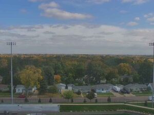
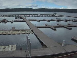


Χιονοδρομικό Κέντρο Χάιλαντ Χιλς, Chalet Road, Μπλούμινγκτον, Μινεσότα, ΗΠΑ
 11.8°C / 53.2°F
15:45

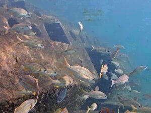
Πομπάνο Μπιτς, Χίλσμπορο Ινλέτ, Φλόριντα, ΗΠΑ
27.9°C / 82.2°F
16:45
Πανεπιστήμιο South Dakota Mines, Ράπιντ Σίτι, Νότια Ντακότα, ΗΠΑ
17.9°C / 64.2°F
14:45
The Chincoteague Webcam looks across Robert Reed Waterfront Park in the heart of downtown Chincoteague, Virginia, to Chincoteague Channel and the long Route 175 bridge that brings traffic onto the island. A broad lawn fills the middle of the frame. Boats tie up at the park’s docks on the left, a brick walkway and a black lamp post run along the right, and the buildings at the right edge stand on the Main Street side of the park. The park sits on the island’s western shore, so late afternoons bring low sun across the water, and boats can come and go from the slips at any hour of the day. In the weeks before the holidays a tall Christmas tree topped with a star stands on the lawn, and the lamp posts wear garlands and red bows.
Chincoteague is a town of 3,344 people (2020 census) on Chincoteague Island, on Virginia’s Eastern Shore. The island is low, with the town standing about 1 meter (3 feet) above sea level, and it is the gateway to Assateague Island next door, where most visitors head for the wildlife refuge, the lighthouse and the beach. The camera’s park carries the full name Robert N. Reed, Sr. Downtown Waterfront Park. It came out of a downtown revitalization for which the town gathered nearly $1.7 million in grants and local matches, and it now serves as the setting for festivals and events. Its docks hold 10 transient slips for boats from 8 to 15 meters (26 to 50 feet) long, with about 3 meters (10 feet) of water alongside.
The bridge on the horizon of the Chincoteague Webcam crosses Chincoteague Channel about half a kilometer (a third of a mile) north of the park. Opened in 2010, it runs more than 1,200 meters (4,000 feet) and has a single-leaf bascule span that lifts to let boats through the navigation channel. It replaced a 1940 swing drawbridge that crossed the channel downtown and was demolished once the new bridge was finished. Part of the old crossing survives: the town built a 47-meter (154-foot) wooden fishing pier on the old bridge’s concrete fender at the end of Bridge Street, near the park.
Chincoteague is known above all for its ponies. Pony Penning has been held every year since 1925, and the 1947 children’s novel Misty of Chincoteague is set among the island’s herd.
NOAA’s 1991 to 2020 normals for nearby Wallops Island give a good picture of the year. January is the coldest month, with highs around 8°C (46°F) and lows near -1°C (30°F). By early November the grass in front of the camera has already faded to tan, and it stays that way through the cold months. April warms to highs of about 18°C (64°F) with lows of 8°C (46°F). July brings highs near 30°C (86°F) and average lows of 21°C (70°F), the season when the lawn is green and the slips are at their busiest.
October cools to highs of about 21°C (69°F) and lows near 11°C (51°F). The Atlantic hurricane season runs from June 1 to November 30, and on an island this low a tropical storm or a winter nor’easter can bring high water and strong wind to the waterfront. On calm days the channel lies flat behind the docks. In the afternoon, shadows from the buildings behind the camera stretch across the brick walkway and creep onto the lawn as the day goes on.
Most visitors cross to Assateague Island, where the Chincoteague National Wildlife Refuge, established in 1943, covers about 57 square kilometers (14,000 acres). The Herbert H. Bateman Educational and Administrative Center, opened in 2003, has exhibits on the refuge’s history, plants and animals. The brick Assateague Lighthouse, finished in 1867, stands within the refuge, which preserves the tower while the Coast Guard keeps the light running. The refuge’s most popular spot is a 1.6-kilometer (1-mile) undeveloped beach managed by the National Park Service, with parking for nearly 1,000 vehicles. A herd of about 150 ponies grazes inside fenced areas on the Virginia end of the island.
The Pony Swim takes place on the last Wednesday and Thursday in July. On the Wednesday the Saltwater Cowboys drive the ponies across Assateague Channel to Veterans Memorial Park, about 2 kilometers (1.2 miles) south of this camera, and on to pens at the Carnival Grounds. The Chincoteague Volunteer Fire Company auctions some of the foals on the Thursday, and the herd swims home on the Friday. Closer to the park, the fishing pier at the end of Bridge Street is open for fishing, and the island’s own tourism site lists boat tours, fishing charters and rocket launches from NASA’s Wallops Flight Facility among its activities. Wallops is the launch site for Antares rockets and the Cygnus cargo craft.
More waterfront and town cameras from Virginia and the Mid-Atlantic coast:
Chincoteague is on Chincoteague Island on Virginia’s Eastern Shore, between the mainland and Assateague Island on the Atlantic coast. Ocean City, Maryland, lies about 52 kilometers (32 miles) to the north-east in a straight line, and the Route 175 bridge links the island to the mainland.
The camera shows the lawn of Robert Reed Waterfront Park, the docks and boats on its left side, Chincoteague Channel, the Route 175 bridge on the horizon and the buildings on the Main Street side of the park.
Winters are cool, with January highs around 8°C (46°F) and lows near -1°C (30°F). Summers are warm, with July highs near 30°C (86°F). Spring and autumn are mild, and the hurricane season runs from June to November.
The swim is held on the last Wednesday in July, followed by the foal auction on the Thursday and the return swim to Assateague on the Friday. Pony Penning has taken place every year since 1925.
Not usually. The ponies live on Assateague Island, and the swim lands at Veterans Memorial Park, about 2 kilometers (1.2 miles) south of the camera and out of its view.
Yes. The park has 10 transient slips for boats from 8 to 15 meters (26 to 50 feet) long, with about 3 meters (10 feet) of water at the dock and restrooms on site. Rates and availability are given by phone.
By road, Route 175 runs out from the mainland and reaches the island over the bridge on the horizon of this camera, which opened in 2010. Its drawbridge span lifts for boat traffic on the channel.
Source: Chincoteague.com
Οι καλύτερες νέες ζωντανές κάμερες web και οι λειτουργίες του ιστότοπου, μία φορά την εβδομάδα.
Με την εγγραφή σας συμφωνείτε να λαμβάνετε το εβδομαδιαίο email μας. Μπορείτε να καταργήσετε την εγγραφή σας ανά πάσα στιγμή.