Ελληνικά
 简体中文
 Deutsch
 English
 Français
 Español
 Nederlands
 Svenska
 Italiano
 日本語
 Polski
 Português
 Русский
 العربية
 Türkçe
Live
 11:10:14
 6.7°C / 44.1°F
 Καθαρός ουρανός
 68%
 19 χλμ/ώρα / 12 μίλια/ώρα
 06:37
 16:02
Φόρτωση πρόβλεψης…
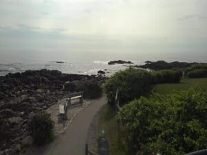
The Mount Katahdin Webcam looks out from the Twin Pine Cabins at the New England Outdoor Center, on the shore of Millinocket Lake in Maine’s North Woods, toward the mountain whose Penobscot name means “The Greatest Mountain”. Open water fills the lower half of the picture and runs to a low wooded shore, with a wooded island right of center and a pine bough hanging into the top left corner. The Katahdin massif stands beyond the trees, about 21 kilometers (13 miles) away. Low cloud can hide the upper mountain completely, leaving only the lake, the islands and the lower ridges in view. A second camera at the same spot faces north for stars, meteors and the occasional aurora, and both streams print the current temperature and wind along the bottom of the picture.
Katahdin is the highest mountain in Maine, reaching 1,606 meters (5,269 feet) at Baxter Peak, with a topographic prominence of 1,307 meters (4,288 feet). It is a granite massif with four glacial cirques cut into its sides, and the Knife Edge, a narrow arete, links Baxter Peak with Pamola Peak to the east. Baxter Peak is the northern end of the Appalachian Trail, and the mountain is the centerpiece of Baxter State Park, the more than 200,000 acres (810 square kilometers) that Governor Percival Baxter gave to the State of Maine. The National Park Service named Katahdin a National Natural Landmark in 1967. Henry David Thoreau climbed it in the 1840s and wrote about “Ktaadn” in The Maine Woods.
Millinocket Lake, the water in the foreground, covers 3,469 hectares (8,571 acres) and is about 8 kilometers (5 miles) long, with a maximum depth of 26 meters (86 feet). Its surface sits at 146 meters (478 feet), so the summit stands roughly 1,460 meters (4,790 feet) above the lake the camera looks across. Many small islands are scattered through its shallower parts. Sandy Stream, which drains the southeastern slopes of Katahdin, feeds the lake, and Millinocket Stream carries its water south through the town of Millinocket to the West Branch of the Penobscot River.
The town itself grew around paper. Settled in 1829, Millinocket was incorporated in 1901 after the Great Northern Paper Company began building its mill in 1899, and the mill closed in 2008. The town had 4,114 residents in the 2020 census, and the outdoor center is about 13 kilometers (8 miles) north-northwest of it. The stream comes from Boston and Maine Live, a YouTube channel that runs cameras across Maine and Massachusetts.
Winters around Millinocket are long and cold. NOAA’s 1991 to 2020 normals for the town give a January high of -5°C (24°F) and a low of -15°C (5°F), with about 219 centimeters (86 inches) of snow a year and 1,152 millimeters (45 inches) of total precipitation. In the coldest months the lake usually freezes and the shoreline pines carry snow, while the summit, far higher and more exposed, is colder and windier than anything the lakeside thermometer shows. Spring is slow to arrive: April averages a high of 10°C (50°F) and a low of -1°C (30°F).
July is the warmest month, with highs around 26°C (79°F) and lows near 14°C (57°F), and October cools to a high of 13°C (55°F) and a low of 3°C (37°F). On still mornings the lake turns glassy and mirrors the far shore and the clouds, while windier days ripple the surface. The cloud ceiling decides what the Mount Katahdin Webcam shows: a ceiling of low cloud can sit on the massif for a whole day, and the full mountain appears when it lifts. The north-facing night camera works best on clear, moonless nights.
Baxter State Park holds the trails up the mountain. The Hunt Trail climbs Katahdin from Katahdin Stream as the final stretch of the Appalachian Trail, the Abol Trail starts at the Abol trailhead, and the Helon Taylor Trail starts at Roaring Brook. The outdoor center’s Basecamp campground, with tent sites, canvas cabin tents and a bunkhouse, is about 3 kilometers (2 miles) from the park. Nearby Katahdin Woods and Waters National Monument became an International Dark Sky Sanctuary in May 2020, the first on the US East Coast, and the Friends of Katahdin Woods and Waters hold an annual Stars Over Katahdin event.
At the New England Outdoor Center itself, River Drivers Restaurant looks straight across Millinocket Lake to Katahdin, and Knife Edge Brewing pours craft beer alongside wood-fired pizza. Lodging runs from the Twin Pines cabins on the lakeshore to the Coveside Ecolodges. The center’s guided trips include whitewater rafting, scenic wildlife tours, hiking, mountain biking, fishing and snowmobiling, and its activity calendar runs year-round.
These cameras look at more of Maine’s lakes, hills and coast.
Mount Katahdin is in Baxter State Park in Piscataquis County, northern Maine, about 40 kilometers (25 miles) northwest of the town of Millinocket. The camera stands on the shore of Millinocket Lake at the New England Outdoor Center, roughly 21 kilometers (13 miles) south-southeast of the summit.
The main camera looks across Millinocket Lake to a wooded far shore and a wooded island, with the Katahdin massif beyond when cloud allows and a pine bough in the top left corner. The second camera faces north from the same shore, framed by tall pines on the left and a lone pine on a rocky point on the right, and adds an on-screen panel of space weather readings such as the Kp index.
Katahdin rises about 1,460 meters (4,790 feet) above the lake and can catch low cloud, so the upper mountain can disappear for hours or a whole day while the lake stays in view. The mountain comes back into sight when the cloud lifts.
At lake level, Millinocket averages a January high of -5°C (24°F) and a July high of 26°C (79°F), with about 219 centimeters (86 inches) of snow a year. The summit is much colder and windier than the lakeshore.
Baxter Peak, the highest point, reaches 1,606 meters (5,269 feet), which makes Katahdin the tallest mountain in Maine.
Yes. Baxter Peak is the northern terminus of the Appalachian Trail, and northbound hikers finish by climbing the Hunt Trail from Katahdin Stream.
Sometimes, when strong geomagnetic activity pushes the aurora far enough south. The area has very dark skies, and Katahdin Woods and Waters National Monument is an International Dark Sky Sanctuary. The north-facing night camera at Millinocket Lake is billed as a stars, aurora and meteors camera, and its on-screen panel tracks the Kp index that aurora watchers follow.
Πηγή: Boston and Maine Live
Οι καλύτερες νέες ζωντανές κάμερες web και οι λειτουργίες του ιστότοπου, μία φορά την εβδομάδα.
Με την εγγραφή σας συμφωνείτε να λαμβάνετε το εβδομαδιαίο email μας. Μπορείτε να καταργήσετε την εγγραφή σας ανά πάσα στιγμή.