 简体中文
 Deutsch
 English
 Français
 Español
 Nederlands
 Svenska
 Italiano
 日本語
 Polski
 Português
 Русский
 Ελληνικά
 العربية
 Türkçe
直播
 10:10:45
 12.4°C / 54.3°F
 阴天
 93%
 24 km/h / 15 mph
 07:06
 16:57
正在加载天气预报…
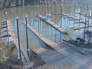
The Chetco River Bar Webcam looks down the last stretch of the Chetco River at Brookings, on Oregon’s south coast, to the gap where the river leaves the Port of Brookings Harbor and meets the Pacific Ocean. Two rock jetties frame the channel, and the bar lies between their tips, where the river’s outflow runs into the incoming swell. On a quiet day the water through the entrance is flat and gray. In a winter swell, white water bursts over the jetty ends and breakers can line up across the bar. Fishing boats and recreational craft come and go through this gap, so the scene shifts with the tide and the season as much as with the weather.
The Chetco River runs 90 kilometers (56 miles) from the Kalmiopsis Wilderness to the sea, and its upper 72 kilometers (45 miles) have been designated Wild and Scenic since 1988. It becomes an estuary about 2.7 kilometers (1.7 miles) from its mouth and empties into the ocean between Brookings and the neighboring community of Harbor, roughly 10 kilometers (6 miles) north of the California state line. The port’s harbor sits just inside the entrance, and Coast Guard Station Chetco River operates from the Brookings boat basin.
The bar itself is what sets this harbor apart. Most Oregon river bars face due west, but the Chetco bar opens to the south, with Chetco Point giving it extra shelter, and it is often called the most passable bar on the Oregon coast. That helps explain why the port is described as the busiest recreational port on the coast and one of its most active harbors for Chinook salmon. Crossings can still turn dangerous when an ebb tide runs out against a southerly swell, which is why boaters are advised to come in on the flood or the early ebb.
Brookings began as a company town. The Brookings Lumber and Box Company founded it in 1908 and built a deep-water harbor here in 1912, and a 366-meter (1,200-foot) wharf went up at the river mouth in 1917. Voters created the port district at a special election in 1956. On March 11, 2011, surges of nearly 2.4 meters (8 feet) from the Tohoku earthquake tsunami swept through the harbor, wrecking docks and sinking boats. The port reopened on March 22, the day the last sunken boat was raised from the harbor floor.
Brookings has a mild climate with small swings between seasons. NOAA’s 1991 to 2020 normals put January at about 12°C (54°F) by day and 6°C (44°F) at night, while July averages 19°C (67°F) and 12°C (53°F). April highs reach about 14°C (58°F) and October highs about 17°C (63°F). Rain defines the year: about 1,970 millimeters (77.6 inches) falls on average, roughly half of it from November to January, when each month brings 280 to 360 millimeters (11 to 14 inches). July gets barely 10 millimeters (0.4 inches), and snow is rare at under 2 centimeters (0.7 inches) a year.
Winter storms bring the roughest water on camera, with breakers across the entrance and spray over the jetties, and short days of about 9 hours of daylight around the December solstice. Late June brings about 15 hours of daylight and the driest weather of the year. The town is also known for the Chetco Effect, sometimes called the Brookings Effect: warm, dry winds funneled down the Chetco River canyon can push temperatures near the river mouth far above the rest of the coast. Brookings set its all-time record of 42°C (108°F) on July 8, 2008, when Crescent City, about 48 kilometers (30 miles) south, reached only 20°C (68°F).
Chetco Point Park, near the wharf, has fire rings, picnic tables and views over the river, the ocean and the port. Just north of town on US Highway 101, Harris Beach State Park looks out to Bird Island, also known as Goat Island, which is reported to be the largest island off the Oregon coast. It is a national wildlife refuge and a breeding site for tufted puffins, and the park campground has RV sites, yurts and tent sites open all year. The port also hosts festivals, including the Pirates of the Pacific Festival.
Upriver, Alfred A. Loeb State Park sits on the banks of the Chetco with cabins, campsites, a drift boat launch and a 1.2-kilometer (0.75-mile) trail that includes the northernmost coastal redwood grove in the United States. North of town, the Samuel H. Boardman State Scenic Corridor runs 19 kilometers (12 miles) along the coast, starting about 5 kilometers (3 miles) north of Brookings. The Oregon Coast Trail threads through it among 300-year-old Sitka spruce, past natural arches and bridges, with about 130 rocks and islands offshore. Its Indian Sands site has yielded evidence of people on this coast 10,000 to 12,000 years ago.
For more of the Oregon coast and other working harbors, try these cameras.
The bar is at the mouth of the Chetco River on the southern Oregon coast, between Brookings and Harbor in Curry County. It is about 10 kilometers (6 miles) north of the California state line, and Crescent City, California, lies about 48 kilometers (30 miles) to the south.
The camera looks down the river channel to the harbor entrance, with a rock jetty on each side and the open Pacific beyond. Boats crossing the bar, surf breaking on the jetty tips and passing weather fronts are the main things that change through the day.
The camera shows what the water is doing, but it is not an official notice. Bar restrictions come from Coast Guard Station Chetco River, which warns of hazardous conditions on VHF channel 16 and lights the Rough Bar sign with flashing amber lights at its station in the boat basin.
Most Oregon river bars face due west into the open ocean. The Chetco bar faces south and sits in the lee of Chetco Point, which gives it more shelter and a reputation as the most passable bar on the coast.
Mild and wet. Winter days average about 12°C (54°F) and summer days about 19°C (67°F), with about 1,970 millimeters (77.6 inches) of rain a year, roughly half of it between November and January.
A local warm wind. Dry air descending from the interior is funneled down the Chetco River canyon, which can make Brookings far warmer than nearby coastal towns.
The Port of Brookings Harbor, the port authority for Brookings and Harbor, publishes the camera on its website. The port district was created in 1956 and is governed by a five-member commission elected by district voters.
Source: Port of Brookings Harbor
每周一次,为您带来最新最棒的实时网络摄像头和网站功能。
订阅即表示您同意接收我们的每周电子邮件。您可以随时取消订阅。

 12.7°C / 54.9°F
 5.3°C / 41.5°F
 1.9°C / 35.4°F