
 Nederlands
 简体中文
 Deutsch
 English
 Français
 Español
 Svenska
 Italiano
 日本語
 Polski
 Português
 Русский
 Ελληνικά
 العربية
 Türkçe

Live
 11:27:40
 10.3°C / 50.5°F
 Onbewolkt
 62%
 11 km/h / 7 mph
 07:15
 17:37
Weersverwachting laden…


Crawfordsville, Montgomery County, Indiana, Verenigde Staten
8.5°C / 47.3°F
11:27
E.J. and E. Griffith Interlocking Tower, East Avenue A, Griffith, IN, VS
6.8°C / 44.2°F
10:27
Duke Farms, Dukes Parkway West, Hillsborough Township, NJ, VS
 13.3°C / 55.9°F
11:27
Bolton Valley Resort, Bolton Access Rd, Richmond, VT, VS
4.1°C / 39.4°F
11:27


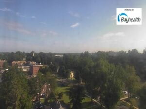
Bayhealth Hospital, Kent Campus, South State Street, Dover, DE, VS
13.6°C / 56.5°F
11:27
Inlet Reef, Holiday Isle, Destin, Florida, Verenigde Staten
18.3°C / 64.9°F
10:27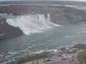
American Falls, Niagara Falls, New York, VS
8.7°C / 47.7°F
11:27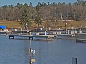
Madeline Island Yacht Club Inc., Fort Road, La Pointe, WI, Verenigde Staten
5.3°C / 41.5°F
10:27The Jeffersonville Webcam looks across the Ohio River from the Indiana bank to downtown Louisville, Kentucky, on the far shore. StreamTime LIVE runs the camera from Upland Jeffersonville, a riverside restaurant whose patio faces the Louisville skyline, and its main shot frames the pale yellow trusses of the George Rogers Clark Memorial Bridge reaching in from the right toward the city. Wide brown water fills the lower half of the picture, office towers and the curved roof of the KFC Yum! Center rise behind the bridge, and white riverboats can be seen moored along the Kentucky bank. Low morning sun can light the bridge while the towers behind it are still in shade, and passing boats can be named on the MarineTraffic map linked from the stream’s description.
Jeffersonville is the county seat of Clark County, Indiana, and had 49,447 residents at the 2020 census. It was named for Thomas Jefferson in 1801, the year he took office, and its riverfront faces Louisville directly across the Ohio. Louisville was founded in 1778 by George Rogers Clark, the man the bridge in this view is named for. Just downstream, the Falls of the Ohio were the only major obstruction to boats between the upper river and the Gulf of Mexico, and Louisville first grew as a portage site around them.
The George Rogers Clark Memorial Bridge, which locals call the Second Street Bridge, is a cantilevered truss bridge that opened to the public on October 31, 1929. It carries four lanes of US 31 over a total length of 1,751.5 meters (5,746.5 feet), and it was added to the National Register of Historic Places in 1984 as the Louisville Municipal Bridge. On camera its trusses run from the right edge of the frame to the Louisville bank, where the bridge comes down beside the arena. Jeffersonville built boats for nearly two centuries: James Howard launched his first steamboat, the Hyperion, here in 1834, and until 2018 the city was home to Jeffboat, the largest inland shipbuilder in the United States.
The river has not always stayed between its banks. In the Great Flood of January 1937 the Ohio crested at Louisville at a record 17.42 meters (57.15 feet), and in Jeffersonville a levee failed and about 90 percent of the city went under water. The camera went live on April 4, 2025, according to StreamTime LIVE, and Upland Jeffersonville sponsors it. It is a pan-tilt-zoom camera, and the figures in the top right corner of the stream give its current direction and zoom. Its main view is the river, bridge and skyline, but it also turns inland toward a parking lot and the buildings along the Jeffersonville side, or zooms in close, so the player does not always show the river.
Jeffersonville shares Louisville’s humid subtropical climate. January is the coldest month, with a mean temperature of 1.6°C (34.9°F); daytime highs average about 6°C (43°F) and nights drop to around -3°C (27°F). Louisville averages 32 centimeters (12.7 inches) of snow a year, and a few days of snow can usually be expected in January and February. The first freeze of the season comes around November 2 on average and the last around April 5, so a winter morning on the Jeffersonville Webcam can mean a gray river under low cloud.
Summers are hazy, hot and humid. July highs average about 31°C (87°F) with nights near 21°C (70°F), and Louisville sees about 38 days a year at or above 32°C (90°F). Spring and summer are the wettest seasons, with April the rainiest month of the last decade at around 138 millimeters (5.4 inches), and severe storms, including occasional tornado outbreaks, are part of the regional pattern. Summer haze can soften the towers across the water, and on clearer days the skyline reads from the domed tower in the middle of the frame to the dark office blocks on either side of it.
The Big Four Bridge is the easiest way across the river on foot. Built as a railroad bridge in 1895, it was converted into a walking and cycling bridge, a project completed in 2014, and its Jeffersonville end lands at Big Four Station Park, with green space, fountains, a pavilion and a playground. A bike route from the foot of the bridge runs about 8 kilometers (5 miles) to Falls of the Ohio State Park in Clarksville, which protects 390-million-year-old fossil beds. Its interpretive center commemorates the Lewis and Clark Expedition, which Meriwether Lewis and William Clark organized at the falls in 1803.
In downtown Jeffersonville, Schimpff’s Confectionery has been making candy since 1891 and offers candy-making demonstrations and a candy museum. The Howard Steamboat Museum fills a 22-room mansion with models, photographs, paintings and other artifacts from the town’s shipbuilding past. Upland Jeffersonville, the camera’s sponsor, pours Upland Brewing beers from 20 taps and has a tri-level patio over the river, and downtown Louisville is a short drive away over the Clark Memorial Bridge.
More river views from Indiana and further up the Ohio:
The camera is at Upland Jeffersonville, a restaurant on West Riverside Drive in Jeffersonville, Clark County, Indiana. It sits on the north bank of the Ohio River, directly across from downtown Louisville, Kentucky.
The main view takes in the Ohio River, the George Rogers Clark Memorial Bridge and the downtown Louisville skyline, including the KFC Yum! Center beside the bridge’s Kentucky end and riverboats moored on the far bank. The camera can also pan inland or zoom in on details.
It is the George Rogers Clark Memorial Bridge, also called the Second Street Bridge. The cantilevered truss bridge opened in 1929 and carries US 31 between Jeffersonville and Louisville.
Winters are cool, with January highs around 6°C (43°F) and some snow most years. Summers are hot and humid, with July highs near 31°C (87°F). Spring and summer bring the most rain and the strongest storms.
It is a pan-tilt-zoom camera. Besides the skyline view it can turn toward the Jeffersonville side or zoom in tight, and the readout in the top right corner shows where it is pointing.
Yes. The Big Four Bridge, a former railroad bridge from 1895, now carries people on foot and by bike between Big Four Station Park in Jeffersonville and downtown Louisville.
A bike route from the Big Four Bridge runs about 8 kilometers (5 miles) to the park in neighboring Clarksville, which protects 390-million-year-old fossil beds.
Bron: StreamTime LIVE
De beste nieuwe live webcams en sitefuncties, één keer per week.
Door je aan te melden, ga je akkoord met het ontvangen van onze wekelijkse e-mail. Je kunt je op elk moment afmelden.
 -0.3°C / 31.5°F