
 Polski
 简体中文
 Deutsch
 English
 Français
 Español
 Nederlands
 Svenska
 Italiano
 日本語
 Português
 Русский
 Ελληνικά
 العربية
 Türkçe

Live
 13:19:22
 -12.3°C / 9.9°F
 Zachmurzenie całkowite
 84%
 9 km/h / 6 mph
 07:27
 16:45
Ładowanie prognozy…




Ninepipes Lodge, Mission Valley, Montana, USA
-0.5°C / 31.1°F
13:19
Elk Mountain, hrabstwo Susquehanna, Pensylwania, USA
13.2°C / 55.8°F
15:19
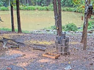
Critter Cove, Piedmont Triad, Karolina Północna, USA
 14.5°C / 58.1°F
15:19


The Cooke City Webcam looks southwest across the main street of Cooke City, Montana, to the steep north face of Republic Mountain. The camera is mounted at the Cooke City Sinclair, the fuel stop and general store at 115 Main Street East, and the stream carries a credit to the Upper Yellowstone Snowmobile Club, which sponsors it. A row of wooden buildings with snow-covered roofs lines the far side of the road, two tall evergreens stand in the right half of the picture, and the mountain fills the sky behind them. The snow on those roofs is a quick check on conditions before a drive to Yellowstone’s Northeast Entrance or a day on the trails. A clock in the top left corner shows local Mountain Time.
Cooke City sits at about 2,320 meters (7,600 feet) in the valley of Soda Butte Creek, on US 212, the Beartooth Highway, just outside the northeast corner of Yellowstone National Park. It counted 77 residents at the 2020 census, and the town takes its name from Jay Cooke, the financier of the Northern Pacific Railroad. The hamlet of Silver Gate lies about 5 kilometers (3 miles) to the west, closer to the park boundary. Tourism is the main industry, with skiing and snowmobiling carrying the town through winter.
The mountain in the frame is Republic Mountain, 3,097 meters (10,162 feet) high and about 1.6 kilometers (1 mile) southwest of town. Its north face climbs more than 790 meters (2,600 feet) above Cooke City in that single mile. Dark conifer forest covers the lower slopes, with snow-filled gullies and rock bands above. The peak belongs to the Absaroka Range and stands inside the North Absaroka Wilderness of Shoshone National Forest, on the Wyoming side of the state line. The U.S. Board on Geographic Names adopted the name Republic Peak in 1930 and changed it to Republic Mountain in 1959.
The store under the camera lists daily hours of 7:00 a.m. to 7:30 p.m. on its website, with the pumps open around the clock, and sells coffee, fresh doughnuts, groceries and backpacking food. The current YouTube broadcast has been running since November 2023.
Cooke City is often called the snowiest community in Montana, and its winters back that up. The weather station about 3.2 kilometers (2 miles) west of town averages 541 centimeters (213 inches) of snow a year. January averages a high of -4.3°C (24°F) and a low of -14.6°C (6°F), and the record low is -46°C (-51°F). On the camera, expect deep snow on the roofs, high banks along the road and the mountain disappearing behind falling snow on stormy days. In late November the midday sun sits low in the southern sky and shows up in the upper left of the picture, so the mountain face is backlit around noon.
Summer is short and cool. July highs average 23.2°C (74°F) and nights drop to around 3.8°C (39°F), and only two months of the year average above 10°C (50°F). The Beartooth Highway east of town usually opens in late May and closes again in mid October, and the camera follows that rhythm. Through early summer the snow typically retreats up the face of Republic Mountain, leaving dark forest and gray rock, and traffic on the main street picks up once the pass is open. The first lasting snow of autumn turns the scene white again.
Yellowstone starts just west of town. The road from the Northeast Entrance runs through Lamar Valley and Tower Junction to Mammoth and the North Entrance at Gardiner, and it is the only road in the park that stays open to cars all year, though snow tires or chains may be required in winter. Heading east in summer, US 212 climbs over Colter Pass at 2,450 meters (8,040 feet) and then up to 3,337 meters (10,947 feet) in the Beartooth Mountains before dropping down to Red Lodge. In summer, hikers can follow the Republic Pass trail to a 3,042-meter (9,979-foot) pass in the same high country.
Winter is snowmobile season, and the sponsor in the corner of the stream is part of it. The Daisy Pass and Lulu Pass route is a cooperative effort between the Upper Yellowstone Snowmobile Club and Montana Fish, Wildlife and Parks, with about 16 kilometers (10 miles) of marked and groomed trail, though the stretch between the two passes is not groomed. Shorter loops include the Miller Loop and the Soda Butte Loop, and east of town the Soda Butte trail follows the closed highway about 4 kilometers (2.5 miles) to Pilot Creek, with intermittent grooming beyond toward the Top of the World area near Beartooth Pass. Riders and skiers should check the Gallatin National Forest Avalanche Center first, which has logged skier-triggered slides on the lower slopes of Republic Mountain.
These cameras cover the other gateways and landmarks around Yellowstone.
Cooke City is in Park County, Montana, on US 212 just outside the northeast corner of Yellowstone National Park. Silver Gate is about 5 kilometers (3 miles) west, and Red Lodge lies at the far end of the Beartooth Highway to the east.
The camera looks southwest across the main street to a row of wooden buildings, tall evergreens and the north face of Republic Mountain. A snowy yard fills the foreground, a clock in the top left corner shows local time, and a line in the bottom right credits the Upper Yellowstone Snowmobile Club.
The peak behind the town on the camera is Republic Mountain, 3,097 meters (10,162 feet) high. Its north face rises more than 790 meters (2,600 feet) above Cooke City in about 1.6 kilometers (1 mile).
Winters are long, cold and very snowy, with about 541 centimeters (213 inches) of snow a year and January lows around -14.6°C (6°F). Summers are short, with July highs near 23.2°C (74°F) and chilly nights around 3.8°C (39°F).
Yes, but only from the west. The road from Gardiner through Yellowstone’s northern range to the Northeast Entrance and Cooke City is open all year, while US 212 east of town is closed in winter between Cooke City and Pilot Creek. Snow tires or chains may be required.
The Beartooth Highway between Cooke City and Red Lodge usually opens in late May and closes in mid October. For 2026 the National Park Service projected May 22 to October 12, and the dates always depend on the weather.
The camera belongs to the Cooke City Sinclair store on Main Street East and streams on its YouTube channel. The Upper Yellowstone Snowmobile Club, a partner on the groomed trails around town, sponsors the stream.
Source: Cooke City Sinclair
Najlepsze nowe transmisje na żywo z kamer internetowych i funkcje witryny, raz w tygodniu.
Subskrybując, wyrażasz zgodę na otrzymywanie naszego cotygodniowego e-maila. Możesz zrezygnować z subskrypcji w dowolnym momencie.
 -0.2°C / 31.6°F
 -8.6°C / 16.5°F
 -5.7°C / 21.7°F