
 Polski
 简体中文
 Deutsch
 English
 Français
 Español
 Nederlands
 Svenska
 Italiano
 日本語
 Português
 Русский
 Ελληνικά
 العربية
 Türkçe
Live
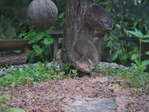
Karmnik dla ptaków Lierganes, Hiszpania
Lierganes, Dolina Miera, Kantabria, Hiszpania
 15.6°C / 60.1°F
 20:22

Stream hours: Both cameras are still images that the weather station replaces every 5 minutes. The player loads each new image by itself.
20:22:34 9.4°C / 48.9°F
 Duże zachmurzenie
 79%
 8 km/h / 5 mph
 08:08
 18:01
Ładowanie prognozy…
Lierganes, Dolina Miera, Kantabria, Hiszpania
15.6°C / 60.1°F
20:22
Costa Teguise, Lanzarote, Wyspy Kanaryjskie, Hiszpania
 24.1°C / 75.4°F
19:22
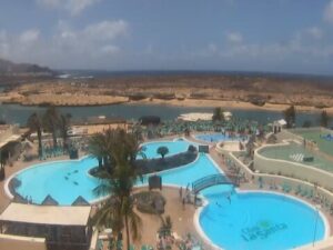
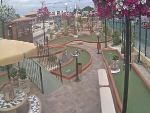
Yumbo Centrum, Avenida Estados Unidos, Maspalomas, Hiszpania
22.1°C / 71.8°F
19:22
Plaża Castelldefels, Passeig Maritim, Castelldefels, Hiszpania
19.5°C / 67.1°F
20:22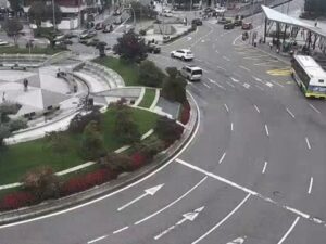

Castell-Platja d'Aro, Katalonia, Hiszpania
19.4°C / 66.9°F
20:22
Girona, Placa d'Espanya, Katalonia, Hiszpania
18.2°C / 64.8°F
20:22
Medina de Pomar, Las Merindades, Burgos, Hiszpania
15.6°C / 60.1°F
20:22
Nabrzeże wycieczkowców Arrecife, Avenida de los Marmoles, Arrecife, Hiszpania
24.1°C / 75.4°F
19:22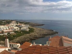
Cala Torret, Sant Lluis, Minorka, Hiszpania
21.5°C / 70.7°F
20:22
Sagrada Familia, Carrer de Mallorca, Barcelona, Hiszpania
19.8°C / 67.6°F
20:22
Santa Mónica Suites Hotel, Paseo Costa Canaria, Maspalomas, Hiszpania
22.1°C / 71.8°F
19:22

The Navalacruz Webcam looks southwest over the rooftops of Navalacruz, a mountain village of 192 people in the province of Avila, in the Castile and Leon region of central Spain. Tiled roofs and brick and painted houses fill the foreground, more of the village climbs the slope on the left, and a green meadow with a line of tall poplars opens in the middle of the frame. Above it all, granite slopes covered in rock and low scrub close around a narrow valley. The view follows the seasons: the poplars stand bare in winter and snow can settle on the slopes, the meadow is at its greenest in spring, and by mid-November the poplars and the woods behind them have turned yellow and orange. A second camera, on the tab beside the main one, looks out from the neighboring village of Navaquesera, higher up the same mountainside.
Navalacruz sits at 1,238 meters (4,062 feet) above sea level in the Valle del Alberche y Tierra de Pinares district, 53 kilometers (33 miles) from the provincial capital, Avila. The municipality covers 49.89 square kilometers (19.3 square miles) of steep, rocky ground between two ranges of the Central System: the Sierra de la Paramera to the north and the Sierra de Gredos to the south. Within its boundaries the land drops from 2,134 meters (7,001 feet) in the Paramera to 1,040 meters (3,412 feet) beside the Garganta de Navalacruz, the stream that carries the village’s name down toward the Alberche river.
Navalacruz has been losing people for a long time. Pascual Madoz’s geographical dictionary of 1849 counted 656 inhabitants; the 2025 census found 192. The village made national news on 14 August 2021, when a wildfire broke out here and went on to burn about 22,000 hectares (54,000 acres) of the surrounding country, according to Spain’s environment ministry. The Navalacruz Webcam belongs to Meteo Navalacruz, a local weather station that also reports to the Meteoclimatic amateur network, and a strip along the bottom of every image prints its latest readings: temperature, humidity, pressure, rainfall, wind speed and direction, solar radiation and UV index.
The second camera stands in Navaquesera, about 2.4 kilometers (1.5 miles) to the southeast and run by the same station. At 1,509 meters (4,951 feet) it is one of the highest villages in the province and in Spain, with 38 residents in 2025. Its camera looks out over wooded slopes and the open valley below, and low cloud sometimes fills the ground beneath the village. Navaquesera’s parish church of Nuestra Senora de la Asuncion has a stone bell gable, and the road above the village climbs to the Navaquesera pass at 1,618 meters (5,308 feet), which the Vuelta a Avila cycling race crossed in 2008.
At this height winters are cold and summers are warm and dry. Reanalysis data for the village from 2015 to 2024 put January afternoon highs around 7°C (45°F), close to the 7.6°C (46°F) that Spain’s weather agency AEMET records at Avila, with January nights typically between -2°C and 0°C (28°F and 32°F). Avila, about 110 meters (360 feet) lower than Navalacruz, averages around 20 days with snowfall a year, and the slopes in the frame sit higher still. Spring warms slowly: April highs reach about 13°C (55°F) and May about 18°C (64°F), while March and April are among the wetter months of the year.
July and August bring highs around 28°C (82°F) and nights of about 13°C to 16°C (55°F to 61°F), with barely 12 to 13 millimeters (half an inch) of rain in each month. Rain returns in autumn: October is the wettest month in the data at close to 90 millimeters (3.5 inches), and November follows with about 77 millimeters (3 inches).
The Sierra de la Paramera rises north of the village, and its highest summit, Pico Zapatero, reaches 2,158 meters (7,080 feet). Hiking routes climb it from villages such as Navandrinal and Robledillo. On the northern edge of the same range, above Villaviciosa near Solosancho, the Castro de Ulaca is among the largest Vettonian hillforts, a pre-Roman settlement whose highest point stands at 1,508 meters (4,948 feet) over the Ambles valley. Its wall runs for more than 3 kilometers (1.9 miles), and a granite sacrificial altar and a ritual sauna survive inside it. Ulaca was declared a historic-artistic site in 1931.
Down the valley, Burgohondo sits at 847 meters (2,779 feet) on the Alberche river, which flows through the municipality for 7 kilometers (4.3 miles). Its river pools at Puente del Arco, Puente Nueva, Tabla de los Abades and La Playita are used for summer swimming, and the river draws canoeists and anglers in winter and spring. Avila itself, 53 kilometers (33 miles) away, is the nearest city, and its complete medieval wall makes the most obvious day trip from the valley.
For more mountain villages and more of Castile and Leon, try these cameras.
Navalacruz is in the province of Avila, in the Castile and Leon region of central Spain. It lies in the upper Alberche valley district between the Sierra de la Paramera and the Sierra de Gredos, 53 kilometers (33 miles) from the city of Avila.
The main camera faces southwest across the village roofs to a meadow, a stand of poplars and the granite slopes around the valley. The second tab shows the view from Navaquesera, higher up the mountainside.
Winters are cold, with January highs around 7°C (45°F) and frost at night, while July and August reach about 28°C (82°F) with very little rain. Autumn and early spring bring most of the year’s rain.
The village stands at 1,238 meters (4,062 feet) above sea level. The municipality climbs to 2,134 meters (7,001 feet) in the Sierra de la Paramera and drops to 1,040 meters (3,412 feet) along the Garganta de Navalacruz.
Yes, snow is part of winter at this altitude. Avila, about 110 meters (360 feet) lower, averages around 20 days with snowfall a year according to AEMET, so the Navalacruz Webcam is a quick way to check for snow on the slopes above the village.
The fire broke out in Navalacruz on 14 August 2021 and spread across the surrounding hills toward the Alberche valley. Spain’s environment ministry put the burned area at about 22,000 hectares (54,000 acres).
Navaquesera is a village of 38 people about 2.4 kilometers (1.5 miles) southeast of Navalacruz, at 1,509 meters (4,951 feet). Its camera, run by the same weather station, looks out from the village over wooded slopes and the valley below.
Source: Meteo Navalacruz
Najlepsze nowe transmisje na żywo z kamer internetowych i funkcje witryny, raz w tygodniu.
Subskrybując, wyrażasz zgodę na otrzymywanie naszego cotygodniowego e-maila. Możesz zrezygnować z subskrypcji w dowolnym momencie.
 19.3°C / 66.7°F