
 Русский
 简体中文
 Deutsch
 English
 Français
 Español
 Nederlands
 Svenska
 Italiano
 日本語
 Polski
 Português
 Ελληνικά
 العربية
 Türkçe
Онлайн
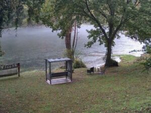
Chocorua Lake, Tamworth, New Hampshire
Chocorua Lake, Carroll County, New Hampshire, USA
 14.4°C / 57.9°F
 14:1114:11:30
 14.4°C / 57.9°FЯсно
 61%
 6 км/ч / 4 миль/ч
 06:50
 16:15
Загрузка прогноза…
Chocorua Lake, Carroll County, New Hampshire, USA
14.4°C / 57.9°F
14:11


Queen City Avenue, Manchester, New Hampshire, USA
 16.2°C / 61.2°F
14:11
Pittsburg, Coos County, New Hampshire, USA
11.2°C / 52.2°F
14:11

Музей Стробери-Бэнк, улица Хэнкок, Портсмут, Нью-Гэмпшир, США
16.3°C / 61.3°F
14:11
Бриджпорт, округ Джексон, Алабама, США
 19.3°C / 66.7°F
13:11



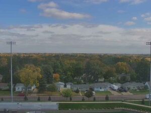

The Littleton Webcam looks south from a meteorologist’s art studio in Littleton, New Hampshire, toward Franconia Notch in the White Mountains. Tall evergreens stand on both sides of the picture, bare hardwoods fill the gap between them in late autumn, and a low, rounded ridge runs along the horizon under a wide sky. Most of the frame is that sky, which suits a camera run by a forecaster: cloud decks build, thin out and drift across it, and the light changes through the day. A strip along the bottom gives the current temperature and wind, a quick weather check before a drive south through the notch.
Littleton is a town of 6,005 people (2020 census) in Grafton County, in northern New Hampshire. It was incorporated in 1784, the same year New Hampshire became a state, and covers 139.9 square kilometers (54.0 square miles). The village sits at about 332 meters (1,089 feet) above sea level on the Ammonoosuc River, a tributary of the Connecticut River, which bounds the town on the northwest and forms the state line with Vermont. Interstate 93 reaches the town center from three exits, and U.S. Route 302 runs through the village as Main Street.
The camera belongs to the North of the Notch studio of Bob Copeland, who spent most of his working life as a television meteorologist after a first broadcast job at WBZ-TV, and who opened a studio and gallery in Littleton shortly after moving to the town in 2004. The stream is carried by the Boston and Maine Live YouTube channel. Its on-screen caption describes the view as looking south to Franconia Notch, the pass roughly 16 kilometers (10 miles) south of the village. There, Interstate 93 runs between Cannon Mountain, 1,240 meters (4,080 feet), on the west and Franconia Ridge on the east, where Mount Lafayette tops out at 1,600 meters (5,249 feet). The notch itself crests at about 590 meters (1,950 feet).
The exact camera spot is not published. In the frame, a tall evergreen with layered branches fills the left side, a stand of dark conifers fills the right, and the center opens over bare treetops to the ridge on the horizon. On the overcast November afternoon we checked, the higher summits toward the notch were hidden in cloud, and which peaks the camera picks out on a clear day is not confirmed.
Littleton has cold, snowy winters and warm summers. Ten years of Open-Meteo reanalysis for the village (2015 to 2024) put January highs around -3°C (27°F) and lows around -13.5°C (8°F), in line with the NOAA normals for St. Johnsbury, Vermont, about 23 kilometers (14 miles) to the northwest. December through March bring most of the snow, and that is when the evergreens in the frame can turn white and the ridge on the horizon can vanish behind falling snow.
July is the warmest month, with highs near 25°C (78°F) and lows around 15°C (59°F). Spring arrives slowly: April averages 10°C (50°F) by day and still dips to about -1°C (30°F) at night. October highs sit around 14°C (57°F), and by November they fall to about 6°C (42°F), with nights near -2°C (28°F). Rain and snow are spread across the whole year, at roughly 1,130 millimeters (44 inches) in total.
Main Street is the place to start. Chutters, at 43 Main Street, holds the Guinness World Records title for the longest continuous candy counter, 34.11 meters (111 feet 11 inches) long, a record first listed in July 2000. A bronze statue of Pollyanna, the character created by Eleanor H. Porter, has stood downtown since 2002. Thayer’s Hotel is listed on the National Register of Historic Places, the Riverwalk and its covered bridge follow the Ammonoosuc River through the village, and the Littleton Grist Mill, opened in 1798, has been restored to its original look.
Franconia Notch State Park lies south along Interstate 93, which runs through the pass as the Franconia Notch Parkway with one lane in each direction. The Cannon Mountain Aerial Tramway climbs to the 1,240 meter (4,080 foot) summit, and in winter Cannon Mountain runs as a ski area; check the tram’s season before you go. Profile Lake, the source of the Pemigewasset River, lies below the cliff that held the Old Man of the Mountain until the rock profile collapsed in 2003, and the beach at Echo Lake is open from June to August. The Flume Gorge is a natural gorge about 244 meters (800 feet) long, reached on a 3.5 kilometer (2.2 mile) loop from the parking lot that crosses it on a boardwalk.
For more of the White Mountains, from the summit weather to the valleys around North Conway, try these.
Littleton is in Grafton County in northern New Hampshire, on the Ammonoosuc River, with the Connecticut River and the Vermont state line along its northwest edge. Franconia Notch is roughly 16 kilometers (10 miles) to the south, and Interstate 93 serves the town center from three exits.
The camera looks south toward Franconia Notch between tall evergreens, over bare treetops to a low ridge on the horizon, with a wide sky above. A strip along the bottom shows the temperature, the wind and a local clock.
It is a weather camera at a television meteorologist’s North of the Notch art studio in Littleton, streamed on the Boston and Maine Live YouTube channel.
Winters are cold, with January highs around -3°C (27°F) and lows near -13.5°C (8°F), and most snow falls from December through March. Summers are warm, with July highs near 25°C (78°F) and lows around 15°C (59°F).
The notch is roughly 16 kilometers (10 miles) south of the village in a straight line, reached on Interstate 93, which becomes the Franconia Notch Parkway through the pass.
The caption labels the view as facing Franconia Notch, and a ridge runs along the horizon. Cloud decides how much shows: on an overcast afternoon the higher summits were hidden.
The YouTube stream is live only. The studio’s own website keeps a webcam page with a still image that refreshes every 60 seconds, daily time-lapse videos and a dated archive.
Chutters on Main Street holds the Guinness record for the longest continuous candy counter, at 34.11 meters (111 feet 11 inches). The town also has a bronze Pollyanna statue, a restored grist mill from 1798 and a riverwalk with a covered bridge.
Источник: Boston and Maine Live
Лучшие новые веб-камеры в прямом эфире и новые функции сайта — раз в неделю.
Подписываясь, вы соглашаетесь получать нашу еженедельную рассылку. Отписаться можно в любое время.
 11.5°C / 52.7°F