
 Русский
 简体中文
 Deutsch
 English
 Français
 Español
 Nederlands
 Svenska
 Italiano
 日本語
 Polski
 Português
 Ελληνικά
 العربية
 Türkçe

Онлайн
 16:54:06
 15.4°C / 59.7°F
 Ясно
 41%
 9 км/ч / 6 миль/ч
 07:25
 17:19
Загрузка прогноза…
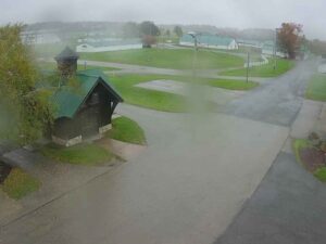
Бертон, округ Геога, штат Огайо, США
 15.7°C / 60.3°F
16:54



Парк развлечений «Сидар-Пойнт», Сидар-Пойнт-драйв, Сандаски, штат Огайо, США
16.1°C / 61°F
16:54
Пейнсвилл-он-зе-Лейк, округ Лейк, штат Огайо, США
18°C / 64.4°F
16:54






Клинч-парк, залив Гранд-Траверс, штат Мичиган, США
 15.7°C / 60.3°F
16:54


База гидросамолетов Лейк-Худ, Анкоридж, Аляска, США
3.4°C / 38.1°F
12:54
The Springboro Traffic Webcam streams three City of Springboro intersection cameras on the two state routes that cross this Warren County city between Dayton and Cincinnati. The main view looks over Main Street and Central Avenue, where SR 741 meets SR 73 in the middle of town. Red brick crosswalks cut across the junction, a sign for East Central Avenue hangs from a signal arm, and lines of cars stack up at the red light with shopfronts and a pale gabled building beyond. Two more tabs cover SR 73 at the Discount Drug Mart signal on West Central Avenue and SR 741 at Lytle-Five Points Road on the north side of town. All three use wide fisheye lenses, so a single glance shows how long the queues are and whether the lanes are dry, wet or white before you set off.
Springboro lies about 23 kilometers (14 miles) south of downtown Dayton and 56 kilometers (35 miles) northeast of downtown Cincinnati in a straight line. Jonathan Wright founded the town in 1815 as Springborough, on land settled from as early as 1796. The 2020 census counted 19,062 residents, and the city stands about 245 meters (804 feet) above sea level, spread over parts of Warren and Montgomery counties. All three cameras sit on the Warren County side.
Central Avenue is State Route 73, the city’s east-west artery. Heading west it reaches Interstate 75 at exit 38, about 3 kilometers (2 miles) from Main Street, and carries on into Franklin. Main Street is State Route 741, which runs 44.4 kilometers (27.6 miles) from Interstate 71 at exit 25, beside Kings Island, north to Interstate 75 at exit 50B in Moraine, just south of Dayton. North of Springboro it becomes Springboro Pike and meets Austin Boulevard at a continuous-flow intersection that links to I-75.
The city streams the cameras on its own YouTube channel and links them from a Traffic Cams panel on its homepage. The Main Street and Drug Mart cameras have run on the same broadcasts since June 2024, and the current Lytle broadcast started in January 2026. The Drug Mart tab is about 600 meters (0.4 miles) west of Main Street, at the signal by the store at 240 West Central Avenue. A wide stretch of SR 73 runs off to the left past lawns and trees, cars wait at the light on the side road to the right, and part of the store’s sign shows at the left edge. The Lytle tab is about 2.1 kilometers (1.3 miles) north on SR 741. It looks across a broad junction with a green-painted bike lane at the curb, a long queue on the multi-lane approach at left, a North Main Street sign on the signal arm and open ground beyond, where new buildings were going up in late 2026.
Springboro has four distinct seasons, and the cameras show each of them on the pavement. Open-Meteo’s archive for 2015 to 2024 puts January afternoons at about 3°C to 4°C (37°F to 39°F) with nights near -5°C (23°F), so icy mornings are common in midwinter. Dayton International Airport, the nearest long-term NOAA station, averages 64 centimeters (25 inches) of snow a year over the 1991 to 2020 normals. Spring warms quickly, from highs of about 12°C (54°F) in March to 23°C (73°F) in May, and March through July are the wettest months, with roughly 110 to 120 millimeters (4.3 to 4.7 inches) of rain each.
July is the warmest month, with highs of about 29°C (84°F) and nights around 19°C to 20°C (66°F to 68°F). A summer downpour can leave the brick crosswalks at Main and Central shining wet. Autumn is the driest stretch, with about 72 to 79 millimeters (2.8 to 3.1 inches) of rain a month from September to November, while highs fall from about 26°C (79°F) in September to 11°C (52°F) in November.
Springboro provided hiding places for people escaping slavery on the Underground Railroad, and on October 17, 1999 it became the first city to put up an Ohio Underground Railroad Historic Marker, unveiled during the 4th Annual Ohio Underground Railroad Summit. For time outside, the city’s parks include Community Park, Clearcreek Park, North Park and Kacie Jane Park with its splash pad. Golfers have Heatherwoode Golf Course and Sycamore Creek Country Club.
West along SR 73, La Comedia Dinner Theatre at 765 West Central Avenue has staged dinner-and-show runs of musicals such as The Wizard of Oz, White Christmas and Saturday Night Fever, a short drive from I-75 exit 38. Up SR 741, a Dorothy Lane Market grocery store sits just northeast of the Lytle junction, and farther north the road passes Austin Boulevard on its way to Moraine. Follow SR 741 south instead and it ends at I-71 near Kings Mills, beside Kings Island amusement park.
For more views around Ohio and other town traffic cameras, try these.
All three are in Springboro, Warren County, Ohio: at Main Street (SR 741) and Central Avenue (SR 73) in the middle of town, on SR 73 at the Discount Drug Mart signal on West Central Avenue, and on SR 741 at Lytle-Five Points Road, about 2.1 kilometers (1.3 miles) north.
The main view shows the Main and Central junction with its red brick crosswalks, queues at the lights and shopfronts beyond. The tabs show a wide stretch of West Central Avenue with lawns and trees, and the broad SR 741 junction at Lytle-Five Points Road with a green-painted bike lane and open ground behind it.
January highs are about 3°C to 4°C (37°F to 39°F) with nights near -5°C (23°F), and nearby Dayton averages 64 centimeters (25 inches) of snow a year. July highs reach about 29°C (84°F). March through July are the wettest months, and autumn is the driest.
The City of Springboro. It streams them on its YouTube channel, City of Springboro Live Traffic, and links that channel from the Traffic Cams panel on cityofspringboro.com.
Yes. Main Street carries SR 741 through Springboro, and Central Avenue carries SR 73. The two routes cross at the junction the main camera watches.
Take SR 73 (Central Avenue) west for about 3 kilometers (2 miles) to I-75 exit 38, or follow SR 741 north to Austin Boulevard, where a continuous-flow intersection links to the interstate.
Yes. The cameras show the pavement at all three junctions, so you can see whether the lanes are bare, wet or snow covered and how long the queues are before you drive.
Source: City of Springboro
Лучшие новые веб-камеры в прямом эфире и новые функции сайта — раз в неделю.
Подписываясь, вы соглашаетесь получать нашу еженедельную рассылку. Отписаться можно в любое время.
 13.9°C / 57°F