
 Svenska
 简体中文
 Deutsch
 English
 Français
 Español
 Nederlands
 Italiano
 日本語
 Polski
 Português
 Русский
 Ελληνικά
 العربية
 Türkçe
Live
 14:05:40
 19.4°C / 66.9°F
 Klart
 39%
 24 km/h / 15 mph
 06:40
 16:18
Laddar prognos…


Vineyard Haven, Tisbury, Massachusetts, USA
17.5°C / 63.5°F
14:05
Amherst, Du Bois-biblioteket, Massachusetts, USA
17.8°C / 64°F
14:05
Westfield, Hampden County, Massachusetts, USA
19.1°C / 66.4°F
14:05
Buzzards Bay, Bourne, Massachusetts, USA
18.4°C / 65.1°F
14:05

Barnstable Harbor, Cape Cod, Massachusetts, USA
18.6°C / 65.5°F
14:05
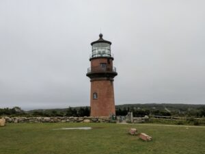
The Weymouth Fore River Webcam looks north over the Fore River from a hillside in Weymouth, Massachusetts, toward the Quincy shore and the Boston skyline on the horizon. The camera sits high above a shore road, so the foreground is a sloping lawn, the road with its yellow center line and a row of houses on the water side, one of them a new timber frame going up behind orange safety fencing when this page was written. Past the rooftops the river opens into a wide sheet of open water, with the low far shore lined with houses and trees and the towers of downtown Boston standing small on the skyline, just right of center. It is a good camera for watching weather arrive over the city, and a readout along the bottom of the stream gives the local temperature and wind.
The Weymouth Fore River forms the boundary between Quincy, on its western shore, and Weymouth, on its southeast shore, before it flows into Hingham Bay, part of Boston Harbor. The Boston and Maine Live channel describes this stream as a view of the Fore River from Weymouth looking north towards Boston. The wide water in the frame points to the lower river in North Weymouth, the most densely populated part of town and an area known for its Boston skyline views. Downtown Boston lies roughly 14 kilometers (9 miles) away as the crow flies, which is why the city shows as a thin band of towers rather than a close-up.
Weymouth was settled in 1622 as the Wessagusset Colony and incorporated in 1635, which makes it the second-oldest settlement in Massachusetts after Plymouth. It had 57,437 residents at the 2020 census. Farther up the river, the Fore River Shipyard built hundreds of ships for military and civilian customers between 1883 and 1986 on the Quincy and Braintree banks. Road traffic crosses the water on the Fore River Bridge, a lift bridge that carries Route 3A between Quincy and Weymouth and measures 675 meters (2,216 feet) with its approaches.
On the Quincy side, the Town River joins the Fore River at Germantown. On the Weymouth side, the shore runs out to Wessagussett Beach in North Weymouth, just before the river meets Hingham Bay.
Weymouth shares the coastal climate of Boston. Logan Airport’s 1991 to 2020 normals give January average highs of 2.7°C (36.8°F) and lows of -4.9°C (23.1°F), and ten years of Open-Meteo data for the lower Fore River come out almost the same, at about 3°C (38°F) by day and -4.5°C (24°F) at night. Logan averages 125 centimeters (49.2 inches) of snow a year, but areas on the immediate coast often get rain instead when warm air is drawn in off the Atlantic, so a winter day on the camera can mean white lawns and rooftops or a wet, gray street. The Boston area is also very prone to nor’easters, and in those storms the far shore and the skyline can vanish from the picture entirely.
Spring warms slowly by the water, with April highs near 13°C (55°F) and lows around 4°C (39°F) in the Open-Meteo record. July at Logan averages 27.8°C (82.1°F) by day and 18.9°C (66.0°F) at night, and sea breezes are common on this coast. October stays mild, with highs near 17°C (63°F) and lows near 9.5°C (49°F). The bare trees at the left of the frame are the easiest guide to the season: leafless through the cold months, green again by early summer. Clear, dry days give the sharpest view of the skyline.
Webb Memorial State Park sits on a peninsula in North Weymouth that reaches nearly 800 meters (half a mile) into Hingham Bay. It is made up of three connected drumlins and a low marsh, and it is the only mainland part of the Boston Harbor Islands National Recreation Area. Wessagussett Beach and George Lane Beach are the town beaches on this side of Weymouth, and the Wessagusset Yacht Club is also in North Weymouth.
Great Esker Park covers 237 acres (96 hectares) along the Weymouth Back River, across from Bare Cove Park in Hingham. Its winding ridge of sand and gravel was left by a glacier about 12,000 years ago and rises to about 27 meters (90 feet) above sea level in places. For history, the house where Abigail Adams was born is in Weymouth, and Adams National Historical Park in neighboring Quincy preserves the homes of presidents John Adams and John Quincy Adams. Greenbush Line commuter trains stop at Weymouth Landing/East Braintree and East Weymouth for trips into Boston.
More water and skyline views from around Massachusetts:
It is in Weymouth, Norfolk County, Massachusetts, on the Weymouth side of the Fore River, most likely in North Weymouth where the river widens toward Hingham Bay. The camera looks north toward Quincy and Boston, about 14 kilometers (9 miles) away.
A sloping lawn, a shore road and a row of houses in the foreground, then the open water of the Fore River, the low Quincy shore and the Boston skyline on the horizon. When this page was written, a new house was being framed in the middle of the view.
Yes. North Weymouth is known for its views of the Boston skyline, and this camera shows the downtown towers small on the horizon, just right of center. Haze, fog and heavy snow can hide them.
Winters are cold, with January highs around 3°C (37°F) and lows near -5°C (23°F), and the Boston area averages 125 centimeters (49.2 inches) of snow a year. Summers are warm, with July highs near 28°C (82°F). Nor’easters are the big storms to watch for.
It runs between Quincy and Weymouth, with Braintree along its upper reach near Weymouth Landing, and empties into Hingham Bay, part of Boston Harbor. The Fore River Bridge carries Route 3A over it between Quincy and Weymouth.
Weymouth was settled in 1622 as the Wessagusset Colony and incorporated in 1635. It is the second-oldest settlement in Massachusetts, after Plymouth.
Webb Memorial State Park, the only mainland part of the Boston Harbor Islands National Recreation Area, is in North Weymouth, along with Wessagussett Beach, George Lane Beach and Great Esker Park, a 237-acre (96-hectare) reserve on a glacial ridge beside the Back River.
Källa: Boston and Maine Live
De bästa nya livewebbkamerorna och webbplatsfunktionerna, en gång i veckan.
Genom att prenumerera godkänner du att få vårt veckovisa e-postmeddelande. Du kan avsluta prenumerationen när som helst.
 18.4°C / 65.1°F