
 العربية
 简体中文
 Deutsch
 English
 Français
 Español
 Nederlands
 Svenska
 Italiano
 日本語
 Polski
 Português
 Русский
 Ελληνικά
 Türkçe
مباشر
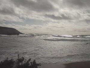
هورسشو كوف، بوديغا باي، كاليفورنيا
هورسشو كوف، بوديغا هيد، كاليفورنيا، الولايات المتحدة
 7.9°C / 46.2°F
 09:5009:50:38
 15°C / 59°F
 سماء صافية
 58%
 19 كم/س / 12 ميل/س
 06:31
 16:49
جارٍ تحميل التوقعات...
هورسشو كوف، بوديغا هيد، كاليفورنيا، الولايات المتحدة
7.9°C / 46.2°F
09:50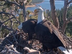
منطقة بيغ بير فالي الترفيهية والمتنزهات، بارك أفينيو، بيغ بير ليك، كاليفورنيا، الولايات المتحدة الأمريكية
1°C / 33.8°F
09:50
كامبوس بوينت، إيسلا فيستا، كاليفورنيا، الولايات المتحدة الأمريكية
 15.4°C / 59.7°F
09:50

شاطئ ليدبيتر، سانتا باربرا، كاليفورنيا، الولايات المتحدة الأمريكية
15.4°C / 59.7°F
09:50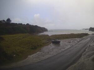
شاطئ كاسبار، كاسبار، كاليفورنيا، الولايات المتحدة
7.8°C / 46°F
09:50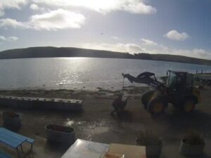
لوسونز لاندينغ، خليج توماليس، كاليفورنيا، الولايات المتحدة
9.1°C / 48.4°F
09:50
ملجأ إنقاذ القطط الصغيرة، لوس أنجلوس، كاليفورنيا
12.3°C / 54.1°F
09:50
ستوكتون، مقاطعة سان جواكين، كاليفورنيا، الولايات المتحدة الأمريكية
 4.4°C / 39.9°F
09:50
مورغان هيل، وادي سانتا كلارا، كاليفورنيا، الولايات المتحدة الأمريكية
7.6°C / 45.7°F
09:50
Hahn Plaza, USC, Los Angeles, California, USA
14.4°C / 57.9°F
09:50
بارستو، صحراء موهافي، كاليفورنيا، الولايات المتحدة الأمريكية
3.6°C / 38.5°F
09:50
وادي يوسيميتي، سييرا نيفادا، كاليفورنيا، الولايات المتحدة الأمريكية
-5.6°C / 21.9°F
09:50
رصيف شاطئ هنتنغتون، شاطئ هنتنغتون، كاليفورنيا، الولايات المتحدة الأمريكية
16°C / 60.8°F
09:50
شاطئ فينيس، لوس أنجلوس، كاليفورنيا، الولايات المتحدة الأمريكية
15.6°C / 60.1°F
09:50
نوتس بيري فارم، بيتش بوليفارد، بوينا بارك، كاليفورنيا، الولايات المتحدة الأمريكية
14.9°C / 58.8°F
09:50
جبل ماموث، ماموث ليكس، مقاطعة مونو، كاليفورنيا، الولايات المتحدة الأمريكية
-1.8°C / 28.8°F
09:50The Catalina Island Webcam looks out from a lookout high on the ridges of the West End, the wild northwestern tip of Santa Catalina Island off Southern California. It is run by explore.org and the Institute for Wildlife Studies (IWS) as the West End Overlook Cam, and it does not hold one framing. Through the day it swings between the open Pacific, the sea cliffs and rocky points below, and the cliff where the West End bald eagles nest. On the morning of November 20, 2026 it looked down on a pale, jagged point with surf breaking around its tip. By late morning it faced south over a sunlit sea with a long, low island on the horizon, and around noon it zoomed in on a stick nest on a rock ledge. Eagles can soar through the frame, and explore.org promotes the overlook for its Pacific sunsets.
Santa Catalina Island lies about 47 kilometers (29 miles) south-southwest of Long Beach. It runs 35 kilometers (22 miles) from end to end and 13 kilometers (8 miles) across at its widest, and Mount Orizaba, its highest point, reaches 639 meters (2,097 feet). Most of the 3,715 residents counted in 2020 live in Avalon. The West End is everything beyond Two Harbors, where Isthmus Cove and Catalina Harbor come within 770 meters (0.48 miles) of each other and leave the northwestern sixth of the island joined to the rest by a narrow, low strip of land.
Juan Rodriguez Cabrillo claimed the island for Spain in 1542 and called it San Salvador. Sebastian Vizcaino landed on November 24, 1602, the eve of Saint Catherine’s day, and renamed it after the saint. William Wrigley Jr. took control of the Santa Catalina Island Company in 1919, and in 1975 the Catalina Island Conservancy received 42,135 acres (17,051 hectares), roughly 88 percent of the island.
The overlook belongs to the same project as the West End Bald Eagle Cam. IWS started a bald eagle restoration program on Catalina in 1980, and the West End nest has been active since 1991 and streaming since 2005, through a partnership of IWS, the Montrose Settlements Program, the Santa Catalina Island Conservancy and explore.org. The nest cameras sit right at the nest. This camera stands back and shows the cliffs and open water around it. At midday on November 20 it was zoomed onto a cliff face where a large stick nest sat on a ledge, with a small camera on a mast just below, most likely the West End nest and one of its own cameras.
Catalina has a mild climate with dry summers. In the island’s NOAA record for 1981 to 2010, January days average 15.8°C (60.4°F) and nights 9.7°C (49.5°F), while August reaches 25.3°C (77.6°F) by day and 16.5°C (61.7°F) at night. About 349 millimeters (13.7 inches) of rain falls in a typical year. The exposed West End runs cooler in summer: ten years of Open-Meteo reanalysis for the ridge put August and September highs nearer 22°C (72°F), while January there averages about 15°C (59°F), close to the NOAA figure.
Roughly three quarters of the West End’s rain falls from December through March, when fronts roll in off the Pacific and the slopes below the camera usually green up. June and July are close to dry, with 2 to 3 millimeters (about 0.1 inches) of rain a month, and the grass on the ridges typically browns through summer and autumn. November highs run around 18°C (65°F). The sun sets well to the southwest in December and far to the northwest in June, so the sunset shifts along the sea horizon through the year.
Two Harbors, the village on the isthmus, is the gateway to the West End. Catalina Express runs daily boats there from San Pedro, about 37 kilometers (23 miles) away, and the seasonal Cyclone ferry links it with Avalon, about 29 kilometers (18 miles) down the coast. The Two Harbors campground has cold-water showers, and the USC Wrigley Institute, a University of Southern California research and teaching campus, is close to the village.
On foot, the Trans-Catalina Trail is the main draw. The Conservancy describes it as 38.5 miles (62 kilometers) of trail starting from Avalon, and since 2017 its official finish has been Parsons Landing on the West End rather than Starlight Beach, the original end point. Parsons Landing is a campground with a pit toilet and no running water, where campers buy keys to lockers holding water and firewood. It is about 10.5 kilometers (6.5 miles) from Two Harbors, and the Starlight Trail carries on 6.9 kilometers (4.3 miles) to the old terminus. Every hiker needs the Conservancy’s free hiking permit. The road back along the north shore looks down on Emerald Bay, Howland’s Landing and Cherry Cove.
See the West End eagles up close, go underwater off Catalina, or cross to the mainland coast:
On the West End of Santa Catalina Island in Los Angeles County, California, beyond the isthmus at Two Harbors. The exact lookout position is not published, so the map marks the West End rather than the camera.
It changes during the day: the open Pacific out to the horizon, sea cliffs and rocky points with surf around them, clouds moving over the water, and close-ups of the cliff where the West End bald eagles nest. The overlook is also used for sunsets.
No. The eagle cams are fixed at the nest and show the adults, eggs and chicks up close. The overlook is a separate camera higher up that takes in the coast, sea and sky, and only now and then zooms toward the nest cliff.
When the camera faces south, a long, low island can stretch along the horizon. In the late-morning view of November 20 the sun glinted off the sea in that direction, in the south-southeast, which makes it most likely San Clemente Island, the next island south of Catalina.
Mild all year. January days average about 16°C (60°F) and August days about 25°C (78°F) in the island’s NOAA record, and most rain falls from December to March.
Take the Catalina Express boat from San Pedro to Two Harbors, then hike or bike out. Parsons Landing is about 10.5 kilometers (6.5 miles) from the village.
The date and time in the top right corner are local Pacific time, so a quick look shows whether the view is current. On November 20, 2026 the clock matched the real time at every check across the day.
Source: explore.org West End Overlook Cam (Institute for Wildlife Studies)
أفضل كاميرات الويب المباشرة الجديدة وميزات الموقع، مرة واحدة في الأسبوع.
بالاشتراك، فإنك توافق على تلقي رسالتنا الإلكترونية الأسبوعية. يمكنك إلغاء الاشتراك في أي وقت.