
 Italiano
 简体中文
 Deutsch
 English
 Français
 Español
 Nederlands
 Svenska
 日本語
 Polski
 Português
 Русский
 Ελληνικά
 العربية
 Türkçe
Live
 08:07:59
 3.9°C / 39°F
 Coperto
 96%
 7 km/h / 4 mph
 07:27
 17:27
Caricamento delle previsioni…

Ironton Ferry, Ferry Road, Charlevoix, MI, USA
4.4°C / 39.9°F
08:07

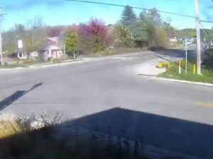
Canada Creek Ranch, Contea di Montmorency, Michigan, Stati Uniti
 1.5°C / 34.7°F
08:07
Lago Leelanau, penisola di Leelanau, Michigan, Stati Uniti
4.8°C / 40.6°F
08:07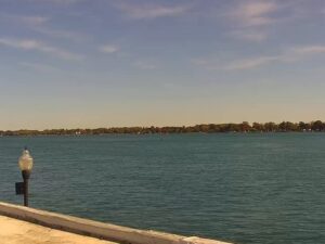
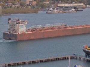


Boyne Falls, Contea di Charlevoix, Michigan, Stati Uniti
2.9°C / 37.2°F
08:07
Clinch Park, Grand Traverse Bay, Michigan, USA
4.9°C / 40.8°F
08:07The Newaygo County Webcam looks down from a tower at the Stephen F. Wessling Observatory, about 10 kilometers (6 miles) north of Fremont in West Michigan, over a fenced cattle pasture, a gravel road lined with old trees and a patchwork of farm fields running out to a flat, wooded horizon. Four more towercams from the same network sit in the tabs: a school campus in Fremont, Fremont Lake seen from the town’s co-op, the Mill Pond marsh in White Cloud and the Muskegon River in Newaygo. On the day this post was written a herd of black cattle was grazing right below the main camera, among rows of white posts, while early November still left rust and gold leaves in the woods.
Newaygo County covers 2,230 square kilometers (862 square miles) of West Michigan, and 49,978 people lived there at the 2020 census. White Cloud is the county seat. The county counts more than 230 natural lakes and over 560 kilometers (350 miles) of rivers and streams, and more than half of it lies inside the Manistee National Forest. The name is traced either to Nuwagon, an Ojibwe leader who signed the Treaty of Saginaw in 1819, or to an Algonquian word meaning “much water”.
The cameras belong to NCATS, short for Newaygo County Advanced Technology Services, the technology division of the Newaygo County Regional Educational Service Agency (NC RESA). It has run since 1995 as an educational telecommunications network that also sells home internet, hence the NCATS logo in the top left corner of most streams. The main camera’s tower stands at the Wessling Observatory, a public observatory on the Kropscott Farm at the corner of Baseline and Stone Roads, about 288 meters (945 feet) above sea level. Earle and Mildred Kropscott donated the farm to the Newaygo Conservation District.
The four tabs move into the towns. Fremont, with 4,516 residents in 2020, is home to Gerber Products Company, which began as the Fremont Canning Company and is still the county’s largest employer. The Fremont campus camera looks across a large parking lot, usually with a yellow school bus in it, to a long low building and a new addition going up. The co-op camera in the center of Fremont normally faces southwest, over warehouses, a rail line and ballfields to Fremont Lake. In White Cloud the water tower camera overlooks the Mill Pond on the White River, a wide marsh threaded with channels, with a park, a picnic pavilion and a playground below. In Newaygo the camera sits on top of the co-op downtown, with the elevator’s legs in the foreground and the Muskegon River beyond, crossed by a steel railroad truss bridge and the M-37 road bridge.
Winters are long and cold. Over the ten years from 2015 to 2024, January afternoons at the observatory site averaged about -1°C (30°F) and nights about -8°C (18°F), and snow can fall from November into April. That is when the pasture on the main camera turns white and the Mill Pond marsh can freeze over. Spring comes slowly, with April highs around 12°C (54°F) and May highs near 20°C (68°F).
Summers are warm, with July highs near 27°C (82°F) and nights around 17°C (62°F). Autumn is the most colorful season on these cameras: October highs average 15°C (59°F), and in the first week of November the woods around Fremont Lake, the Mill Pond and the Muskegon valley still showed orange, rust and yellow. Rain leaves drops on the camera covers now and then, so the picture can look smudged for a while after a shower.
The Stephen F. Wessling Observatory is staffed by the Newaygo County Dark Sky Astronomers, who hold public events there, such as a solar eclipse open house in April 2024. It works with the Kropscott Environmental Center on the same farm. In Fremont, the National Baby Food Festival takes over the town in the third week of July and draws more than 50,000 visitors.
The Muskegon River through Newaygo is used for canoe trips, tubing and fishing, with steelhead running in spring and salmon in the fall. Hardy Dam, one of three large dams built in the county in the early 20th century, is the largest earthen dam east of the Mississippi River. White Cloud is a recognized Trail Town on the North Country Trail, which stretches 7,400 kilometers (4,600 miles), and its Mill Pond Park has a beach and playground. Across the Manistee National Forest, camping, hunting, cross country skiing, cycling and birding are the usual pastimes, and Newaygo Brewing waits in Newaygo after a day on the river.
More West Michigan towns and farm country on live cameras:
The main camera stands at the Stephen F. Wessling Observatory on Baseline Road, about 10 kilometers (6 miles) north of Fremont and roughly 70 kilometers (43 miles) north of Grand Rapids. The tab cameras are in Fremont, in White Cloud and in Newaygo.
The main view is open farmland: a fenced pasture where cattle graze, a tree-lined gravel road, barns, a farmhouse, rows of young trees and two tall masts on the horizon. The tabs show towns, a lake, a marsh and river bridges.
NCATS is Newaygo County Advanced Technology Services, the technology division of the Newaygo County Regional Educational Service Agency. It runs the county’s educational network, sells internet service and streams these towercams on the agency’s YouTube channel.
It has cold, snowy winters and warm summers. January averages about -1°C (30°F) by day and -8°C (18°F) at night, while July afternoons reach about 27°C (82°F).
The town cameras are pan, tilt and zoom models, and NCATS says the White Cloud and Newaygo cameras may move around now and then; the Fremont co-op camera changes its view at times too. The White Cloud camera’s normal view is the Mill Pond, and the Newaygo camera typically overlooks the Muskegon River.
Yes. It is a public observatory on the Kropscott Farm, run with the Newaygo Conservation District. Check the Dark Sky Astronomers’ schedule before driving out, since stargazing needs clear skies.
The Muskegon River runs through the north side of Newaygo, beneath M-37 and a railroad bridge, both visible on the Newaygo tab. In the lumber era it carried logs down to the mills at Muskegon.
Source: Newaygo County RESA (NCATS)
Le migliori nuove webcam in diretta e le funzionalità del sito, una volta a settimana.
Iscrivendoti, accetti di ricevere la nostra email settimanale. Puoi disiscriverti in qualsiasi momento.