
 Polski
 简体中文
 Deutsch
 English
 Français
 Español
 Nederlands
 Svenska
 Italiano
 日本語
 Português
 Русский
 Ελληνικά
 العربية
 Türkçe
Live
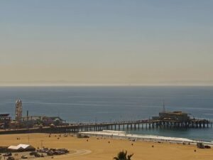
Plaża Santa Monica, Kalifornia
Plaża w Santa Monica, Santa Monica, Kalifornia, USA
 15.4°C / 59.7°F
 07:1907:19:31
 14.1°C / 57.4°F
 Zachmurzenie całkowite
 85%
 6 km/h / 4 mph
 06:53
 16:59
Ładowanie prognozy…
Plaża w Santa Monica, Santa Monica, Kalifornia, USA
15.4°C / 59.7°F
07:19


Knott's Berry Farm, Beach Boulevard, Buena Park, Kalifornia, USA
14.6°C / 58.3°F
07:19

Auburn, hrabstwo Placer, Kalifornia, USA
9.7°C / 49.5°F
07:19
Schronisko dla kociąt, Los Angeles, Kalifornia
14.1°C / 57.4°F
07:19
Big Bear Valley Recreation and Park District, Park Avenue, Big Bear Lake, Kalifornia, USA
0.1°C / 32.2°F
07:19


Silver Lake, Los Angeles, Kalifornia, USA
14.1°C / 57.4°F
07:19
Mammoth Mountain, Mammoth Lakes, hrabstwo Mono, Kalifornia, USA
-8.6°C / 16.5°F
07:19
The Lawson’s Landing Webcam looks out from the boathouse at Lawson’s Landing, the family-run campground at the mouth of Tomales Bay in Dillon Beach, Marin County. The camera faces roughly south-west across the bay to the long, low ridge of Tomales Point in Point Reyes National Seashore. In the foreground are the boathouse patio, a blue picnic table and the sandy launch beach, where a tractor backs trailered boats into the water and pulls them out again later in the day. On a calm morning the bay can lie almost flat, while a windy afternoon roughens it all the way across, and from late autumn into winter the afternoon sun sits straight ahead of the camera, laying a bright band of glare over the water.
Lawson’s Landing covers 940 acres (380 hectares) at the end of the county road south of the village of Dillon Beach. The Pacific Ocean forms its western edge and Tomales Bay its southern one, and the operator describes it as sitting directly across the bay from Pierce Point. That is the ridge on the far side of the frame, the northern tip of the Point Reyes peninsula, roughly 2 kilometers (1.2 miles) away across the water. Behind the campground lie the Tomales Dunes, which the Lawsons call some of the last mobile dune systems left on the California coast, and more than a mile (1.6 kilometers) of ocean beach runs along its western side.
The Lawson family has been here for a century. Sylvester Lawson, a dairy and grain farmer from Woodland, leased the Dillon Beach hotel in the mid-1920s, and in 1926 his son Howard and daughter-in-law Winifred bought the resort outright. Another son, Walter, and his wife Nita bought the neighboring farmland, and part of it became Lawson’s Landing, open to campers, boaters and anglers since 1957. Decades earlier, George Dillon from Ireland had built a hotel here in the 1880s and ran a stagecoach from the railroad stop at Tomales, 4 miles (6.4 kilometers) to the east.
The launch beach in front of the camera is the working center of the place. Single and double axle boat trailers go in by tractor, with the fee covering both the launch and the haul-out and every boat due out of the water by 4:45 PM. Owners who launch their own boats drive across the beach in four-wheel drive. The operator warns that the shallow entrance to the bay can build the ocean swell into a line of breakers at any time, so the mouth can look very different from the calmer water inside it.
Lawson’s Landing has a cool coastal climate that changes little through the year. Averages for 2016 to 2025 put winter highs at 13°C to 14°C (55°F to 57°F) and lows at 5°C to 6°C (41°F to 43°F). Most of the rain falls between November and March, with December and January the wettest months at about 150 millimeters (6 inches) each. In December the sun sets behind the Tomales Point ridge, roughly in the middle of the view, so a clear winter afternoon on the Lawson’s Landing Webcam ends with the sun dropping toward the hills across the water.
Summer stays mild, with highs of 18°C to 19°C (64°F to 66°F) from June to August, lows of 11°C to 12°C (52°F to 54°F) and almost no rain. September is the warmest month on average, with highs around 20°C (68°F). Wind is the condition to watch: the operator notes it can become quite strong, especially in the afternoon, which can make the run back to the Landing from the south uncomfortable. Low cloud and fog off the Pacific can also hide the far ridge entirely.
Clamming and fishing bring most people here. The giant clams of Tomales Bay are dug on the low tides of spring and fall, when a tide of 0.5 feet (15 centimeters) or lower uncovers the beds, reached either by boat out to the mudflats or on foot along the Landing’s southern shoreline. Diggers need a California fishing license. Spring brings redtail and rubberlip surfperch to the surf, salmon and halibut are usually best from mid-June through August, and striped bass can be caught all year. The campground store sells licenses and gear, and oysters from Friday to Sunday.
Across the water, the Tomales Point Trail starts at the historic Pierce Point Ranch and follows the ridge in the frame for about 15 kilometers (9.4 miles) out and back, through country where tule elk are often seen. Bikes and dogs are not allowed on it. Further down the bay’s west shore, Heart’s Desire Beach in Tomales Bay State Park is a popular picnic beach off Pierce Point Road. On the east shore, Hog Island Oyster Company and Tomales Bay Oyster Company in Marshall sell oysters and run bayside picnic areas, and Hog Island’s tables are best booked well ahead. North of Dillon Beach, the mudflats along Westshore Road in Bodega Bay are another place to dig clams on a low tide.
For more of the California coast, from the Bay Area to San Diego Bay, try these cameras:
At 137 Marine View Drive in Dillon Beach, in the northwestern corner of Marin County, California, at the mouth of Tomales Bay and about an hour and a half north of the Golden Gate Bridge. The operator warns that Google Maps has misdirected visitors and suggests driving through Tomales and out along Dillon Beach Road.
The view runs south-west from the boathouse across the mouth of Tomales Bay to the Tomales Point ridge. The patio, a picnic table and the launch beach fill the foreground, with boats going in and out by tractor and the shoreline curving away to the right.
Cool and mild all year, with winter highs of 13°C to 14°C (55°F to 57°F), summer highs of 18°C to 19°C (64°F to 66°F) and most of the rain from November to March.
Tomales Point, the northern tip of Point Reyes National Seashore, where the Tomales Point Trail runs out along the ridge from Pierce Point Ranch.
On calm days during the low tides of spring and fall, when the tide falls to 0.5 feet (15 centimeters) or lower. Clamming is only legal in daylight.
Staff launch trailered boats by tractor and haul them out again by 4:45 PM. Kayaks and rafts go in by hand.
The season starts in February and usually finishes by the end of October. Dungeness crab season usually opens on the first Saturday of November, though recent years have seen delayed openings and gear restrictions.
Source: Lawson’s Landing
Najlepsze nowe transmisje na żywo z kamer internetowych i funkcje witryny, raz w tygodniu.
Subskrybując, wyrażasz zgodę na otrzymywanie naszego cotygodniowego e-maila. Możesz zrezygnować z subskrypcji w dowolnym momencie.