
 Polski
 简体中文
 Deutsch
 English
 Français
 Español
 Nederlands
 Svenska
 Italiano
 日本語
 Português
 Русский
 Ελληνικά
 العربية
 Türkçe

Live
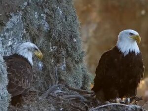
Sacramento National Wildlife Refuge, Willows, Kalifornia
Sacramento NWR, Glenn County, Kalifornia, USA
 8.3°C / 46.9°F
 05:4305:43:43
 12.5°C / 54.5°F
 Bezchmurnie
 81%
 6 km/h / 4 mph
 06:40
 17:06
Ładowanie prognozy…
Sacramento NWR, Glenn County, Kalifornia, USA
8.3°C / 46.9°F
05:43


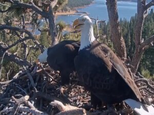
Big Bear Valley Recreation and Park District, Park Avenue, Big Bear Lake, Kalifornia, USA
4.4°C / 39.9°F
05:43

Auburn, hrabstwo Placer, Kalifornia, USA
8.4°C / 47.1°F
05:43
Knott's Berry Farm, Beach Boulevard, Buena Park, Kalifornia, USA
16.8°C / 62.2°F
05:43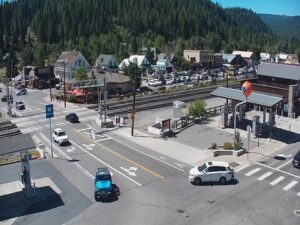
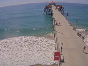
Molo Huntington Beach, Huntington Beach, Kalifornia, USA
14.1°C / 57.4°F
05:43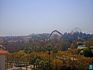
Wyspa Catalina, hrabstwo Los Angeles, Kalifornia, USA
19°C / 66.2°F
05:43
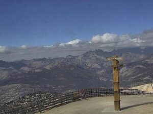
Mammoth Mountain, Mammoth Lakes, hrabstwo Mono, Kalifornia, USA
-8.6°C / 16.5°F
05:43
The San Francisco Webcam looks west across the bay from the shore of Treasure Island, streaming from Mersea, a restaurant on Avenue of the Palms. It frames the city’s northern waterfront roughly 3.5 kilometers (2.2 miles) away. Apartment blocks and high-rises climb the hillsides on the left and in the center, long pier sheds line the water’s edge below them, and on the right the masts of the Fisherman’s Wharf marina crowd beneath the SkyStar Wheel. Wooded ridges close off the view to the west, and boulders on the island’s own shoreline fill the bottom of the frame. Work barges and sailboats cross the open water in between. A second camera, on the Oakland Bay Bridge tab, looks along the bridge’s western span from the San Francisco end.
Treasure Island is not a natural island. It was built in 1936 and 1937 to host the 1939 Golden Gate International Exposition, which opened on February 18, 1939. It covers 393 acres (159 hectares) and is joined to the natural Yerba Buena Island by a causeway of about 270 meters (900 feet). Yerba Buena Island carries the ramps on and off Interstate 80 on the Bay Bridge, which is how traffic reaches Treasure Island. The Navy took the island over in 1942 and ran a naval station there until 1997. About 2,800 people live on it today, and a redevelopment plan approved in 2011 allows for up to 8,000 new homes.
Because the camera faces west, the sun stays behind the lens through the morning and around midday, lighting the hillside buildings from the front. By mid-afternoon the sun moves in front of the camera, the hills turn into dark silhouettes and the water breaks into glare. The right side of the frame takes in Fisherman’s Wharf. Pier 39 opened there on October 4, 1978, and California sea lions began hauling out on the docks of its marina in September 1989. As many as 1,700 have been counted at one time. The SkyStar Wheel, about 45.7 meters (150 feet) tall with 36 enclosed gondolas, moved to the wharf from Golden Gate Park’s Music Concourse in November 2023.
The Oakland Bay Bridge tab, run by ABC7 News Bay Area, looks east along the western span toward Yerba Buena Island. The bridge opened on November 12, 1936, and runs 7.18 kilometers (4.46 miles) without its approaches. Its western half is a double suspension bridge, two main spans of 704 meters (2,310 feet) each joined at a central anchorage, and from this angle the towers line up one behind another. Traffic crosses Yerba Buena Island through a tunnel 160 meters (540 feet) long to reach the eastern span, whose replacement opened in 2013. After dark, lights run along the main cables, with headlights on the upper deck and red taillights moving through the truss below.
The ocean sets San Francisco’s weather, so the seasons are mild and fog matters more than heat. Winter, from December to February, brings highs around 14°C (58°F) and lows near 8°C (47°F). December and January are the wettest months, with roughly 125 millimeters (5 inches) of rain each. Spring dries out quickly: April highs average about 16°C (61°F) with lows about 10°C (50°F), and by May rain is light.
Summer is cool by California standards. July highs average about 19°C (66°F) and lows about 12°C (54°F), and marine fog can roll in from the Pacific and wipe the hillsides out of the frame for hours at a time. September is the warmest month, with highs near 21°C (70°F) and lows near 13°C (56°F), and from June through September almost no rain falls. Most of the year’s rain comes between November and March.
Mersea, the restaurant the camera streams from, sits on Avenue of the Palms with the same view across the bay as the player. Nearby, the island’s Administration Building, which housed its museum from 1976 to 1997, and the Hall of Transportation were both listed on the National Register of Historic Places in 2008. The causeway leads on to Yerba Buena Island, the natural island the Bay Bridge crosses on its way between San Francisco and Oakland.
On the city side of the frame, Pier 39 is the place to see the sea lions up close on the marina docks, and the pier’s two-story carousel stands among its attractions. A few steps along Fisherman’s Wharf, the SkyStar Wheel’s climate-controlled gondolas each seat up to six people for a ride above the waterfront.
More bay and city views from California:
The main camera looks west from Treasure Island across the bay to San Francisco’s northern waterfront: hillside apartment towers, the pier sheds along the shore, the Fisherman’s Wharf marina and the SkyStar Wheel, with wooded ridges beyond. The Oakland Bay Bridge tab shows the bridge’s western span, seen from the San Francisco end.
The main camera streams from Mersea, a restaurant on Avenue of the Palms on Treasure Island, a man-made island in San Francisco Bay that is part of the city. It sits roughly 3.5 kilometers (2.2 miles) east of Pier 39, and the island is reached over the Bay Bridge by way of Yerba Buena Island.
Yes, from a distance. Pier 39 and its marina sit on the right side of the frame, close to the SkyStar Wheel. At roughly 3.5 kilometers (2.2 miles), the camera shows boat masts and buildings, not the sea lions on the docks.
Not in its usual framing. The operator’s description mentions the Golden Gate Bridge, but the camera normally points at the northern waterfront, and the bridge lies farther to the right, past the edge of the picture. Downtown and the Financial District towers are out of view to the left.
Yes. The Oakland Bay Bridge tab plays a 24/7 stream from ABC7 News Bay Area that looks along the western span toward Yerba Buena Island. Traffic fills the upper deck by day, and at night lights run along the main cables.
Mild all year. Highs run from about 14°C (58°F) in January to about 21°C (70°F) in September, the warmest month. Summer is cool and often foggy, and most of the rain falls between November and March.
It was built in 1936 and 1937 for the 1939 Golden Gate International Exposition, then served as a Navy base from World War II until 1997. In 2009 the Navy agreed to sell it to the city, and a 2011 plan allows for up to 8,000 new homes as the island is redeveloped.
Source: Teleport.camera and ABC7 News Bay Area
Najlepsze nowe transmisje na żywo z kamer internetowych i funkcje witryny, raz w tygodniu.
Subskrybując, wyrażasz zgodę na otrzymywanie naszego cotygodniowego e-maila. Możesz zrezygnować z subskrypcji w dowolnym momencie.