
 Svenska
 简体中文
 Deutsch
 English
 Français
 Español
 Nederlands
 Italiano
 日本語
 Polski
 Português
 Русский
 Ελληνικά
 العربية
 Türkçe

Live
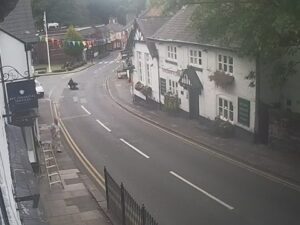
The Barber Shop, Buckingham, Storbritannien
The Barber Shop Buckingham, Market Square, Buckingham, Storbritannien
 8.8°C / 47.8°F
 13:2713:27:31
 10°C / 50°FMulet
 80%
 6 km/h / 4 mph
 07:13
 16:46
Laddar prognos…
The Barber Shop Buckingham, Market Square, Buckingham, Storbritannien
8.8°C / 47.8°F
13:27
Portsmouths historiska varv, HM Naval Base, Portsmouth, Storbritannien
10.2°C / 50.4°F
13:27

High Wycombe, Buckinghamshire, England, Storbritannien
9.4°C / 48.9°F
13:27


Beblowe Crag, Holy Island, Northumberland, England
10.7°C / 51.3°F
13:27

Queen Mary Reservoir, Spelthorne, Surrey, Storbritannien
10.1°C / 50.2°F
13:27


Breighton, East Riding of Yorkshire, England, Storbritannien
10.7°C / 51.3°F
13:27The Plymouth Hoe Webcam looks roughly west along the grassy clifftop of Plymouth Hoe in Devon, England, with the red and white stripes of Smeaton’s Tower rising from the green just right of center. On the left, the lawns fall away to a road that curves down toward Tinside Lido, and the gray water of Plymouth Sound runs out past Drake’s Island to the wooded Cornish shore at Mount Edgcumbe. A memorial statue inside iron railings stands in the right foreground. It is a good camera for watching the weather: showers and bright spells cross the Sound in plain sight, walkers come and go on the paths, and small boats sometimes sit out on the water. After dark, the channel says, the old lighthouse is lit in color, so the view keeps changing well past sunset.
Plymouth Hoe is a large, south-facing public open space on top of low limestone cliffs at the edge of Plymouth’s city center. The camera appears to be set on the high ground at the eastern end of the Hoe, next to the Royal Citadel, a fortress built in the late 1660s that is still a military site today. The stream carries the logo of the Marine Biological Association, whose Citadel Hill Laboratory is set into the Citadel’s sea-facing walls, and the channel’s description thanks the association for its ocean research and conservation work.
Smeaton’s Tower, the striped landmark in the frame, did not start out here. Civil engineer John Smeaton designed it as a lighthouse for the Eddystone Rocks off Plymouth, and it was first lit on 16 October 1759 with 24 candles. The tower stood 22 meters (72 feet) tall. By 1877 the rock beneath it was eroding and the tower shook with every large wave, so it was taken out of service, and in 1882 its upper part was rebuilt on the Hoe as a memorial. It opened to the public on 24 September 1884. The foundation and a stub of the old tower are still out on the reef next to the current Eddystone Lighthouse, because they were too strong to dismantle.
Below the Hoe, Tinside Lido sits on the limestone shore at the foot of the cliff. Designed in 1935 and opened on 2 October that year, the semicircular pool is Grade II listed and filled with treated seawater. The domed building on the clifftop above it was built into a small old quarry as the Plymouth Dome, a history attraction that drew about 2.3 million visitors before it closed in 2006. Farther out, Drake’s Island sits in the Sound, and the hills behind it belong to Mount Edgcumbe in Cornwall. Plymouth itself, home to around 271,000 people in 2025, lies just inland of the Hoe.
Plymouth has a mild, damp maritime climate. At the Met Office station at Mount Batten, January days average about 9°C (48°F) and nights about 4°C (39°F). July and August are the warmest months, with highs around 20°C (68°F) and lows near 13°C (55°F). Rain is spread through the year, at about 1,038 mm (40.9 inches) annually, and this camera shows it well: showers can be seen moving across Plymouth Sound and blotting out the Cornish hills before they reach the Hoe.
Sunshine averages about 1,730 hours a year, from roughly 62 hours in January to nearly 210 in July, so summer gives the brightest frames, with greener lawns, more people out on the grass and Tinside Lido open for its May to September season. In winter the light is lower and softer and the lido is closed. Because the camera faces west over the water, sunsets often color the sky above the Sound, and the channel notes that the tower is lit up once dusk falls.
Smeaton’s Tower is open to visitors, and 93 steps, including some steep ladders, lead up to the lantern room, which looks out over Plymouth Sound and the city. Visiting details are published by The Box, Plymouth. A walk across the Hoe takes in Joseph Boehm’s 1884 statue of Sir Francis Drake, a copy of the original in Drake’s home town of Tavistock, the Armada Memorial of 1888 and the Naval War Memorial, whose obelisk by Robert Lorimer was unveiled in 1924. The three-tier Belvedere of 1891 stands on the site of an earlier camera obscura. In summer, Tinside Lido opens its seawater pool from May to September.
In the Barbican district around Sutton Harbour, the Mayflower Steps mark the spot linked to the Pilgrim Fathers’ departure for the New World in 1620, with the Mayflower Museum beside them. The National Marine Aquarium, run by the Ocean Conservation Trust on the edge of Sutton Harbour, is widely described as the largest aquarium in the UK. For a day across the water, the Cremyll ferry lands at Cremyll Quay in Cornwall, the gateway to Mount Edgcumbe Country Park, which is Grade I on the national register of parks and gardens and whose manor house holds collections gathered by the Earls of Mount Edgcumbe.
More harbor, seafront and lighthouse views from England and beyond:
Plymouth Hoe is in the city of Plymouth, Devon, in southwest England, on the clifftop between the city center and Plymouth Sound. Across the Sound lies Cornwall, where the Cremyll ferry lands for Mount Edgcumbe Country Park.
The camera looks roughly west along the Hoe to Smeaton’s Tower, with Tinside Lido below the cliff on the left, Plymouth Sound and Drake’s Island beyond it, and the wooded hills of Mount Edgcumbe on the far shore. A memorial statue stands in the right foreground.
Mild and often wet. Winter days average about 9°C (48°F), summer highs reach around 20°C (68°F), and about 1,038 mm (40.9 inches) of rain falls in a typical year, according to the Met Office station at Mount Batten.
Yes. Visitors climb 93 steps, including steep ladders, to the lantern room for views across Plymouth Sound and the city.
It was built as the Eddystone lighthouse and first lit in 1759. When the rock under it began to erode, the upper part was taken down and rebuilt on the Hoe in 1882 as a memorial. The stump of the original still stands on the reef.
The Grade II listed seawater pool, opened in 1935, operates in the summer months from May to September. Outside that season the lido is closed.
The stream is broadcast on YouTube by the Surveillance Map Foundation. It carries the logo of the Marine Biological Association, whose Citadel Hill Laboratory stands at the eastern end of the Hoe, and the channel thanks the association in its description.
Source: Surveillance Map Foundation
De bästa nya livewebbkamerorna och webbplatsfunktionerna, en gång i veckan.
Genom att prenumerera godkänner du att få vårt veckovisa e-postmeddelande. Du kan avsluta prenumerationen när som helst.
 10.4°C / 50.7°F
 11.1°C / 52°F