Live

 07:59:27
 17.2°C / 63°F
 Clear Sky
 78%
78% 11 km/h / 7 mph
 05:47
05:47 17:18
17:18Loading forecast…
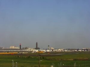
Narita International Airport (NRT), 1-1 Furugome, Narita, Chiba, Japan
17°C / 62.6°F
07:59

Peace Memorial Park, Nakajimachō, Naka Ward, Hiroshima, Japan
 18.4°C / 65.1°F
07:59
18.4°C / 65.1°F
07:59

The Fuji Yui Bypass Webcam looks down from Satta Pass in Shizuoka City onto one of the narrowest transport corridors in Japan. Under a wooded cliff, the Tokaido Main Line, National Route 1 and the Tomei Expressway run side by side along a thin strip of shore, and the expressway’s carriageways sweep out on viaducts over the rocks and water of Suruga Bay. Shizuoka City runs the camera and calls this angle the traffic hub of the pass. Trains run under the railway’s overhead gantries on the left, cars and heavy trucks fill the road lanes, and the open bay takes up the right of the frame. A second tab carries the city’s other camera at the same spot, which frames Mount Fuji above the bay from the angle Hiroshige chose for his print of Yui.
The Fuji Yui Bypass is a 21.4 kilometer (13.3 mile) section of National Route 1 that runs from Imai in Fuji City to Okitsu-Higashimachi in Shimizu Ward, Shizuoka City. The first stretch opened in April 1972 and the whole route in April 1975. It was built as a toll road, became free to use in 1992, and was completed as a four-lane highway in 2003. At Satta Pass the hills drop almost straight into the sea, so the bypass, the railway and the expressway all have to share the same ledge. From the pass the order is easy to read: the Tokaido Main Line hugs the hillside on the left, the Tomei Expressway takes the seaward edge on the right, and Route 1 runs between them.
The camera looks along the coast toward Yui, so the traffic runs toward and away from the lens rather than across it. A small cluster of houses sits on the strip between the roads, and banks of concrete blocks shield the expressway’s piers where swells roll in from the bay. Shizuoka City describes the corridor as one of the main arteries of Japan, and heavy trucks often make up a large share of what goes by.
Satta Pass itself rises to 93 meters (305 feet) between Yui and Okitsu, two post towns on the old Tokaido road. Its position made it a natural choke point, and armies fought over it twice: in 1351 Ashikaga Takauji battled his brother Ashikaga Tadayoshi here, and in 1568 Takeda Shingen clashed with Imagawa Ujizane and reinforcements sent by Hojo Ujimasa. Utagawa Hiroshige pictured the pass in Yui, his print for this stage of the Fifty-three Stations of the Tokaido. The slope is also geologically unstable, with landslides recorded in 1707, 1854, 1892, 1938, 1948, 1974 and 2014.
The nearest long-term record comes from the Japan Meteorological Agency station in Shizuoka. Winters are mild and often sunny. January averages 6.9 C (44 F), with afternoons around 11.7 C (53 F) and nights near 2.1 C (36 F). On clear winter days the Mt Fuji View tab can show the snowcapped cone across the bay. Spring warms quickly, from 15.2 C (59 F) in April to 19.2 C (67 F) in May.
Summer is hot and humid. August averages 27.4 C (81 F), with afternoon highs near 31.3 C (88 F), and July is the wettest month at 296.6 millimeters (11.7 inches) of rain. The annual total is about 2,327 millimeters (91.6 inches). Late summer and early autumn are typhoon season, when surf can pile up against the blocks under the expressway. Autumn cools to 19.4 C (67 F) in October and 14.3 C (58 F) in November, and Shizuoka logs roughly 2,150 hours of sunshine a year.
The camera’s own hillside is the first stop. A section of the old Tokaido climbs over Satta Pass to an observation deck, about 45 to 50 minutes on foot from JR Okitsu Station. On a clear day the deck lines up Mount Fuji with the Tomei Expressway, Route 1 and the railway directly below, the same scene as the city’s two cameras.
Yui was the 16th post town on the Tokaido, and its small fishing port is known across Japan for sakura shrimp, a tiny shrimp caught only in Suruga Bay and nicknamed the jewels of Suruga Bay. In the old town, Yui Honjin Park stands on the site of the inn where traveling lords once stayed, and the Shizuoka City Tokaido Hiroshige Museum of Art holds the artist’s woodblock prints of the road. Both are about 25 minutes on foot from Yui Station.
For more of Japan and more busy roads, try these cameras.
The Fuji Yui Bypass is part of National Route 1 in Shizuoka Prefecture, Japan. It runs 21.4 kilometers (13.3 miles) from Imai in Fuji City to Okitsu in Shimizu Ward, Shizuoka City. The camera watches the section below Satta Pass, between the old post towns of Yui and Okitsu on the shore of Suruga Bay.
The main view looks down from Satta Pass along the coast toward Yui. The Tokaido Main Line runs against the hillside on the left, Route 1 runs through the middle, and the Tomei Expressway curves out over the sea on viaducts to the right, with Suruga Bay filling the rest of the frame.
Not on the main traffic view, which points down at the roads. Switch to the Mt Fuji View tab: that camera, at the same spot, takes in Mount Fuji above the bay with the roads curving along the shore at the bottom of the frame. The 3,776 meter (12,388 foot) peak is about 37 kilometers (23 miles) away, so haze and cloud often hide it, and it shows best on clear, dry days.
No. The bypass opened as a toll road in the 1970s and has been free to use since 1992.
Mild and fairly sunny in winter, hot and humid in summer. Shizuoka averages 6.9 C (44 F) in January and 27.4 C (81 F) in August, and July is the wettest month.
Start at JR Okitsu Station and walk about 20 minutes across the Okitsu River to the foot of the pass. The upper trail to the observation deck is about 3.4 kilometers (2.1 miles) from the station, roughly 50 minutes, and the middle trail is about 2.9 kilometers (1.8 miles), roughly 45 minutes. From the deck the old road continues down toward Yui.
Legend says fishermen in the Kamakura period pulled a stone statue of Jizo Bodhisattva from the sea in their nets and enshrined it on the pass, and the pass took its name from that statue.
The best new live webcams and site features, once a week.
By subscribing you agree to receive our weekly email. Unsubscribe any time.
 22.3°C / 72.1°F
 16.7°C / 62.1°F