Live

 20:36:27
 8.6°C / 47.5°F
 Clear Sky
 92%
 6 km/h / 4 mph
 08:04
 18:38
Loading forecast…



Kollen Park, Lake Macatawa, Holland, Michigan, USA
13.1°C / 55.6°F
20:36
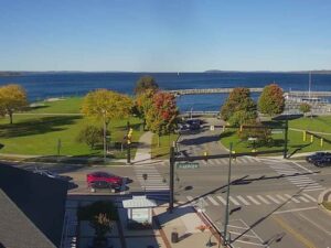
Clinch Park, Grand Traverse Bay, Michigan, USA
 10.5°C / 50.9°F
20:36

Michigan Technological University, Houghton, Michigan, USA
8.9°C / 48°F
20:36
Boyne Falls, Charlevoix County, Michigan, USA
8.8°C / 47.8°F
20:36


Caberfae Peaks, Caberfae Lane, Cadillac, MI, USA
11.1°C / 52°F
20:36The Soo Locks Webcam looks down from the Tower of History, 64 meters (210 feet) above Sault Ste. Marie, Michigan, onto the locks that lift and lower ships between Lake Superior and the lower Great Lakes. It is a pan-tilt-zoom camera, so the picture moves. One minute it holds a wide shot of Portage Avenue, the lock park and the St. Marys River, with the steel arches of the International Bridge behind. The next it zooms in tight on a freighter sitting low in a lock chamber, or swings east to follow a laker past the museum ship Valley Camp. From mid-January to late March the locks close for the winter.
The locks exist because of the St. Marys Rapids, where the river drops 6.4 meters (21 feet) on its way from Lake Superior toward Lake Huron. The first lock on the American side, the State Lock, opened in 1855. Today two locks carry the ship traffic. The MacArthur Lock opened in 1943 and is 244 meters (800 feet) long. The Poe Lock, rebuilt in 1968, is 366 meters (1,200 feet) long and 34 meters (110 feet) wide, and it is the only one that can take the largest lake freighters, ships carrying up to 72,000 short tons (65,000 tonnes) of cargo. Up to about 10,000 vessels pass through in a year, from Great Lakes “lakers” to ocean-going “salties”.
Tower cranes stand over the lock yard, where a new lock is under construction and slated for completion by 2030. Beyond them, a band of white water marks the rapids, and the double steel arch of the Sault Ste. Marie International Bridge crosses the American locks with 38 meters (124 feet) of clearance. Closer in, the International Railroad Bridge, first built in 1887, crosses the canal, its tall steel lift tower standing out in the zoomed shots. On the far shore, the stacks of a steel mill and the buildings of Sault Ste. Marie, Ontario fill the skyline.
The Tower of History itself was built by the Catholic Church in 1968 as the Shrine of the Missionaries and has been run by Sault Historic Sites since 1980. Turned east, the camera looks over the Museum Ship Valley Camp, a 168 meter (550 foot) freighter launched in 1917, and the Saint Marys Falls Hydropower Plant, a red stone powerhouse about 408 meters (1,340 feet) long, completed in 1902. Sault Ste. Marie was founded by French missionaries in 1668, which makes it the oldest city in Michigan.
Winters here are long, cold and snowy. January highs average -4 C (24 F) and lows -13 C (8 F), and the city gets about 305 centimeters (120 inches) of snow a year, so winter frames can show snow across the rooftops of downtown. The locks close on January 15 and reopen on March 25 under a federal rule tied to Great Lakes ice, which makes late winter the quietest stretch on the camera. Spring arrives late, with April averaging 9 C (49 F) by day and -1 C (30 F) at night.
Summer is mild, with July highs around 25 C (77 F) and lows near 13 C (55 F). October averages 12 C (54 F) by day and 4 C (39 F) at night, and the trees around the lock park and along Portage Avenue turn orange and red.
The Soo Locks Visitor Center and its viewing deck put you right beside the lock chambers, close enough to watch a freighter rise or fall the full 6.4 meters (21 feet). Once a year, on Engineers Day on the last Friday of June, the public is allowed behind the security fence. For the reverse of this camera’s view, take the express elevator up the Tower of History, whose observation decks look out over as much as 3,100 square kilometers (1,200 square miles) of river, city and Canadian wilderness.
On the waterfront, the Museum Ship Valley Camp lets you go aboard a laker that hauled iron ore and coal on the Great Lakes from 1917 until 1966. Soo Locks Boat Tours, in business since 1934, takes passengers through the locks themselves on a cruise of about two hours. The International Bridge leads across the river to Sault Ste. Marie, Ontario, so carry a passport or another accepted border document.
For more freighters, bridges and locks, try these cameras next.
The Soo Locks are on the St. Marys River in Sault Ste. Marie, in Michigan’s Upper Peninsula, on the border with Ontario, Canada. They connect Lake Superior with Lake Huron and the rest of the Great Lakes. The Mackinac Bridge at St. Ignace is about 80 kilometers (50 miles) to the south.
The camera pans between several views from the Tower of History. Looking west, it covers the lock park, the lock chambers, the rapids and the International Bridge. Looking east, it follows the river past the Valley Camp and the hydropower plant. It often zooms in close when a ship is in the locks.
Two locks handle ship traffic today: the MacArthur Lock, opened in 1943, and the Poe Lock, rebuilt in 1968. Only the Poe is large enough for the biggest lake freighters. A new lock is under construction in the same complex and is slated to be completed by 2030.
Freighter traffic changes from day to day, so the most reliable guide to what is coming is a live ship-tracking map. The camera’s YouTube description links one centered on the locks, along with a scanner feed of marine radio channel 12, which carries Soo traffic.
The locks close for winter maintenance at 11:59 p.m. on January 15 and reopen at 12:01 a.m. on March 25. During those weeks the chambers sit empty, so the camera shows the city and the river rather than ships.
Yes. The double steel arch that carries the bridge over the American locks appears in most of the westward shots, often with the railroad bridge and its lift tower in front. The bridge opened in 1962 and runs 4.5 kilometers (2.8 miles) across the river to Ontario.
Yes. The wide shots look straight down on downtown, with Portage Avenue running toward the locks. Sault Ste. Marie, Ontario appears only as a skyline across the river.
Winters are cold and snowy, with January highs near -4 C (24 F). Summers are mild, with July highs around 25 C (77 F).
Source: StreamTime Live
The best new live webcams and site features, once a week.
By subscribing you agree to receive our weekly email. Unsubscribe any time.
 12.1°C / 53.8°F