
Live

 19:38:19
 11.4°C / 52.5°F
 Broken Clouds
 96%
 9 km/h / 6 mph
 08:06
 18:44
Loading forecast…



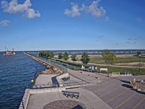

Canada Creek Ranch, Montmorency County, Michigan, USA
 13.8°C / 56.8°F
19:38

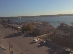
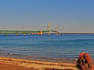
Mackinaw City, Straits of Mackinac, Michigan, USA
13.2°C / 55.8°F
19:38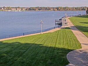
Kollen Park, Lake Macatawa, Holland, Michigan, USA
17.7°C / 63.9°F
19:38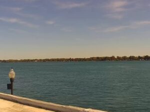


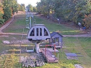
Caberfae Peaks, Caberfae Lane, Cadillac, MI, USA
19.1°C / 66.4°F
19:38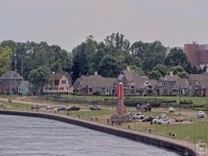
The Charlevoix Webcam looks west down the Pine River Channel in Charlevoix, Michigan, from a rooftop on the south bank toward the red South Pier Light and the open water of Lake Michigan. A paved walkway with a blue railing follows the left wall of the channel, while the right bank holds a stone restaurant with a waterside deck and, higher up, the turreted Weathervane Terrace hotel. Every boat moving between Lake Michigan and Round Lake has to pass through this cut, from small runabouts to the car ferry that serves Beaver Island. Two more cameras from the same operator sit in the tabs, one on the downtown drawbridge and one over the yacht docks on Round Lake.
Charlevoix is a city of 2,348 people (2020 census) at an elevation of 181 meters (594 feet), set on a narrow neck of land between Lake Michigan and Lake Charlevoix. Round Lake sits in the middle of town as its harbor, and the Pine River Channel links it to Lake Michigan. Work on the channel began in the late 1860s, and by 1884 it had been widened from 23 meters (75 feet) to more than 30 meters (100 feet) and deepened from under 2 meters (6 feet) to 3.7 meters (12 feet), turning a shallow river mouth into a harbor entrance.
At the far end of the frame, the Charlevoix South Pier Light marks the harbor mouth. The current red steel tower was installed in 1948 and stands 13 meters (44 feet) tall, a square pyramid under a black ten-sided lantern. It is still an active aid to navigation, lit from May 1 to October 20 each year, and the wooden pier beneath it was rebuilt in 1989 with steel piles, concrete and rock fill. Lighthouse historians describe a two-way current in the channel: after a storm pushes water into Lake Charlevoix, it drains back out against the incoming flow, raising eddies and whitecaps even on calm days.
The turreted building on the right bank is the Weathervane Terrace, which Earl Young finished in 1965. Young (1889 to 1975) put up 31 structures in Charlevoix over 52 years, built from limestone, fieldstone and boulders gathered across northern Michigan, and his stone homes are known locally as the mushroom houses. Behind the camera to the east, US 31 crosses the channel on the Memorial Drawbridge, a double-leaf bascule bridge that opened to traffic in late June 1949 as the fifth bridge on the spot.
Lake Michigan keeps summers mild here. July averages a high of 24 C (76 F) and a low of 16 C (61 F), and August is almost identical. Spring warms slowly beside the cold lake: April highs reach only 9 C (48 F), and May about 16 C (61 F). Autumn holds on longer, with October highs near 14 C (57 F) and lows around 6 C (43 F). October is also the wettest month, at 110 millimeters (4.3 inches) of precipitation, and by mid-month the trees along the north bank turn orange and red.
Winter is long and snowy. January averages a high of -2 C (29 F) and a low of -8 C (18 F), and the town gets about 255 centimeters (100 inches) of snow a year, three quarters of it between December and February. The camera keeps running through the cold months, when the operator describes ice flowing through the channel, while the lighthouse stays dark from late October until the following May.
The paved walkway on the left of the frame is the easiest place to start, since it runs along the channel wall toward the South Pier and the red light. Inland, ten of Earl Young’s stone houses stand in Boulder Park, on land he bought in 1924, and more sit around Park Avenue, including his own home at 306 Park Avenue.
The Beaver Island Boat Company sails from 103 Bridge Park Drive in Charlevoix, a two-hour crossing to Beaver Island out in Lake Michigan. Fisherman’s Island State Park covers 1,084 hectares (2,678 acres) southwest of town, with 9.7 kilometers (6 miles) of Lake Michigan shoreline. In town, the Venetian Festival has run since 1931 and fills a week each July with music, a boat parade and fireworks, and Apple Fest takes over downtown on the second weekend of October.
These cameras cover the same corner of Lake Michigan and another lighthouse pier on its shore.
The main Channel Cam looks west along the Pine River Channel to the red South Pier Light and Lake Michigan, with the walkway on the left bank and the Weathervane Terrace on the right. The Bridge Cam tab looks east along the channel to the US 31 drawbridge with Round Lake beyond, and the Round Lake Cam tab shows motor yachts at the docks with boathouses, condos and trees along the far shore.
Charlevoix is in the northwest of Michigan’s Lower Peninsula and is the county seat of Charlevoix County. It sits between Lake Michigan and Lake Charlevoix, about 25 kilometers (15 miles) west-southwest of Petoskey in a straight line. Beaver Island lies offshore, a two-hour ferry ride away.
Michigan. These cameras are in the city of Charlevoix on Lake Michigan in the United States. Charlevoix in Quebec is a separate region on the north shore of the St. Lawrence River in Canada.
Yes, on the Bridge Cam tab. It looks east along the channel to the Memorial Drawbridge, the double-leaf bascule bridge that carries US 31 through downtown Charlevoix. From April through October it opens on the hour and half hour for larger boats, so a few minutes either side of those times is the moment to watch it lift. The main Channel Cam faces the other way, toward Lake Michigan.
Not of the main lake. The Channel Cam faces west to Lake Michigan, and the Round Lake Cam shows Round Lake, the small harbor between the channel and Lake Charlevoix. The same operator also streams the Ironton Ferry crossing on Lake Charlevoix, which has its own page on this site.
Summers are mild, with July highs around 24 C (76 F), and winters are cold, with about 255 centimeters (100 inches) of snow a year. The AccuWeather box in the top right corner of the Channel Cam shows the current temperature.
Earl Young’s stone houses stand in a few clusters, with ten in Boulder Park and several more around Park Avenue, Grant Street and Clinton Street, built between about 1918 and the early 1970s. The Weathervane Terrace on the right bank of the Channel Cam view is one of his buildings, finished in 1965.
Source: CharlevoixCam
The best new live webcams and site features, once a week.
By subscribing you agree to receive our weekly email. Unsubscribe any time.
 13.7°C / 56.7°F