
 English
 简体中文
 Deutsch
 Français
 Español
 Nederlands
 Svenska
 Italiano
 日本語
 Polski
 Português
 Русский
 Ελληνικά
 العربية
 Türkçe

Live
Zambezi River, Namibia
Zambezi Mubala Lodge - Gondwana Collection Namibia, Katima Mulilo, Namibia
 30.9°C / 87.6°F
 20:2321:23:07
 21°C / 69.8°F
 Scattered Clouds
 53%
 29 km/h / 18 mph
 06:12
 18:19
Loading forecast…
Zambezi Mubala Lodge - Gondwana Collection Namibia, Katima Mulilo, Namibia
30.9°C / 87.6°F
20:23
Paarl Golf Club, Wemmershoek Road, Boschenmeer Golf Estate, Paarl, South Africa
 16.7°C / 62.1°F
20:23

Atlantic Star Nautical Center, Santa Maria, Cabo Verde
 29.3°C / 84.7°F
17:23





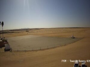
Swakopmund Municipal Aerodrome, Swakopmund, Namibia
16.5°C / 61.7°F
20:23
Savanna Car Hire /Autovermietung Savanna Windhoek, Namibia, Trift Street, Windhoek, Namibia
22.2°C / 72°F
20:23
The Mpala Research Centre Webcam looks across a slow brown river to a rocky hill crowned with rounded boulders, at the watering hole of Mpala Research Centre in Laikipia County, central Kenya. Thornbush and scattered trees cover the slope beyond the water, a bleached dead tree stands in the middle distance, and grass and shrubs crowd the near bank. Four cameras share this page, all streamed by explore.org: the main view over the watering hole’s main beach, an Animal Lookout over the same stretch of river, a closer Watering Hole camera, and a Hippo River camera upriver where hippos rest in the shallows. Animals come down when they need to drink, so a view can sit empty for an hour and then fill with elephants, giraffes or a string of impala within minutes.
Mpala Research Centre opened in November 1994 on the Laikipia Plateau, northwest of Mount Kenya, at the heart of what scientists call the Ewaso ecosystem: a large and varied stretch of central Kenya defined by the Ewaso Ng’iro River and its tributaries. The property has since grown to more than 48,000 acres (about 19,400 hectares, or 75 square miles), and the land lies between 1,700 and 2,000 meters (5,580 and 6,560 feet) above sea level. The nearest town of any size is Nanyuki, about 50 kilometers (31 miles) away.
This is the Smithsonian Institution’s first permanent research facility in Africa. It runs as a joint venture of the Mpala Wildlife Foundation, Princeton University, the Smithsonian, the Kenya Wildlife Service and the National Museums of Kenya. The country around it is arid and semi-arid savanna and woodland, with an estimated 550 bird species and 100 mammal species, among them large elephant populations and rarer animals such as Grevy’s zebra, reticulated giraffe and African wild dog.
All four cameras sit along the river at the watering hole. The operator calls the fields behind the watering hole Tranquility Glade, and names another favorite spot Basking Beach. The upriver camera covers the wildlife corridors on both banks, the routes elephants, giraffes and kudus take on their way down to drink. Acacia trees line the riverbank on the Animal Lookout view, and they are home to vervet monkeys, olive baboons and many birds. On the main camera, a clock in the bottom right corner shows the local date and time, three hours ahead of UTC.
Altitude keeps Mpala milder than its position just north of the equator suggests, and the temperature barely shifts through the year. Afternoon highs typically run from about 24°C (75°F) in July and August to about 28°C (82°F) in March, while nights cool to around 13 to 15°C (55 to 59°F). Rain, not heat, sets the seasons. Mpala averages only about 500 millimeters (20 inches) a year, most of it in the long rains around April and May and the short rains around October and November, with a smaller rise in the middle of the year. January to March is the driest stretch.
On the Mpala Research Centre Webcam, the grass and the river show the season. After the rains the banks turn green and the river can run high and muddy, while pools across the plateau give animals other places to drink. In the dry months the grass fades to straw and the river matters more, which typically brings heavier traffic to the watering hole. Being so close to the equator, Mpala sees almost no change in day length, and sunrise falls between 6 and 7 am local time all year.
Ol Pejeta Conservancy, to the south near Nanyuki, is the best known wildlife stop in this part of Laikipia. It is the largest black rhino sanctuary in East Africa and home to Najin and Fatu, the last two northern white rhinos anywhere, who live under guard in the Endangered Species Enclosure and are seen on a booked guided tour. The entry fee covers the Morani Information Centre, where a ranger can walk visitors in to meet Baraka, a blind black rhino, and Sweetwaters Chimpanzee Sanctuary, the only place in Kenya where chimpanzees can be seen.
Nanyuki is the practical base for this side of Laikipia. The town sits just north of the equator at 0 degrees 1 minute north, and it is the usual staging point for climbs and treks on Mount Kenya, which rises to the southeast of Mpala. Beyond Ol Pejeta to the southwest rises the Aberdare range, which with Mount Kenya forms the pair of highland massifs that frame this part of Laikipia.
These cameras watch water and wildlife elsewhere in Kenya and southern Africa.
Mpala is in Laikipia County in central Kenya, on the Laikipia Plateau northwest of Mount Kenya. The nearest town is Nanyuki, about 50 kilometers (31 miles) away, and the property covers more than 48,000 acres (about 19,400 hectares).
The main camera looks across the river from the watering hole’s main beach toward a boulder-topped rocky hill. Three more cameras sit in the tabs: an Animal Lookout over the same stretch of river, a closer Watering Hole camera where impala graze among fallen logs at times, and a Hippo River camera upriver, where hippos rest in the shallows.
The operator lists elephants, hippos, giraffes, Grevy’s zebras, gazelles, crocodiles, kudus, hyenas, lions and leopards among the visitors. Vervet monkeys, olive baboons and many birds live in the acacias along the riverbank.
Mild and fairly dry. Afternoon highs run from about 24°C (75°F) to 28°C (82°F) through the year, and nights cool to around 13 to 15°C (55 to 59°F). Rainfall averages about 500 millimeters (20 inches) a year, falling mostly in April and May and again in October and November.
Dawn and dusk local time, according to the operator, when the most animals come down to drink. Kenya runs on UTC+3, so that is roughly 6 to 7 am and 6 to 7 pm in Laikipia, or 3 to 4 am and 3 to 4 pm UTC. The Hippo River camera catches the sunrise between 6 and 7 am.
Mpala is a joint venture of the Mpala Wildlife Foundation, Princeton University, the Smithsonian Institution, the Kenya Wildlife Service and the National Museums of Kenya. The cameras are streamed by explore.org under the Mpala Live name.
No. Mpala and Ol Pejeta are separate properties in Laikipia County, with Ol Pejeta lying to the south near Nanyuki. Ol Pejeta has its own waterhole camera at Porini Rhino Camp, on the Ol Pejeta Webcam page.
Source: Explore African Wildlife
The best new live webcams and site features, once a week.
By subscribing you agree to receive our weekly email. Unsubscribe any time.