
Live
Zambezi River, Namibia
Zambezi Mubala Lodge - Gondwana Collection Namibia, Katima Mulilo, Namibia
 25.2°C / 77.4°F
 02:00
02:00 02:00:13
 21°C / 69.8°FClear Sky
 24%
24% 8 km/h / 5 mph
 06:23
06:23 19:01
19:01Loading forecast…
Zambezi Mubala Lodge - Gondwana Collection Namibia, Katima Mulilo, Namibia
25.2°C / 77.4°F
02:00

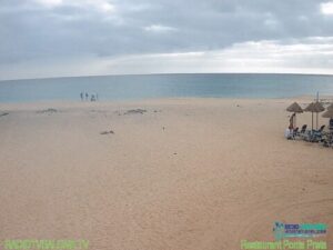

Bloubergstrand Beach, Marine Drive, Cape Town, South Africa
 14.7°C / 58.5°F
02:00
14.7°C / 58.5°F
02:00
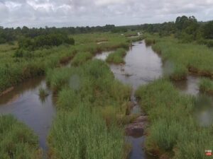
Kruger Shalati - The Train on the Bridge, Kruger National Park, Skukuza, South Africa
25.9°C / 78.6°F
02:00

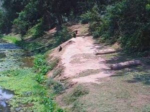

Kwa Maritane, Pilanesberg, North West, South Africa
 23.4°C / 74.1°F
02:00
23.4°C / 74.1°F
02:00The Namib Desert Webcam looks across a small waterhole on an open plain in Gondwana Namib Park, about 8 kilometers (5 miles) from Namib Desert Lodge in western Namibia. A round pool with a flat boulder in the middle sits left of center, ringed by a rim of pale stone. Two bleached, dead trees stand behind it, and beyond them the red gravel gives way to a strip of dry grass and a low reddish ridge on the horizon. Gemsbok, springbok, zebra and ostriches are among the animals that walk in from the open desert to drink, and on one October midday a pair of vultures stood at the water’s edge. A line across the top of the picture reports the live temperature, wind and rainfall at the site, with the local time in the corner.
Gondwana Collection Namibia built the waterhole in 2006 and rebuilt it in June 2021. It lies in the privately owned Gondwana Namib Park, alongside the much larger Namib-Naukluft Park. A solar-powered pump lifts water from a borehole 100 meters (328 feet) deep into a reservoir 150 meters (492 feet) to the northeast, and a pipe with a float valve tops the pool up as animals drink it down. The plain around it lies at roughly 940 meters (3,080 feet) above sea level. Gondwana says the fences between neighboring farms and parks here have been taken down, creating an open area of more than 56,540 square kilometers (21,830 square miles) that wildlife can cross freely.
The visitors Gondwana has recorded at the pool range from gemsbok, the Namibian name for the oryx, to Angolan giraffe, blue wildebeest, red hartebeest and two kinds of zebra. Jackals and hyenas come in too, and the operator even counts a leopard as a possibility.
The Namib itself runs for more than 2,000 kilometers (1,200 miles) along the Atlantic coast through Angola, Namibia and northwest South Africa, and it has been arid or semi-arid for roughly 55 to 80 million years. Behind Namib Desert Lodge rise red fossil dunes, the hardened remains of an older Namib. Not far beyond, the Namib Sand Sea was listed as a UNESCO World Heritage Site in 2013, covering about 3.08 million hectares (7.6 million acres) with dunes up to 300 meters (980 feet) high. Near the coast, thick fog rolls in on more than 180 days a year, and the Namib desert beetle drinks it, letting droplets condense on its back and run down to its mouth.
Summer, from December to February, is hot on this plain. Afternoons typically reach 33 to 34 C (91 to 93 F), and nights stay warm at around 18 C (64 F). What little rain falls comes mostly between January and April, and a typical year adds up to only about 50 millimeters (2 inches). Autumn cools slowly: March highs are still near 33 C (91 F), and May afternoons sit around 29 C (84 F).
Winter, from June to August, brings the mildest days, with highs around 25 C (77 F), but the nights turn cold at between 7 and 11 C (45 and 52 F). Spring heats up fast, from about 30 C (86 F) in September back to 33 C (91 F) by November. From May to November the area gets almost no rain at all, and Gondwana describes the pumped water as what draws wildlife in from miles around.
Namib Desert Lodge stands on the C19 road at the foot of the fossil dunes, 30 kilometers (19 miles) south of Solitaire and 60 kilometers (37 miles) north of Sesriem. From the lodge, self-guided trails cross a dry riverbed to the base of the fossil dunes, and a guided walk of about three hours climbs onto them, with the guide explaining the plants and animals along the way. Solitaire, to the north, is known for the old car wrecks left around it.
To the south, the Sesriem gate beside Sesriem Canyon is the way into the Sossusvlei area of Namib-Naukluft Park. Dune 45, 45 kilometers (28 miles) past Sesriem on the road in, is 80 meters (262 feet) high. Sossusvlei itself is a salt and clay pan about 66 kilometers (41 miles) past the gate, where the seasonal Tsauchab River ends in the sand. Big Daddy, the highest dune around it, reaches about 325 meters (1,066 feet), and the white clay pan of Deadvlei lies close by.
More live views from Namibia and from other waterholes in southern Africa:
A round, stone-rimmed waterhole on a flat gravel plain, with dead trees behind it and a low red ridge on the horizon. Gemsbok, springbok, zebra, giraffe and ostriches are among the animals that come to drink, and birds such as vultures stop at the water too. A line at the top of the picture shows the live temperature, wind and rain at the site.
In Gondwana Namib Park in western Namibia, on an open plain 8 kilometers (5 miles) from Namib Desert Lodge. The nearest settlements are Solitaire, 30 kilometers (19 miles) north of the lodge on the C19, and Sesriem, 60 kilometers (37 miles) south of it. The operator gives the waterhole’s GPS position as -24.074923, 15.887410.
No. The lodge is 8 kilometers (5 miles) away and out of frame, and the tall red dunes of Sossusvlei are roughly 125 kilometers (78 miles) south of it by road. The camera shows the open plain around the waterhole, with gravel, dry grass and a low ridge rather than sand dunes.
At this waterhole Gondwana has recorded gemsbok, springbok, blue wildebeest, red hartebeest, steenbok, Angolan giraffe, Hartmann’s mountain zebra, Burchell’s zebra, ostriches, jackals and hyenas. Smaller specialists live in the fog belt nearer the coast, among them the Namib desert beetle, which drinks the fog that condenses on its back.
Around the waterhole, summer afternoons from December to February typically reach 33 to 34 C (91 to 93 F). Winter days are milder at around 25 C (77 F), but winter nights fall to between 7 and 11 C (45 and 52 F), so the desert is hot by day and can be cold after dark.
The Namib covers about 160,000 square kilometers (62,000 square miles) and stretches more than 2,000 kilometers (1,200 miles) along the Atlantic coast, through Angola, Namibia and northwest South Africa.
Gondwana Collection Namibia runs the NamibiaCam channel. Besides this one, it streams the Okaukuejo waterhole in Etosha National Park, a camera in the Kalahari Desert and one on the Kwando River. The Namib Desert stream has run as the same broadcast since November 2021.
The best new live webcams and site features, once a week.
By subscribing you agree to receive our weekly email. Unsubscribe any time.
 25.8°C / 78.4°F