Live

 02:31:32
 10.2°C / 50.4°F
 Overcast Clouds
 90%
 38 km/h / 24 mph
 07:58
 17:58
Loading forecast…

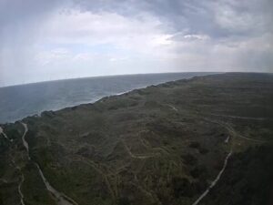
Lyngvig Fyr, Holmsland Klitvej, Hvide Sande, Denmark
8.6°C / 47.5°F
02:31

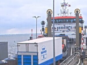


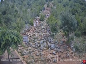
Church of Saint James the Greater (Apostle) - Medjugorje, Međugorje, Bosnia and Herzegovina
 9.2°C / 48.6°F
02:31

Port de Vannes, Quai Bernard Moitessier, Vannes, France
14.8°C / 58.6°F
02:31
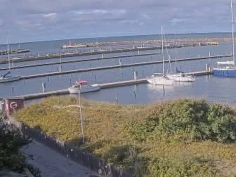
The Anholt Marina Webcam looks over Anholt Havn, the harbor at the western end of Anholt, a small Danish island in the middle of the Kattegat. The fixed camera faces roughly west from the landward side of the marina. A low dune bank covered in grass and shrubs fills the foreground, edged with weathered wooden boards and wrapped by paved paths. Behind it, long pontoons reach across the marina basin, with sailboats and motorboats tied up along them. The outer breakwater runs across the back of the frame, and beyond it the open sea stretches to the horizon. Harbor buildings line the quay on the right. The number of boats follows the sailing season, and because the view faces open water, clear evenings can end with the sun going down over the Kattegat.
Anholt lies roughly midway between the Djursland peninsula on the east coast of Jutland and the coast of Sweden. The island covers 21.75 square kilometers (8.4 square miles), measures about 11 kilometers (6.8 miles) from end to end, and had 150 residents at the start of 2022. It belongs to Norddjurs Municipality in the Central Denmark Region. There are two settlements: the harbor village around this marina, and Anholt By, the main village, about 3 kilometers (1.9 miles) inland.
The harbor was built between 1899 and 1902, and almost everyone who comes to Anholt arrives through it. The ferry from Grenaa docks here, and in summer the operator says hundreds of masts fill the basin as visiting yachts come in. Boats lie between the pontoons and stern mooring buoys, and the harbor keeps a fuel point for petrol and diesel open around the clock.
Most of the island east of the harbor is Orkenen, “the Desert”, a treeless area covering about 80 percent of Anholt that has never been plowed and holds some 300 to 400 kinds of lichen. The highest points are Sonderbjerg at 48 meters (157 feet) and Nordbjerg at 39 meters (128 feet), and on clear days both look out toward Jutland and Sweden. Britain occupied the island during the Napoleonic Wars, from 1809 to 1814, and on 27 March 1811 a Danish force tried and failed to retake it in the Battle of Anholt.
Surrounded by open water, Anholt has a strongly maritime climate, and the sea keeps the gap between day and night small. Weather model data for 2017 to 2025 puts January and February highs around 4 C (39 F), with nights near 2 C (36 F). Spring warms slowly while the Kattegat is still cold: April highs average about 8 C (47 F) and May about 12 to 13 C (54 to 55 F). The island is one of the driest parts of Denmark, and spring is typically its driest season.
July and August are the warmest months, with highs of about 18 to 19 C (64 to 66 F) and mild nights around 16 C (61 F), and this is when the pontoons on the Anholt Marina Webcam are at their fullest. Autumn holds on to the warmth of the sea: September still averages about 17 C (62 F), October about 13 C (55 F) and November about 9 C (48 F), and October tends to be the wettest month. At 56.7 degrees north, daylight lasts about 17.5 hours in late June and drops below 7 hours in late December, so winter views of the marina are short and lit by a low sun.
Anholt By, with the island’s church, rebuilt after the British occupation, is an easy walk or bike ride inland from the harbor. A sandy beach about 8 kilometers (5 miles) long runs along the north coast, and more sand rings most of the island. The airfield has a 650 meter (2,133 foot) grass runway, with flights from Roskilde, west of Copenhagen.
At Totten, the far eastern tip, stands Anholt Fyr. The current tower dates from 1881, and its light sits about 40 meters (131 feet) above the sea. The British fortified the lighthouse as Fort York during the occupation, and the 1811 battle was fought for it. Totten is also a seal reserve, set up in 1981, with one of the largest harbor seal colonies in Denmark; the reserve is closed to visitors, so the seals are watched from a distance. Out to sea between Anholt and Djursland, the 111 turbines of the Anholt Offshore Wind Farm, completed in 2013, generate 400 megawatts, and the ferry passes close by them on the crossing.
Three more Nordic coasts to watch:
Anholt Marina is the harbor at Anholt Havn, at the western end of the island of Anholt in the Kattegat, Denmark. The ferry port of Grenaa on Djursland is about 50 kilometers (31 miles) to the southwest, roughly three hours away by ferry.
The camera faces roughly west over a grassy dune bank to the marina basin: long pontoons, moored sailboats and motorboats, the outer breakwater, and the open Kattegat on the horizon. Harbor buildings stand along the quay on the right, and paved paths run around the dune in the foreground.
No. Anholt Fyr and the seal reserve are at Totten, on the far eastern tip of the island, well out of sight of the harbor. The offshore wind farm lies between Anholt and Djursland, but its turbines could not be picked out in the frames checked for this page. Anholt By is inland and not in view either.
Mild and maritime. Winter highs are around 4 C (39 F) with nights near 2 C (36 F), and July and August highs reach about 18 to 19 C (64 to 66 F). The island is one of the driest parts of Denmark, and October tends to be the wettest month.
The ferry sails daily from Grenaa on Djursland, takes about three hours and docks in this harbor. Private boats moor in the marina, and the island’s grass airfield has flights from Roskilde.
The Sailor House has toilets, washrooms and a lounge, and berths use stern mooring buoys. Harbor fees and electricity and shower cards are paid at card-only machines, petrol and diesel are available 24 hours a day, and there is a barbecue area.
A privacy mask covers part of the paved area to the right of the dune, so that patch always shows as a pixelated block. It is built into the stream and does not mean the camera is faulty. The text along the top of the picture is the camera’s own date, time and name stamp.
Source: Anholt Havn
The best new live webcams and site features, once a week.
By subscribing you agree to receive our weekly email. Unsubscribe any time.
 8.3°C / 46.9°F
 15°C / 59°F
 2°C / 35.6°F