Live

 18:19:36
 7.2°C / 45°F
 Overcast Clouds
 100%
100% 26 km/h / 16 mph
 07:48
07:48 18:28
18:28Loading forecast…
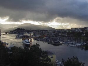
The Westman Islands Webcam looks across the harbor approach on Heimaey, the largest of Iceland’s Westman Islands, at the south face of Heimaklettur. The mountain fills most of the frame, a wall of orange and brown cliffs with a strip of grass along the top, and a small light beacon stands on a stone jetty at its foot. The low sun of morning and late afternoon turns the rock a deep orange, and on calm mornings the water below holds a mirror image of the cliff. Small boats and the occasional larger vessel cross the frame on their way to and from the harbor. Two more cameras from the same operator sit in the player’s tabs: a town view from the upper secondary school, and the seaside holes of the island’s golf course.
The Westman Islands, Vestmannaeyjar in Icelandic, are a group of 18 islands and about 30 rock stacks and skerries off Iceland’s south coast. Heimaey is the largest at 13.4 square kilometers (5.2 square miles) and holds the town of Vestmannaeyjar, home to 4,537 people. Its harbor sits behind a narrow entrance, with Heimaklettur rising straight out of the water on the northern side. At 283 meters (928 feet), Heimaklettur is the highest point in the islands. It is a tuff mountain, built by an eruption under a glacier late in the last ice age, which explains the layered, pitted look of the cliff face on camera.
The island’s recent history was shaped by lava. On 23 January 1973 an eruption began without warning on the eastern side of Heimaey, and roughly 5,000 residents were evacuated to the mainland. It built the cone of Eldfell to about 200 meters (660 feet) and lasted 155 days, until early July. About 300 buildings were engulfed by lava or gutted by fire. Crews pumped 6.8 billion liters (1.8 billion US gallons) of cold seawater onto the advancing flow, and the harbor survived. The lava narrowed the entrance without closing it and now works as a breakwater, giving the harbor better shelter than before. The eruption also added about 2.5 square kilometers (1 square mile) of new land to the island.
In 1627 pirates from the Barbary Coast raided Heimaey, burned the church and killed or carried off almost half the islanders to Algeria. The youngest island in the group, Surtsey, rose from the sea in an eruption that began on 14 November 1963 and lasted about four years.
Winters are mild for Iceland. January days average a high of about 3.8 C (39 F), and nights usually stay just above freezing, around 1 to 2 C (34 to 36 F). Spring warms slowly, with April highs near 6.5 C (44 F). July and August are the warmest months, with highs around 12 C (54 F) and lows near 10 C (50 F), and by October daytime temperatures are back to about 8 C (47 F). Wind and rain are the constants. The islands get about 1,600 millimeters (63 inches) of precipitation a year, and Iceland’s highest measured wind speed, 61 meters per second (220 km/h or 140 mph), was recorded here.
On camera, that weather decides how much of Heimaklettur you get. Low cloud and drizzle can wrap the summit and turn the water gray, while a clear day shows every ledge of the cliff against a deep blue sky. Daylight swings hard at 63 degrees north. Around the winter solstice the sun climbs only about 3 degrees above the horizon at midday, so the view is lit for just a few hours. In June the sun dips only slightly below the horizon, and the sky over the harbor never gets fully dark.
Heimaklettur itself can be climbed. The route starts with a vertical ladder on the west side of the mountain and continues on a stepped path, and a ladder has been fixed at the most difficult section since around 2000. The hike takes about an hour. Eldfell rises on the east side of town, and Eldheimar, a museum about the 1973 eruption, lies 1.7 kilometers (1.1 miles) south of the Herjolfur ferry terminal.
Seabirds are the other big draw. More than 30 species nest in the cliffs, and the islands hold about 1,125,000 puffin burrows, 42 percent of Iceland’s total, often described as the largest nesting puffin population in the world. The Sea Life Trust Beluga Whale Sanctuary on Heimaey also houses puffins and seals. Golfers can play the Westman Islands Golf Club course in Herjolfsdalur. The club was founded in 1938, the third oldest in Iceland, and the course grew to 18 holes in 1992, with the first nine among the hills and cliffs of the valley and the second nine beside the sea, the stretch the golf course tab looks over. The island also hosts the annual Thjodhatid festival of music, bonfires and fireworks.
More Icelandic cams and North Atlantic island waters to watch next:
The Westman Islands lie off the south coast of Iceland. Heimaey, the largest island, is about 12 kilometers (7.5 miles) by ferry from Landeyjahofn on the mainland.
The main view shows the south face of Heimaklettur above the water at the approach to Heimaey’s harbor, with a light beacon on a jetty at the foot of the cliff and boats passing through. Two tabs add a town view from the upper secondary school and the seaside holes of the golf course, looking out to two sea stacks.
Mild, wet and windy. January highs average about 3.8 C (39 F) and July highs about 12 C (54 F), with around 1,600 millimeters (63 inches) of precipitation a year.
Heimaklettur stands 283 meters (928 feet) high, the tallest point in the Westman Islands. The hike starts with a vertical ladder on the west side and takes about an hour.
The Herjolfur ferry sails from Landeyjahofn on Iceland’s south coast and takes roughly 30 to 35 minutes. Flights to Heimaey are the other option.
Eldfell erupted on 23 January 1973 and kept going for 155 days, until early July. Around 5,000 people were evacuated, and seawater pumped onto the lava helped save the harbor.
Yes. The islands hold about 1,125,000 puffin burrows, 42 percent of Iceland’s total, and more than 30 bird species nest in the cliffs.
The camera streams around the clock, so at night the player shows darkness. Winter days are very short at this latitude, and around the solstice the view is lit for only a few hours around midday.
Source: Live From Iceland
The best new live webcams and site features, once a week.
By subscribing you agree to receive our weekly email. Unsubscribe any time.
 3.8°C / 38.8°F
 1.8°C / 35.2°F


 20.1°C / 68.2°F

 12.7°C / 54.9°F
 15.5°C / 59.9°F