Live

 15:53:36
 -3.4°C / 25.9°F
 Broken Clouds
 98%
98% 4 km/h / 2 mph
 08:33
08:33 17:19
17:19Loading forecast…
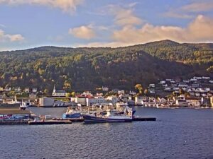
The Akureyri Webcam looks out from Rosenborg, a former school on the hill above the town center, and follows the rooftops of North Iceland’s largest town down to the harbor and the long waters of Eyjafjordur. The twin towers of Akureyri Church stand on the right of the frame. Beyond them the fjord runs north toward the open sea, with the long slope of Vadlaheidi on the far shore and a line of peaks closing off the horizon. The picture changes a great deal through the year. The trees in the gardens below turn yellow and orange in autumn, snow can cover the roofs and hillsides in winter, and around midsummer the sky stays bright through the night. Cloud often sits low on the mountains, so the far shore can vanish and return within an hour.
Akureyri sits at the head of Eyjafjordur, a fjord that stretches 60 kilometers (37 miles) from the town to its mouth and is mostly 5 to 10 kilometers (3 to 6 miles) wide. With 20,284 residents in 2026, it is the largest municipality in Iceland outside the Capital Region, and Icelanders call it the capital of North Iceland. The town lies about 100 kilometers (62 miles) south of the Arctic Circle and about 390 kilometers (242 miles) from Reykjavik. Permanent settlement began here in 1778 and the town received its charter in 1786. Its ice-free harbor is central to the local economy, and cruise ships call there through the summer. Akureyri Airport is the only airport in Iceland apart from Keflavik with scheduled international flights.
The camera is mounted on Rosenborg, at Skolastigur 2. The building opened in 1930 as Akureyri’s primary school, to a design by the architect Gudjon Samuelsson, and gained an extension in 1949 and 1950 once the classes had outgrown it. It served as a school for 75 years, until the last bell rang in June 2005. After a renovation it took the name Rosenborg in 2006, chosen in a public vote, and it now houses the town’s community centers, municipal offices and the Punkturinn craft workshop.
The church in the foreground is Akureyrarkirkja, the Lutheran Akureyri Church, also designed by Gudjon Samuelsson and completed in 1940, so the Akureyri Webcam looks from one of his buildings straight at another. Inside the church are a 3,200-pipe organ, an altarpiece painted in 1863 by the Danish artist Edvard Lehmann, and windows made by J. Wippel & Co. of Exeter in England. The camera sits behind glass, which is why a strip of window frame edges the right side of the picture.
July is the warmest month in Akureyri, with a mean temperature of 11.2 C (52 F) over the 1991 to 2020 period, and January is the coldest at -0.5 C (31 F). The record high is 29.4 C (85 F), set in June, and the record low is -23.0 C (-9 F), set in March. The town gets about 574 millimeters (22.6 inches) of precipitation in a year. The climate is mild enough that the botanical garden up the hill grows its collection outdoors, without a greenhouse.
Each season looks different from this vantage point. Summer brings green lawns, a green far shore and the occasional cruise ship at the harbor, and in June the sun dips below the horizon only briefly. Autumn turns the trees in town gold and the slope of Vadlaheidi a rusty brown. In winter the roofs and the far side of the fjord often go white, and around the December solstice the sun is up for only a few hours, so for most of the day the camera shows the town under street lights. Spring brings the light back quickly, while snow lingers on the high ground well after the streets have cleared.
Akureyri Church is a short walk from the camera, and from there the streets drop into the town center. Hof, the town’s cultural and conference center, hosts concerts and also serves as the stop for long-distance buses. The town has a good spread of museums for its size: the Akureyri Museum, the Akureyri Art Museum, the Aviation Museum, a motorcycle museum, and Nonnahus, the old home of the children’s author Jon Sveinsson. The Akureyri Botanical Garden, Lystigardurinn, opened as a public park in 1912 through the work of local women led by Anna Schioth, and the botanical collection was added in 1957.
Hlidarfjall, west of Akureyri, is the largest ski area in northern Iceland, with slopes reaching 1,014 meters (3,327 feet). Sulur, the twin rhyolite peaks southwest of town, rises to 1,213 meters (3,980 feet) and is a popular summer hike. Farther out, Godafoss, the horseshoe waterfall on the Ring Road, is 35 kilometers (22 miles) from town. The Vadlaheidargong tunnel under the ridge across the fjord opened in December 2018; it is Iceland’s only toll road and shortens the drive toward Lake Myvatn by 16 kilometers (10 miles). Out in the fjord, the island of Hrisey is 7.5 kilometers (4.7 miles) long and home to about forty bird species, including Arctic terns, eiders and ptarmigan.
Three more cams from Iceland and the far north.
Akureyri is in North Iceland, at the head of the Eyjafjordur fjord. It lies about 100 kilometers (62 miles) south of the Arctic Circle and about 390 kilometers (242 miles) from Reykjavik, and its airport is one of only two in Iceland with scheduled international service.
The camera looks north from the Rosenborg building over the rooftops of the town center. Akureyri Church and its twin towers fill the right of the frame, the harbor sits beyond, and the fjord stretches away between the slope of Vadlaheidi and the mountains on the western shore.
Cool summers and fairly mild winters for the latitude. July averages 11.2 C (52 F) and January -0.5 C (31 F), based on the 1991 to 2020 averages.
It is the largest municipality outside the Capital Region, with 20,284 people in 2026, and it serves as the main service center for the north, with a university, a busy harbor and an airport with international flights.
The architect Gudjon Samuelsson designed the church, which was completed in 1940. He also designed the 1930 school building, now called Rosenborg, that the camera is mounted on.
Yes. Hlidarfjall, just west of town, is the largest ski area in northern Iceland, and its slopes reach 1,014 meters (3,327 feet).
Hrisey lies about 35 kilometers (22 miles) north of Akureyri, out in Eyjafjordur. Drive up the western shore of the fjord to Arskogssandur and take the ferry, which crosses in about fifteen minutes.
Source: Akureyrarbaer (Town of Akureyri)
The best new live webcams and site features, once a week.
By subscribing you agree to receive our weekly email. Unsubscribe any time.
 3.6°C / 38.5°F

 3.9°C / 39°F

 18.1°C / 64.6°F

 9.3°C / 48.7°F