
Live

 18:19:12
 8.6°C / 47.5°F
 Overcast Clouds
 93%
93% 13 km/h / 8 mph
 07:43
07:43 18:24
18:24Loading forecast…


HOVIMA La Pinta Beachfront Family Hotel, Avenida de España, Costa Adeje, Spain
 26.7°C / 80.1°F
19:19
26.7°C / 80.1°F
19:19

Kijkduin, The Hague, Netherlands
 13.3°C / 55.9°F
20:19
13.3°C / 55.9°F
20:19




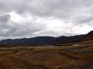
The Dyrholaey Webcam looks north across the top of Dyrholaey, a 120 meter (390 foot) headland on the south coast of Iceland, about 6.5 kilometers (4 miles) west of Vik. A dark footpath curves through the grass toward the upper car park, where campervans and rental cars line up on the right of the frame. In the middle, a rock outcrop with a sheer face and a deep hollow drops toward the Dyrholaos lagoon, whose shallow water and flats spread across the left side. Hills close the view, and on a clear day the long white dome of the Myrdalsjokull ice cap rises along the skyline behind them. The grass is green in July and turns gold by September, while low cloud on grey days can hide the glacier completely.
Dyrholaey means “door hill island”, a name taken from the huge black lava arch that stands in the sea at the tip of the headland. It was once an island of volcanic origin, built by an eruption about 100,000 years ago during the Pleistocene, and it now rises 120 meters (390 feet) between the Dyrholaos lagoon and the Atlantic. In October 1993 a pilot who was also a member of parliament became the first person to fly an airplane through the arch, making three passes in a small aircraft.
The camera looks over the upper part of the headland, close to Dyrholaey Lighthouse. A light has stood here since 1910, when the first one was a skeletal steel tower prefabricated in Sweden. The present lighthouse dates from 1927: a square concrete tower 13 meters (43 feet) tall, painted white with red trim, with its light 118 meters (387 feet) above the sea. It flashes white every 10 seconds and reaches 27 nautical miles (50 kilometers, 31 miles) offshore. The grounds are open to visitors, but the tower is not.
Live From Iceland lists this feed under the name Solheimajokull, one of 14 named outlet glaciers that flow off Myrdalsjokull. What the camera shows is the Dyrholaey plateau, with the ice cap as the backdrop whenever the cloud lifts.
The nearest long-term records come from Vik, just along the coast. Winters are mild for the latitude: January averages highs of 3.5 C (38 F) and lows of -1.4 C (29 F). April warms to highs of 6.5 C (44 F), July averages 13.2 C (56 F) by day and 8.3 C (47 F) at night, and October cools to highs around 7.4 C (45 F). Rain is the defining feature. Vik is the wettest coastal town in Iceland, with about 2,250 millimeters (89 inches) a year, three times the total in Reykjavik, so the camera often shows wet paths, puddles and cloud sitting low on the hills.
Light changes the scene as much as the weather. At 63 degrees north, the headland gets about 20.5 hours of daylight around the June solstice and only about 4.5 hours in late December. Summer brings green grass and long evenings, while in autumn the plateau turns gold and the late afternoon sun lights the outcrop orange. In winter, snow can cover the plateau. After dark the camera switches to a black and white night mode, with a few distant lights showing as bright points.
On the headland itself, the short path from the upper car park around the lighthouse leads to the best view of the arch. A steep switchback road, rebuilt and paved in 2022, climbs to that car park, and a second one sits at the base. In summer, Atlantic puffins nest on the cliff faces, and from the top you can look east to Reynisdrangar, the basalt sea stacks off the shore near Vik. The black sand beach at Vik, facing those stacks, was named by the US journal Islands Magazine in 1991 as one of the ten most beautiful beaches on Earth.
Vik i Myrdal, 180 kilometers (112 miles) southeast of Reykjavik, has about 750 residents and is the largest settlement for some 70 kilometers (43 miles) around, which makes it the place to stop for fuel, food and a bed. Its hilltop church is the evacuation point if Katla, the volcano under Myrdalsjokull, erupts; it last did in 1918, and residents could have as little as 15 minutes to reach the church. The ice cap reaches 1,450 meters (4,760 feet) and covered about 520 square kilometers (200 square miles) in 2019, with Solheimajokull among its outlet glaciers to the northwest.
More live views from Iceland and the far North Atlantic:
Dyrholaey is on the south coast of Iceland, in the Myrdalur district of the Southern Region, about 6.5 kilometers (4 miles) west of Vik in a straight line. Vik is 180 kilometers (112 miles) southeast of Reykjavik.
The camera looks north over the upper plateau: a footpath through the grass, the upper car park on the right, a rock outcrop above the Dyrholaos lagoon, and hills beyond. On clear days the Myrdalsjokull ice cap appears across the skyline.
Mild and very wet. Nearby Vik averages highs of 3.5 C (38 F) in January and 13.2 C (56 F) in July, with about 2,250 millimeters (89 inches) of rain a year.
Yes, on a clear day. The ice cap lies to the north and shows as a white dome across the middle of the skyline, though low cloud often hides it. It covers the Katla volcano, which last erupted in 1918.
The camera runs around the clock and switches to a black and white night mode after dark, so the overnight picture is grainy and grey. Color returns at first light.
Atlantic puffins nest on the cliff faces of Dyrholaey in summer. This camera faces inland over the plateau, so the seaward cliffs are out of frame.
No, although it is often described that way. Kotlutangi is the southernmost point of mainland Iceland, and the island of Surtsey lies farther south still.
Source: Live From Iceland
The best new live webcams and site features, once a week.
By subscribing you agree to receive our weekly email. Unsubscribe any time.
 3.8°C / 38.8°F
 1.8°C / 35.2°F
 15.9°C / 60.6°F
 9.3°C / 48.7°F