
Live

 18:16:38
 1.5°C / 34.7°F
 Broken Clouds
 1%
 6 km/h / 4 mph
 08:35
 17:41
Loading forecast…
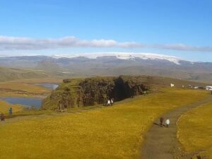
The Thingvellir Webcam looks out from the Hakid viewpoint, across the rift valley of Thingvellir National Park to Thingvallavatn, the largest natural lake in Iceland. A curved boardwalk with steel railings loops out over a mossy lava outcrop in the middle of the frame, walkers follow it from the paved stone plaza in the foreground, and beyond them the plain runs down to the water and the low hills on the far shore. A second camera, on the Skjaldbreidur tab, turns north over open heath and fissured lava toward the shield volcano that gives it its name. The light changes the scene fast here. A sunny hour turns the grass gold and the lake silver, a passing shower can wipe out the far shore within minutes, and in winter snow fills the cracks in the lava.
Thingvellir lies about 40 kilometers (25 miles) northeast of Reykjavik, on the floor of the rift valley where the North American and Eurasian plates meet. Almannagja, the largest of the faults crossing the valley, forms its western wall. Hakid is the park’s main viewpoint, on high ground above the gorge beside the visitor center, which was extended in July 2018. Three walking paths start there, and boardwalks lead down through Almannagja itself.
The place matters to Iceland for more than its geology. The Althing, the national assembly, was founded here in 930 and met in the open air at Thingvellir until 1798, with assemblies opened and closed at Logberg, the Law Rock, a natural platform for speeches. Legislation to protect the area passed in 1928, the national park followed in 1930, and UNESCO listed Thingvellir as a World Heritage Site in 2004.
Thingvallavatn fills the background of the main view. It covers 84 square kilometers (32 square miles), averages 34 meters (112 feet) deep and reaches 114 meters (374 feet) at its deepest point. Its surface sits about 103 meters (338 feet) above sea level, so the bottom of that deepest hole lies 11 meters (36 feet) below the sea. Spring water filtered through fissures such as Silfra feeds the lake along with the Oxara river, the Sog is its only outflow, and four distinct forms of Arctic char live in it.
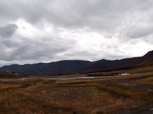
The Skjaldbreidur camera faces the other way, up the valley. Moss, dwarf shrubs and lines of broken lava fill the foreground, the corner of a viewing platform juts in at the right edge, and a dark mountain closes the view on the left. Skjaldbreidur, a shield volcano 1,066 meters (3,497 feet) high whose name means broad shield, sits on the skyline when the cloud lifts. Its lava, erupted roughly 9,500 years ago, flowed south and built the basin that Thingvellir and the lake now occupy.
Thingvellir lies inland at around 100 meters (330 feet), and its winters are cold and dark. From December to February the average temperature stays around -2 to -3 C (27 F), daytime highs hover near 0 C (32 F) and nights drop to about -6 C (21 F). Snow can cover the lava and the boardwalk, and the low sun throws long shadows across the plain for the few hours it is up. By the December solstice daylight shrinks to about 4 hours, roughly late morning to mid afternoon, so the picture is dark for most of a winter day. Spring arrives slowly, and April still averages only about 2 C (36 F).
Summer is mild rather than warm. July averages about 11 C (52 F), with afternoon highs near 14 C (57 F), and around the June solstice the sun is up for about 21 hours, so the cameras show daylight almost around the clock. In October the heath on the Skjaldbreidur view turns rust red and the grass below Hakid goes gold, while the mean temperature falls to about 4 C (39 F). Rain comes through in every season, most of all from autumn into winter, often as fast showers that sweep across the lake and clear again.
The classic walk starts at Hakid. Take the path down into Almannagja and follow the gorge to Logberg, then carry on to Oxararfoss, where the Oxara river drops about 13 meters (43 feet) over the gorge wall. The visitor center at Hakid houses the Heart of Iceland exhibition on the park’s history and nature, and Thingvellir church stands on the plain beyond the river, easy to spot from the viewpoint.
Silfra, a fissure filled with clear spring water on the northern shore of Thingvallavatn, is the park’s best known site for guided snorkeling and diving tours.Thingvellir is also one of the three stops on the Golden Circle drive, together with the Geysir geothermal area and Gullfoss waterfall farther east, so it fits easily into a day trip from Reykjavik.
More of Iceland, plus another protected valley on a different continent.
Thingvellir National Park is in southwest Iceland, in the municipality of Blaskogabyggd, about 40 kilometers (25 miles) northeast of Reykjavik. It sits on the northern shore of Thingvallavatn, inside the rift valley.
The main view looks over the boardwalk and paved plaza at Hakid, across the lava plain to Thingvallavatn and the hills beyond it. The Skjaldbreidur tab looks north over heath and fissures toward the shield volcano of the same name.
Cool and changeable. Winter days hover near 0 C (32 F) with nights around -6 C (21 F), while July afternoons reach about 14 C (57 F). Showers blow through in every season.
About 40 kilometers (25 miles) to the northeast, a drive many visitors combine with Geysir and Gullfoss on the Golden Circle.
In a sense, yes. Both views look across the rift valley between the North American and Eurasian plates, and the cracks running through the lava are part of that rift.
It is the largest natural lake in Iceland, at 84 square kilometers (32 square miles), with a greatest depth of 114 meters (374 feet).
Yes. Silfra is a spring-fed fissure on the northern shore of Thingvallavatn and one of the few places where guided snorkeling and diving tours run.
Near the December solstice the sun is up for only about 4 hours, from late morning to mid afternoon, so the picture is dark for most of the day. In June the sun shines for about 21 hours.
Source: Live From Iceland
The best new live webcams and site features, once a week.
By subscribing you agree to receive our weekly email. Unsubscribe any time.
 -0.7°C / 30.7°F
 1.6°C / 34.9°F

 0.8°C / 33.4°F

 13.7°C / 56.7°F


 10.7°C / 51.3°F