
Bird Migration Map
Where are the birds right now? Thirty-three of the world's great migrations, animated on a world map along their real routes and calendars. The map opens on today. Play the year, fly along with a bird, and watch the live webcams on its way.
On the move today: 13 of 33 species, 7 October
Where a typical bird of each travelling species is today, furthest along first. Open one on the map to follow it.
- White Stork Heading south · The Nile valley · 12 days to go
- Ruby-throated Hummingbird Heading south · Crossing the Gulf of Mexico · 7 days to go
- Northern Wheatear Heading south · Across Siberia · 32 days to go
- Bobolink Heading south · resting at Venezuelan llanos · 24 days to go
- Broad-winged Hawk Heading south · Hawk Mountain, Pennsylvania · 23 days to go
- Barn Swallow Heading south · Through France and Spain · 28 days to go
- Swainson's Hawk Heading south · Veracruz, the river of raptors · 37 days to go
- Arctic Tern Heading south · North Atlantic stopover · 49 days to go
- Sooty Shearwater Heading south · 23 days to go
- Amur Falcon Heading south · 58 days to go
- Short-tailed Shearwater Heading south · 30 days to go
- Whooping Crane Heading south · 39 days to go
- Blackpoll Warbler Heading south · 21 days to go
What this bird migration map shows
- Live today, and any day of the year. The map opens on today's date with the real day and night line. Drag the timeline to any week, or press play to watch twelve months of migration in about a minute.
- Real routes, real calendars. Every species follows the path tracking studies have revealed, with its stopovers, and leaves and arrives when it does in nature, including the loops some birds fly out one way and back another.
- Fly along. Pick a bird and follow its journey from above, the map moving with the flock, with the story of each stopover as it comes: the Yellow Sea mudflats, the Platte River, the horseshoe crabs of Delaware Bay.
- Live webcams on every route. The pins are this site's own cameras. Open a species to see the webcams along its route and at its nesting and wintering grounds, bird cams first.
- The flyways. Switch on the ribbons of the world's nine great migration corridors to see how the routes gather along coastlines and valleys.
- Every bird explained. Distance, time, speed, height, weight, the longest nonstop flight, the conservation status and the facts worth repeating, with a photo of each species.
The birds and their journeys
Every species on the map, longest journey first: where it goes, how far one way, and the months it sets off. Distances are typical for the population described; the dates are the usual windows and shift a week or two with the weather.
| Bird | Journey | One way | Leaves to winter | Leaves to breed | Today |
|---|---|---|---|---|---|
| Sooty Shearwater Ardenna grisea | The islands of southern New Zealand to the North Pacific, off Alaska, Japan and California | 30,000 km (18,600 mi) | Mar to Apr | Sep to Oct | Heading south |
| Arctic Tern Sterna paradisaea | Greenland, Iceland and Arctic Canada to the Antarctic pack ice of the Weddell Sea | 19,000 km (11,800 mi) | Aug to Sep | Apr | Heading south |
| Red Knot Calidris canutus rufa | The central Canadian Arctic to Tierra del Fuego, at the southern tip of South America | 15,000 km (9,300 mi) | Jul to Sep | Feb to Mar | Wintering grounds |
| Short-tailed Shearwater Ardenna tenuirostris | Tasmania and the Bass Strait islands to the Bering Sea, between Alaska and Siberia | 15,000 km (9,300 mi) | Apr to May | Sep to Oct | Heading south |
| Northern Wheatear Oenanthe oenanthe | Alaska and the Yukon to East Africa, from Sudan to Kenya | 14,500 km (9,000 mi) | Aug to Sep | Mar to Apr | Heading south |
| Bar-tailed Godwit Limosa lapponica baueri | The Yukon-Kuskokwim Delta, Alaska to New Zealand and eastern Australia | 11,500 km (7,100 mi) | Sep to Oct | Mar | Wintering grounds |
| Amur Falcon Falco amurensis | The Amur region of Siberia, Mongolia and northern China to southern Africa | 11,000 km (6,800 mi) | Sep to Oct | Apr to May | Heading south |
| Swainson's Hawk Buteo swainsoni | The prairies of Canada and the western United States to the pampas of Argentina | 10,000 km (6,200 mi) | Aug to Oct | Feb to Mar | Heading south |
| Barn Swallow Hirundo rustica | Britain and Ireland to South Africa | 10,000 km (6,200 mi) | Sep to Oct | Feb to Mar | Heading south |
| White Stork Ciconia ciconia | Poland, Germany and eastern Europe to East and southern Africa | 10,000 km (6,200 mi) | Aug to Sep | Feb to Mar | Heading south |
| Manx Shearwater Puffinus puffinus | The islands of Wales, Scotland and Ireland to the coast of Brazil and Argentina | 10,000 km (6,200 mi) | Aug to Oct | Feb to Mar | Wintering grounds |
| Bobolink Dolichonyx oryzivorus | The hayfields of the northern United States and southern Canada to the grasslands of Bolivia, Paraguay and Argentina | 10,000 km (6,200 mi) | Aug to Sep | Mar to Apr | Heading south |
| Common Swift Apus apus | Britain and northern Europe to the Congo basin and Mozambique | 8,000 km (5,000 mi) | Jul to Aug | Apr to May | Wintering grounds |
| Common Cuckoo Cuculus canorus | Britain and northern Europe to the Congo rainforest | 8,000 km (5,000 mi) | Jun to Jul | Feb to Mar | Wintering grounds |
| Red-necked Phalarope Phalaropus lobatus | Fetlar, Shetland to the Pacific Ocean off Peru and Ecuador | 8,000 km (5,000 mi) | Jul to Aug | Apr to May | Wintering grounds |
| Broad-winged Hawk Buteo platypterus | The forests of eastern North America to Central America and the northern Andes to Brazil | 7,000 km (4,300 mi) | Sep to Oct | Mar to Apr | Heading south |
| Great Snipe Gallinago media | The mountain bogs of Scandinavia to the Sahel and central Africa | 6,500 km (4,000 mi) | Aug to Sep | Apr to May | Wintering grounds |
| Rufous Hummingbird Selasphorus rufus | The Pacific Northwest, north to southern Alaska to the mountains of central Mexico | 6,300 km (3,900 mi) | Jul to Aug | Feb to Apr | Wintering grounds |
| Tundra Swan Cygnus columbianus | The Arctic coast of Alaska and Canada to Chesapeake Bay and the Carolina sounds | 6,000 km (3,700 mi) | Sep to Nov | Feb to Mar | Breeding grounds |
| Osprey Pandion haliaetus | Scotland and northern England to the coast of Senegal and The Gambia | 5,000 km (3,100 mi) | Aug to Sep | Mar to Apr | Wintering grounds |
| Pacific Golden Plover Pluvialis fulva | The tundra of western Alaska to the Hawaiian Islands | 4,800 km (3,000 mi) | Aug to Sep | Apr to May | Wintering grounds |
| Snow Goose Anser caerulescens | The Arctic tundra of Canada, from Hudson Bay to Baffin Island to the Gulf Coast of Texas and Louisiana | 4,500 km (2,800 mi) | Sep to Nov | Feb to Apr | Breeding grounds |
| Blackpoll Warbler Setophaga striata | The boreal forest of Canada and Alaska to the northern Amazon basin | 4,500 km (2,800 mi) | Sep to Oct | Apr to May | Heading south |
| Sandhill Crane Antigone canadensis | Canada, Alaska and eastern Siberia to Texas, New Mexico and northern Mexico | 4,000 km (2,500 mi) | Sep to Nov | Feb to Mar | Breeding grounds |
| Whooping Crane Grus americana | Wood Buffalo National Park, Alberta and the Northwest Territories to Aransas National Wildlife Refuge, Texas | 4,000 km (2,500 mi) | Sep to Oct | Mar to Apr | Heading south |
| Semipalmated Sandpiper Calidris pusilla | The Arctic tundra of Canada and Alaska to the coast of Suriname and the Guianas | 4,000 km (2,500 mi) | Jul to Aug | Apr to May | Wintering grounds |
| Ruby-throated Hummingbird Archilochus colubris | Eastern North America, from Texas to Nova Scotia to southern Mexico and Central America | 3,500 km (2,200 mi) | Aug to Oct | Feb to Apr | Heading south |
| Demoiselle Crane Grus virgo | The steppes of Mongolia and Kazakhstan to Rajasthan and Gujarat, India | 3,000 km (1,900 mi) | Aug to Oct | Feb to Mar | Wintering grounds |
| Canada Goose Branta canadensis | Canada and the northern United States to the central and southern United States | 2,500 km (1,600 mi) | Oct to Nov | Feb to Apr | Breeding grounds |
| Common Crane Grus grus | Sweden, Finland and the Baltic to Extremadura and Aragón, Spain | 2,500 km (1,600 mi) | Sep to Nov | Feb to Mar | Breeding grounds |
| Bar-headed Goose Anser indicus | The lakes of Mongolia, Tibet and Qinghai to the plains of northern India | 2,500 km (1,600 mi) | Sep to Nov | Mar to Apr | Breeding grounds |
| Pink-footed Goose Anser brachyrhynchus | The interior of Iceland and east Greenland to Scotland, Lancashire and Norfolk | 1,600 km (990 mi) | Sep to Oct | Apr to May | Wintering grounds |
| Whooper Swan Cygnus cygnus | Iceland to Ireland, Scotland and northern England | 1,000 km (620 mi) | Oct to Nov | Mar to Apr | Breeding grounds |
The world's flyways
The broad corridors that migrating birds funnel through, drawn as ribbons on the map. Coastlines, mountain ranges and the places to rest and feed shape them.
- Pacific Americas FlywayDown the west coast of the Americas from Alaska to Patagonia: rufous hummingbirds, Pacific shorebirds and the swans and geese of California's Central Valley.
- Central Americas FlywayThe Great Plains corridor and the land bridge of Central America. The whooping crane's whole wild flock uses it, and millions of hawks squeeze through Veracruz every autumn.
- Mississippi Americas FlywayThe great river valley from Hudson Bay to the Gulf of Mexico, the busiest waterfowl route on Earth: snow geese, ducks and the sandhill cranes of the Platte.
- Atlantic Americas FlywayThe eastern seaboard from the Canadian Arctic to Tierra del Fuego, with the Bay of Fundy and Delaware Bay as its great refuelling stops. Red knots, warblers and the hawks counted at Hawk Mountain.
- East Atlantic FlywayWestern Europe to West and southern Africa by way of Iberia, Gibraltar and the Sahara: Britain's swallows, swifts, ospreys and cuckoos, and the Icelandic geese and swans that winter in Britain.
- Black Sea / Mediterranean FlywayEastern Europe to Africa over the Bosporus, Israel and the Nile. The white stork's route, and the busiest raptor and stork crossings in the world.
- West Asian / East African FlywaySiberia and central Asia to East Africa across Arabia. The northern wheatear's 14,500 km (9,000 mi) road from Alaska ends on it.
- Central Asian FlywayMongolia and Tibet over the Himalaya to India: the highest flyway on Earth, used by bar-headed geese and demoiselle cranes.
- East Asian / Australasian FlywaySiberia and Alaska through the Yellow Sea to Australia and New Zealand, home to the godwit's record flight and the most threatened mudflats in the world.
Watch the birds live
Nest cameras and feeder cameras from this site, the same ones pinned on the map. Osprey and stork nests fill in spring and empty in late summer, exactly as the map shows those species arriving and leaving.





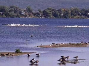
How bird migration works
Twice a year, billions of birds move between the places they breed and the places they can survive the winter. The engine is food. The north has a vast summer flush of insects and plants and almost 24 hours of daylight to feed chicks in, but nothing to eat once the ground freezes. So a warbler raises its young in a Canadian spruce forest and spends January in the Amazon; a swallow nests in an English barn and winters in South Africa. The routes are not random: they bend around the oceans and deserts that cannot be crossed without fuel, and they pass through the handful of estuaries, lakes and valleys where a bird can rest and refuel.
Before a long flight a bird becomes an athlete. It eats until fat makes up half its body weight; some even shrink their digestive organs to make room. Then it waits for a tailwind. Small birds fly at night, when the air is cool and calm and the hawks are asleep, and navigate by the stars and the Earth's magnetic field. Big soaring birds fly by day, riding thermals in spirals thousands strong and gliding from one to the next with barely a wingbeat. Shorebirds and seabirds simply go: a bar-tailed godwit leaves Alaska and does not stop, eat or sleep until it lands in New Zealand nine days later.
Migration is also the most dangerous thing a bird does. Storms, deserts, exhaustion, lit windows and the loss of the stopover sites themselves take an enormous toll, and many of the species on this map are declining. The Yellow Sea mudflats, Delaware Bay, the Bay of Fundy and the Platte River are protected because the birds that pass through them cannot do without them.
Migration seasons in North America and Britain
In the United States and Canada, spring arrives from the south in waves. Sandhill cranes are on the Platte in March; the first ruby-throated hummingbirds cross the Gulf of Mexico in late February and reach Canada by May; the songbird peak comes in the first half of May, when a single front can bring a million warblers down on the Texas coast or the Great Lakes shore. Autumn is slower and longer: shorebirds head south from July, broad-winged hawks pass Hawk Mountain in mid-September, snow geese fill the Mississippi valley in October and tundra swans reach Chesapeake Bay in November.
In Britain and Ireland the first swallows and ospreys are back in late March, the cuckoo is heard from mid-April and the swifts arrive in the first days of May. The summer visitors leave between July (the adult cuckoos first) and October (the last swallows), and as they go the winter visitors arrive: pink-footed geese from Iceland in September, whooper swans in October, and the fieldfares, redwings and waders of a British winter. The map's "on the move" list follows exactly these rhythms day by day.
Bird migration map FAQ
What does this bird migration map show?
It shows where 33 of the world's great migratory birds are through the year, animated on a world map. Each species has its real route, from the breeding grounds to the wintering grounds and back, with the stopovers the birds use, and a calendar of when they travel. The flocks on the map leave, fly and arrive on those dates, so on any day you can see which birds are on the move, which way they are heading and roughly where they are. Open a species for its photo, its journey in numbers, the story of the route and the live webcams along it.
Is the bird migration map live?
The clock is live: the map opens on today's date, with the day and night line where it really is, and the flocks are where that species typically is at this point in the year. The birds themselves are not GPS-tracked in real time; no map of a whole species could be, because a species is millions of individuals. What you see is the well-documented pattern, from tracking studies and decades of ringing and counting, applied to today. The "Today" button always brings you back to now.
When is bird migration season?
In North America and Britain there are two seasons. Spring migration runs from late February to early June and peaks in late April and May, when the songbirds pour north. Autumn migration is longer and more spread out: shorebirds start south in July, hawks and swallows go in September, and geese, swans and cranes are still arriving in November. The southern hemisphere is the mirror image: New Zealand's shearwaters and godwits head north in March and April and come home in September and October. Press play on the timeline to watch the whole year in a minute.
Which bird has the longest migration?
The Arctic tern. It breeds in the Arctic and spends the other half of the year on the edge of Antarctica, a round trip of about 70,000 km (43,500 mi), and over a 30-year life it flies the equivalent of three return trips to the Moon. For a single nonstop flight the record belongs to the bar-tailed godwit, which flies from Alaska to New Zealand, 11,000 to 13,000 km (6,800 to 8,100 mi), in eight to eleven days without landing. The sooty shearwater's 64,000 km (39,800 mi) figure-of-eight around the Pacific is the longest migration ever recorded with an electronic tag.
Why do birds migrate?
Food. The far north has an enormous flush of insects, plants and daylight in summer, enough to raise a brood quickly and with few predators, but nothing to eat in winter. So birds commute: north to breed where the summer food is, south to where it is warm enough to survive the winter. Each species' route and timing is tuned to that: hummingbirds follow the flowers, geese follow the thaw, hawks wait for the thermals and shorebirds time their stops to the hatching of horseshoe crabs and mud shrimp.
How do birds know where to go?
Several compasses at once. Birds read the sun by day and the stars by night, they sense the Earth's magnetic field, and they remember landmarks, coastlines and even smells. Some learn the route from their parents: geese, swans and cranes travel as families. Others are born knowing it: a young cuckoo has never met its parents and still finds the Congo rainforest on its first try, and Manx shearwater chicks leave Wales alone for South America. Birds that have flown a route once will return to the same tree, the same lawn or the same stretch of beach year after year.
Do birds migrate at night?
Most small birds do: warblers, thrushes, sparrows and shorebirds take off an hour after dusk and fly through the night, when the air is calmer and cooler and there are fewer hawks about. On a good night in spring or autumn hundreds of millions of birds are aloft over North America, which is why so many are heard calling overhead in the dark. Soaring birds such as hawks, storks and cranes do the opposite: they need the thermals that only rise in daytime, so they travel by day and stop at dusk. The night layer on the map shows where it is dark right now.
How high and how fast do migrating birds fly?
Most migration happens between a few hundred and 2,000 metres (6,600 ft) up, where the winds help, but the records are remarkable. Bar-headed geese have been tracked above 7,000 metres (23,000 ft) crossing the Himalaya, and a flock of whooper swans was reported by a pilot at 8,000 metres (26,200 ft). Cruising speeds are typically 40 to 70 km/h (25 to 43 mph); the great snipe averaged 97 km/h (60 mph) over 6,800 km (4,200 mi) nonstop, with no help from the wind. With a tailwind, geese cover more than 1,000 km (620 mi) in a day and a night.
How is "on the move" worked out?
Each species has a departure window and a flying time for both legs of its journey, plus the stopovers where it rests. The map gives each bird in a flock its own departure date and pace within those windows, so the flock strings out along the route just as a real population does. A species counts as on the move when a typical bird, one leaving in the middle of the window, is between its two grounds today. "About to leave" means that bird departs within three weeks. The windows are typical for the population described; an early spring or a late cold snap can shift a real migration by a week or two.
Can I watch migrating birds on a live webcam?
Yes. Open any species on the map and the panel lists the live webcams on its route and at its breeding and wintering grounds, bird cams first. The osprey nests in Scotland, Oregon and New Jersey fill in late March and April and empty again in August; the stork nests of Germany and Latvia follow the same rhythm; the eagle and falcon cams are busy from February; and the feeder cams in Alberta and the Andes show whatever is passing through. The pins on the map are the same cameras: click one for a preview and a link to watch it live.
What is a flyway?
A flyway is one of the broad corridors that migrating birds funnel through, shaped by coastlines, mountain ranges and the places birds can rest and feed. Conservationists recognise eight or nine major ones: four down the Americas, three between Europe or western Asia and Africa, one through central Asia to India and one from Siberia through East Asia to Australia and New Zealand. Switch the Flyways layer on to see them as ribbons under the routes; most of the species on this map follow one of them.