
Live

 17:37:27
 6.4°C / 43.5°F
 Overcast Clouds
 81%
81% 13 km/h / 8 mph
 07:57
07:57 18:35
18:35Loading forecast…


Riverside Rd, Hoveton, Norwich NR12 8UD, United Kingdom
11.1°C / 52°F
18:37
Church of Saint James the Greater (Apostle) - Medjugorje, Međugorje, Bosnia and Herzegovina
21.2°C / 70.2°F
19:37

Cruise Pirs Arrecife, Avenida de los Marmoles, Arrecife, Spain
 27.1°C / 80.8°F
18:37
27.1°C / 80.8°F
18:37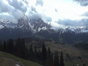



Destination Apelviken, Varberg, Halland County, Sweden
8.9°C / 48°F
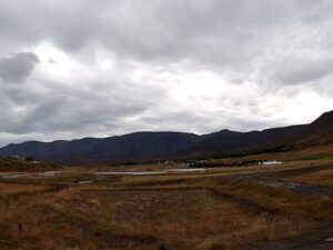
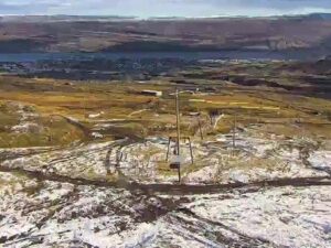
19:37The Fagradalsfjall Webcam looks out over the volcanic heart of Iceland’s Reykjanes Peninsula from the top of Thorbjorn, the 243 meter (797 foot) hill that rises directly north of the town of Grindavik. The Fridriksson channel aims it across the lava country around Svartsengi toward Fagradalsfjall, which stands about 9.4 kilometers (5.9 miles) to the east-northeast. Mossy slopes and a line of dark crags on the summit fill the foreground, with a gravel track winding down between them. Beyond, a pale road crosses the flat ground, a broad dark hill rises on the left, and low ridges run along the horizon. Low cloud sits on Thorbjorn often enough that some mornings show nothing but grey. The stream has been on air without a break since January 12, 2025.
Fagradalsfjall is a tuya, a flat-topped mountain built by eruptions under the ice sheet of the last glacial period. Its highest point, Langholl, reaches 385 meters (1,263 feet), and the mountain lies around 40 kilometers (25 miles) from Reykjavik. The name also covers a wider volcanic system, a strip about 5 kilometers (3 miles) wide and 16 kilometers (10 miles) long between the Eldvorp-Svartsengi and Krysuvik systems. The mountain itself had been dormant for about 6,000 years.
That ended on March 19, 2021, when lava broke out in the Geldingadalir valley, the first eruption on the Reykjanes Peninsula in roughly eight centuries. It lasted six months, until September 18, and left a lava field of 143 million cubic meters (5.0 billion cubic feet) covering 4.6 square kilometers (1.8 square miles). Two shorter eruptions followed: in the Meradalir valley from August 3 to 21, 2022, and near the hill Litli-Hrutur from July 10 to August 5, 2023, which produced 12.4 million cubic meters (440 million cubic feet) of lava. An estimated 700,000 people have walked out to the eruption sites since 2021.
Since December 2023 the activity has shifted west to the Sundhnukur crater row in the Svartsengi system, about 3.5 kilometers (2.2 miles) north of Grindavik, which erupted nine times up to August 2025. Thorbjorn, the camera’s hill, has its own part in the story. In early 2020 the ground around it rose by 3 to 4 millimeters a day, and by mid-April it had lifted about 10 centimeters (4 inches) over a sill of magma 3 to 4 kilometers (1.9 to 2.5 miles) down, with some 8,000 earthquakes recorded. During World War II the U.S. Army built the jeep track that still climbs the hill, and transmitters for Siminn and RUV now stand where the U.S. Navy once ran radar stations.
The Reykjanes Peninsula has a mild, wet and very windy climate for its latitude. From December to February, daytime highs on the lava fields around Fagradalsfjall average about 2 C (36 F) and nights about -2 C (28 F), so snow comes and goes on the heath all winter. Spring warms slowly, from around 3 C (37 F) in March to 8 C (47 F) in May. July and August are the warmest months, with highs near 13 C (55 F) and nights around 8 C (47 F). Autumn turns wet again quickly: September highs average about 10 C (50 F), and October is the rainiest month at roughly 160 millimeters (6.3 inches). Across a year the area gets around 1,600 millimeters (63 inches) of rain and snow.
Late June brings about 21 hours of daylight, while the winter solstice gives only around four, so in midwinter the view is dark for most of the day. Thorbjorn’s summit sits right where the low cloud tends to gather, and on those days the frame turns flat grey. At night the scene goes almost black. An eruption changes that completely, because glowing lava lights up the clouds above it.
Marked hiking paths start from car parks off Route 427, the south coast road east of Grindavik, and lead across the 2021 lava field toward the craters. Paths open and close with the eruption risk in the neighboring Svartsengi system, so check Visit Reykjanes and the Icelandic Met Office before you set out. Thorbjorn itself is a short climb, with trails from the southwest as well as the old jeep track. The mountain is split by a fissure called Thjofagja, the Thieves’ Gap, where 15 thieves are said to have hidden until they were tricked and killed, and on fine days the summit looks out over most of the peninsula.
The Blue Lagoon geothermal spa sits in the lava just 1.7 kilometers (1 mile) north of Thorbjorn’s summit, beside the Svartsengi power station. Farther west, Brimketill is a rock pool in the shoreline lava about 9 kilometers (5.6 miles) west-southwest of Grindavik, and the Gunnuhver geothermal area steams near the Reykjanesviti lighthouse at the southwestern tip of the peninsula. To the east, the lake Kleifarvatn lies about 24 kilometers (15 miles) from Grindavik in a straight line.
These cameras watch the same eruption zone from another angle, or other volcanoes and Iceland’s capital.
Fagradalsfjall is on the Reykjanes Peninsula in southwest Iceland, east of Grindavik and around 40 kilometers (25 miles) from Reykjavik.
The view runs from Thorbjorn’s own mossy summit, with its dark crags and a winding gravel track, across the lava country around Svartsengi toward Fagradalsfjall. The distant ridges vanish when cloud comes down.
It is on Thorbjorn, the 243 meter (797 foot) hill directly above Grindavik, about 9.4 kilometers (5.9 miles) west-southwest of Fagradalsfjall’s summit. The stream is run by the Fridriksson YouTube channel, which calls it a 24/7 webcam from Thorbjorn.
Fagradalsfjall itself has not erupted since August 5, 2023. Since December 2023 the eruptions have come from the Sundhnukur crater row nearby, nine of them up to August 2025. The live view is the quickest check: an eruption shows as a plume by day and an orange glow at night.
Its third eruption in three years ran from July 10 to August 5, 2023, near Litli-Hrutur. The first, in Geldingadalir in 2021, was by far the largest.
Yes, when the area is open. Marked paths start from car parks off Route 427 and cross the 2021 lava field. Access changes with the volcanic hazard, so check Visit Reykjanes and the Icelandic Met Office before going.
Cool, wet and windy. Winter highs average about 2 C (36 F) and summer highs about 13 C (55 F), and October is the wettest month.
Very little unless lava is flowing. The stream runs around the clock, but the lava fields are unlit, so the frame goes nearly black after dark, and in midwinter there are only about four hours of daylight.
Source: Fridriksson
The best new live webcams and site features, once a week.
By subscribing you agree to receive our weekly email. Unsubscribe any time.
 3.8°C / 38.8°F
 1.8°C / 35.2°F
 21.3°C / 70.3°F