
 English
 简体中文
 Deutsch
 Français
 Español
 Nederlands
 Svenska
 Italiano
 日本語
 Polski
 Português
 Русский
 Ελληνικά
 العربية
 Türkçe

Live
 08:41:10
 -3.8°C / 25.2°F
 Overcast Clouds
 69%
 12 km/h / 7 mph
 08:31
 16:57
Loading forecast…
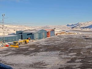
Ilulissat Airport, Ilulissat, Avannaata, Greenland
-9.2°C / 15.4°F
08:41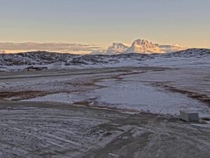


Hotel Miramonti, Viale degli Sci, Gambarie, Metropolitan City of Reggio Calabria, Italy
10.3°C / 50.5°F
11:41


Kijkduin, The Hague, Netherlands
7.1°C / 44.8°F
11:41
Lomnice nad Popelkou, Liberec Region, Czechia
5.7°C / 42.3°F
11:41
The Nanortalik Webcam is the weather camera Greenland Airports runs at Nanortalik Heliport, in the far south of Greenland. Sky takes up most of this wide, low view. Along the bottom runs a line of long red and yellow buildings with a tall white chimney, with brightly painted houses on the right and a bare, rounded hill on the left. Behind the rooftops, a strip of open water separates the town from a jagged ridge of snow-capped peaks. In front of the camera, a wire fence runs past a shallow pond and rocky, rust-colored heath, while a gravel track sweeps in from the right. After dark the camera keeps running, picking out street lamps and lit windows under the stars.
Nanortalik stands on Nanortalik Island on the Labrador Sea coast, about 100 kilometers (62 miles) north of Cape Farewell, the southern tip of Greenland. It had 1,072 residents in 2024, which makes it the third-largest town in the Kujalleq municipality and the southernmost town in Greenland with more than 1,000 people. The name comes from nanoq, the Greenlandic word for polar bear, and is usually translated as “place of polar bears”. The town was founded in 1770, and in 1830 it moved about 3 kilometers (1.9 miles) north to its present site because the old harbor was poor.
The camera belongs to Mittarfeqarfiit, the Greenland Airport Authority, which operates Nanortalik Heliport (ICAO code BGNN) in the eastern part of town. The heliport lies just 5.2 meters (17 feet) above sea level and has a single asphalt landing pad of 9 by 9 meters (30 by 30 feet), with no runway. Air Greenland helicopters connect the town with Qaqortoq and with the small settlements of the district, such as Aappilattoq and Narsarmijit. The same operator streams heliport cameras from Narsaq, Tasiilaq and Uummannaq.
Nanortalik has a cool, wet coastal climate. The yearly mean temperature is 1.5°C (35°F), and about 1,089 millimeters (42.9 inches) of rain and snow fall in an average year. January is the coldest month, with average highs of -1.3°C (30°F) and lows of -8.0°C (18°F), when snow can cover the heath and the pond in front of the camera. Winter days are short. Around the December solstice the sun climbs only about 6 degrees above the horizon at noon and stays up for roughly six hours, so for most of the day the camera shows the town’s lights rather than the mountains.
Spring comes slowly, and April averages highs of 3.6°C (38°F) and lows of -3.1°C (26°F). July is the warmest month, with highs of 12.4°C (54°F) and lows of 4.8°C (41°F). Around the June solstice the sun is up for close to 19 hours and reaches about 53 degrees at midday. October averages highs of 4.6°C (40°F) and lows of -1.0°C (30°F). By late October the heath in front of the camera has turned rust brown, and fresh snow sits on the distant peaks.
In town, Nanortalik Museum is an open-air museum in the old colonial harbor quarter, where the historic houses serve as the exhibits, alongside replica turf houses and umiak skin boats. Two hills rise on the island itself, Quassik at 308 meters (1,010 feet) and Quaqqarsuasik at 559 meters (1,834 feet).
Tasermiut Fjord, 70 kilometers (43 miles) long, is usually explored by boat or kayak. Its granite walls draw big-wall climbers from around the world, among them Ketil at 2,010 meters (6,594 feet), Ulamertorsuaq at 1,858 meters (6,096 feet) and Nalumasortoq at 2,045 meters (6,709 feet). The Qinngua Valley, about 40 kilometers (25 miles) from town, holds the only forest in Greenland. Uunartoq, a small uninhabited island between Nanortalik and Alluitsup Paa, has three natural hot springs that feed a bathing pool at about 38°C (100°F), and bathers can sometimes watch icebergs drift past. Boats to the springs leave from Nanortalik.
More live views from Greenland’s towns and coast:
A wide view from Nanortalik Heliport. From left to right, there is a bare, rounded hill, a long row of red buildings with a tall white chimney, a yellow building, then brightly painted houses below a second hill on the right. Behind them, a strip of open water and a ridge of snow-capped peaks fill the skyline. The foreground is a shallow pond, a wire fence and rocky heath, with a gravel track along the right. Sky takes up about three quarters of the frame, and a weather panel sits in the lower left corner.
Nanortalik is on Nanortalik Island in the Kujalleq municipality of southern Greenland, on the Labrador Sea coast, about 100 kilometers (62 miles) north of Cape Farewell. The heliport is in the eastern part of town.
Yes. The stream is the Nanortalik Heliport camera of Greenland Airports, the Greenland Airport Authority (Mittarfeqarfiit), which operates the heliport. It shows the weather and visibility around the heliport, which has a single landing pad of 9 by 9 meters (30 by 30 feet).
Cool all year. January is the coldest month, with highs around -1.3°C (30°F) and lows near -8.0°C (18°F). April warms to highs of 3.6°C (38°F), July peaks at 12.4°C (54°F) by day and 4.8°C (41°F) at night, and October falls back to highs of 4.6°C (40°F).
Yes, the stream runs around the clock. After dark, the street lamps and lit windows of the town show along the bottom of the frame, and on clear nights stars appear above them. The peaks behind the town show only as faint outlines until morning.
Nanortalik keeps West Greenland time, one hour behind UTC in summer and two hours behind UTC in winter. The clock in the weather panel on the stream shows the current local time.
The open-air Nanortalik Museum fills old colonial buildings by the harbor. Boat trips run into Tasermiut Fjord, where granite peaks such as Ketil rise above 2,000 meters (6,560 feet), and out to the hot springs on Uunartoq island, where the water is about 38°C (100°F). The Qinngua Valley, about 40 kilometers (25 miles) away, holds Greenland’s only forest.
Source: Greenland Airports
The best new live webcams and site features, once a week.
By subscribing you agree to receive our weekly email. Unsubscribe any time.
 8.5°C / 47.3°F
 7.5°C / 45.5°F