Live

 23:16:21
 -0.9°C / 30.4°F
 Few Clouds
 74%
 9 km/h / 6 mph
 08:45
 17:39
Loading forecast…

Ilulissat Airport, Ilulissat, Avannaata, Greenland
 -13.8°C / 7.2°F
23:16






Belfast, County Antrim, Northern Ireland, UK
 9.3°C / 48.7°F
01:16
Planes on the ground and in the air within about 22 km (14 miles) of the airport, updated every 10 seconds. Tap a plane or a flight in the list for its details. Altitudes are above sea level. Positions come from volunteer ADS-B receivers, so some airports show few or no planes on the ground.
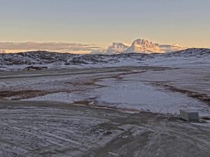
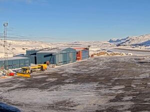
The Kulusuk Webcam streams two live views from Kulusuk Airport, the gravel airstrip on Kulusuk Island off the southeast coast of Greenland. The main camera faces east across a rocky plain to a strip of water, with snow-covered peaks on the left, a sharp pyramid-shaped summit in the middle and a steep mountainside filling the right of the frame. The second view, Airport West, looks over the airfield itself, where wheel loaders clear snow after a fall and a hangar and a few small red buildings stand in the distance. Both cameras belong to Greenland Airports, the state-owned company that runs the airport.
Kulusuk is a village of 241 people, according to Statistics Greenland’s 2020 count, on Kulusuk Island in the Sermersooq municipality. It sits about 110 kilometers (68 miles) south of the Arctic Circle, and the houses lie roughly 2.5 kilometers (1.5 miles) west of the airport terminal, a walk of 20 to 30 minutes along the road. The village church dates from 1908. Hunting and fishing still matter here, but unemployment is high and many villagers rely on tourism for extra income.
The US military built the airstrip in 1956 to supply DYE-4, a radar station on the Distant Early Warning Line that stood on the south tip of the island at the end of an 8 kilometer (5 mile) road. The Americans left in 1991, and a new terminal opened in December 1994. Runway 11/29 is 1,199 meters (3,934 feet) of gravel at an elevation of 36 meters (117 feet).
The airport works as a small hub for the district. Air Greenland flies to Nuuk and to Tasiilaq, 24 kilometers (15 miles) away, where helicopters handle the transfer because ice makes boat travel impractical for part of the year. Icelandair started summer day trips from Iceland in 1959. Those ended in 2019, and since 2025 Icelandair serves Kulusuk in summer only. Hotel Kulusuk opened in 1998.
The closest long climate record comes from Tasiilaq, where the Danish Meteorological Institute’s 1991 to 2020 normals give a yearly mean of -0.3 C (31 F). Winters are dark and cold: January averages a high of -3.3 C (26 F) and a low of -8.9 C (16 F), February nights drop to -9.2 C (15 F), and the station records about 1 hour of sunshine in the whole of January. Spring comes late. April highs reach only 1.3 C (34 F), with lows of -5.7 C (22 F), although April already brings about 162 hours of sunshine.
July is the warmest month, with highs of 10.9 C (52 F), lows of 3.5 C (38 F) and about 245 hours of sunshine. In summer the low ground in the east view turns to brown tundra and gravel, snow lingers on the peaks and ice floes can drift through the water in the middle of the frame. October brings highs of 2.5 C (37 F) and lows of -2.2 C (28 F), and by late October the plain in front of the camera is already white. Wind is the bigger story. Speeds above 100 km/h (62 mph) occur throughout the year, and Tasiilaq holds the wind record for a Greenland settlement, 194 km/h (121 mph) on February 7, 1970.
The walk from the airport to the village takes 20 to 30 minutes, and Hotel Kulusuk runs transfers for its guests. In the village, the church has stained-glass windows donated by a German artist, and visitors sometimes catch an Inuit drum dance. Visit Greenland points to Isikajia Mountain, directly behind the airport, and names the road past the airport to the old DYE-4 station as the most popular self-guided day hike from Kulusuk.
Winter is the season for dog sledding, and a short excursion crosses the frozen fjord to Apusiaajik Glacier. In summer, trips head for the ice caves inside the glacier on nearby Apusiaajik Island, icebergs drift past the coast and whales or seals sometimes surface. Tasiilaq, a helicopter flight away, adds ice cave tours, glacier hikes, boat trips, whale watching and kayaking in summer, and its newer church, built in 1986, has interior decoration by the artist Aka Hoegh.
For more of Greenland’s airports and Arctic coast, these cameras are a good next stop:
Kulusuk is on Kulusuk Island off the southeast coast of Greenland, in the Sermersooq municipality. It lies about 110 kilometers (68 miles) south of the Arctic Circle and 24 kilometers (15 miles) from Tasiilaq.
The main Airport East camera looks east across a snowy, rocky plain to a strip of water, with snow peaks on the left, a pointed summit in the center and a steep slope on the right. The Airport West tab shows the gravel airfield, snow clearing vehicles at work after a fall, a hangar and a few red buildings in the distance. Both pictures carry a Greenland Airports logo and a small weather panel.
Sometimes. The Airport West view covers the airfield, so aircraft can appear there while they are on the ground. The Airport East view points at the mountains and the water, which makes it the one to watch for scenery rather than planes.
No. The cameras are at the airport, roughly 2.5 kilometers (1.5 miles) east of the village. The main camera faces east, away from the houses, and the West camera is aimed across the airfield, with only a few scattered buildings at the edge of the view.
Cold and often windy. At nearby Tasiilaq, January averages -3.3 C (26 F) by day and -8.9 C (16 F) at night, while July reaches 10.9 C (52 F) by day and 3.5 C (38 F) at night. The weather panel on the stream shows the current temperature, wind and a three-day forecast for Kulusuk.
Because of the latitude. Around December 21 the sun is up for only a little over three hours and climbs barely 1 degree above the horizon, so nearby mountains can hide it altogether. From November to February darkness takes up most of the day, with the airfield lights showing on the West view. The streams keep running, and by June daylight lasts close to 23 hours.
Kulusuk Airport is KUS to IATA and BGKK to ICAO. It has one gravel runway, 11/29, which is 1,199 meters (3,934 feet) long, at an elevation of 36 meters (117 feet).
In summer, yes. Icelandair has served Kulusuk from Reykjavik-Keflavik on a summer-only basis since 2025. Air Greenland links Kulusuk with Nuuk and Tasiilaq. Schedules change, so check them before planning a trip.
Source: Greenland Airports
The best new live webcams and site features, once a week.
By subscribing you agree to receive our weekly email. Unsubscribe any time.
 0.9°C / 33.6°F
 0.9°C / 33.6°F
 9.6°C / 49.3°F