
 English
 简体中文
 Deutsch
 Français
 Español
 Nederlands
 Svenska
 Italiano
 日本語
 Polski
 Português
 Русский
 Ελληνικά
 العربية
 Türkçe

Live
 08:45:55
 -1.8°C / 28.8°F
 Broken Clouds
 54%
 20 km/h / 12 mph
 09:40
 16:32
Loading forecast…





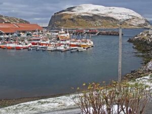
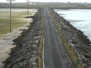
Baleshare, North Uist, Outer Hebrides, Scotland
 2°C / 35.6°F
10:45


Ķemeri National Park, Meža māja, Jūrmala, Latvia
 10°C / 50°F
12:45
Planes on the ground and in the air within about 22 km (14 miles) of the airport, updated every 10 seconds. Tap a plane or a flight in the list for its details. Altitudes are above sea level. Positions come from volunteer ADS-B receivers, so some airports show few or no planes on the ground.
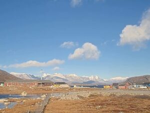
The Kangerlussuaq Airport Webcam streams two views across Greenland’s former US air base, one looking west down the valley toward the fjord and one looking east toward the inland hills. Both cameras are run by Greenland Airports and look out over hangars, aprons and taxiways, with long, bare ridges rising on each side. The sky fills the upper half of each frame, so the weather is a big part of the show. The valley changes sharply through the year: brown tundra and round-the-clock daylight in June and early July, white hills and short, low-sun days from October on. On clear autumn evenings the sunset glows at the far end of the western valley, and after dark the taxiway and runway lights trace lines of blue and amber across both frames.
The United States built the airfield in 1941 as Bluie West-8, and it later became Sondrestrom Air Base. The base closed in 1992, when the airport passed to Greenlandic civilian control. Today it is run by Mittarfeqarfiit, Greenland Airports, under the codes SFJ and BGSF. Its single asphalt runway, 09/27, is 2,810 meters (9,219 feet) long, and the field lies only 50 meters (165 feet) above sea level near the head of Kangerlussuaq Fjord, about 50 kilometers (31 miles) north of the Arctic Circle.
For decades this was the country’s main gateway, because the long runway and steady inland weather suited large jets. That changed in November 2024, when Nuuk’s lengthened runway and new terminal opened and Air Greenland moved its hub to the capital. The last regular Air Greenland service to Copenhagen left Kangerlussuaq on 27 November 2024. Routes to Aasiaat, Maniitsoq and Narsarsuaq ended, and flights to Nuuk, Ilulissat and Sisimiut became less frequent, although seasonal Copenhagen flights have since called here with leased aircraft. The airport remains open to large civil aircraft, and its stable weather and long runway still matter to Greenland’s air network.
The settlement grew up around the base and still lives mostly from aviation, tourism and support for scientific research. Its population fell from 564 in 2024 to 399 in 2025 after the hub moved. About 15 kilometers (9 miles) west lies Kellyville, home of the Sondrestrom Upper Atmospheric Research Facility from 1982 to 2018. Its buildings were demolished in 2023, but the big dish still stands.
Kangerlussuaq is known for more stable weather than Greenland’s coastal airports, and it is very dry, with only about 168 millimeters (6.6 inches) of precipitation a year. Summers are short and mild. July averages highs of 16.8°C (62°F) and lows of 5°C (41°F), and the record high is 26.6°C (80°F). In summer the hills on camera are bare brown rock and tundra, and the sun stays above the horizon around the clock from early June until about the middle of July, so the cameras show daylight at any hour.
Winter is long and very cold. February is the coldest month, with average highs of -14.8°C (5°F) and lows of -24.9°C (-13°F), and the record low is -47.2°C (-53°F). By late October the sun climbs only about 12 degrees at midday, and around the December solstice it barely clears the southern horizon for an hour and a half, so the cameras spend most of the day in twilight and floodlight. Spring warms slowly, with April highs still just below freezing at -0.9°C (30°F). Autumn turns fast: October averages a high of -0.8°C (31°F) and a low of -8.7°C (16°F). Visit Greenland counts more than 300 clear nights a year here and gives the northern lights season as October to April.
Hotel Kangerlussuaq, with 70 rooms and a restaurant, is inside the terminal building itself. The Kangerlussuaq Museum covers the town’s years as an American air base and its later role as Greenland’s transport hub. Lake Ferguson is used for kayaking, and Restaurant Roklubben looks out over the water. Short day trips lead to Sugarloaf Mountain and Garnet Rock, both with views over the surrounding valleys.
The ice sheet is the main draw. A road built in 1999 by Nausta for Volkswagen runs from the town through Isunngua to the edge of the ice, and the front of Russell Glacier is one of the area’s best-known sights. The open tundra is home to musk oxen, reindeer, Arctic foxes and Arctic hares, and the Ammalortup Nunaa highland was stocked with 27 musk oxen to start its herd. Long-distance hikers set off from Kellyville on the Arctic Circle Trail, which runs for more than 160 kilometers (99 miles) through mountains, lakes and valleys to Sisimiut on the coast.
More live views from Greenland’s west coast, from the capital’s airport to the icefjord at Ilulissat.
Kangerlussuaq Airport is in western Greenland, beside the settlement of Kangerlussuaq near the head of Kangerlussuaq Fjord. It lies about 50 kilometers (31 miles) north of the Arctic Circle, 50 meters (165 feet) above sea level.
The main West View looks down the valley toward the fjord, with hangars and airport buildings on the left, a wide paved area and a curving taxiway in front, and ridges on both sides. The East View tab looks up the valley at a long sunlit slope with a row of buildings at its foot, dark asphalt aprons, a red-walled building beside a large white hangar, and snow-capped peaks at the far end. After dark, both cameras pick up the blue and amber airfield lights.
The IATA code is SFJ and the ICAO code is BGSF. The airport was known as Sondrestrom Air Base until the US Air Force left in 1992.
No. The East View ends at the snow-capped peaks that close off the valley, and the ice sheet lies farther inland, at the end of the road from town. Russell Glacier is out of sight as well.
Only when an aircraft happens to taxi or take off in view. The cameras show the airfield, not a departures board, so check Air Greenland or Greenland Airports for times. Since November 2024 Kangerlussuaq has had far fewer flights, mainly services to Nuuk, Ilulissat and Sisimiut plus seasonal Copenhagen flights, so long quiet spells on camera are normal.
Dry and more stable than on Greenland’s coast. Summers are mild, with July highs around 16.8°C (62°F), and winters are very cold, with February lows around -24.9°C (-13°F). Only about 168 millimeters (6.6 inches) of precipitation falls in a year.
Yes. Hotel Kangerlussuaq, with 70 rooms and a restaurant, is inside the terminal building.
Source: Greenland Airports
The best new live webcams and site features, once a week.
By subscribing you agree to receive our weekly email. Unsubscribe any time.
 1.3°C / 34.3°F
 19.5°C / 67.1°F