Live

 21:57:34
 3.2°C / 37.8°F
 Scattered Clouds
 65%
65% 35 km/h / 22 mph
 07:11
07:11 16:55
16:55Loading forecast…
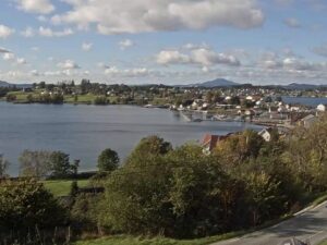
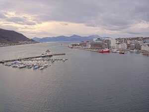
The Kamoyvaer Webcam pans across the fishing harbor of Kamoyvaer, a small village on the island of Mageroya in Finnmark, at the top of Norway. At one end of its sweep, a curved stone breakwater wraps around a small basin, with houses in yellow, white and red on the slope behind and a small light tower on the skyline. Swing the other way and the harbor opens up: small fishing boats tied along floating pontoons, a row of red sheds on a breakwater, and a high, rounded island hill across the water. A blue building and a parking area sit close to the camera on the right. Light changes this scene more than anything else. Early summer brings daylight around the clock, while midwinter gives a few hours of blue twilight and then the harbor lamps.
Kamoyvaer lies along Kamoyfjorden in Nordkapp Municipality, about 10 kilometers (6.2 miles) northwest of Honningsvag, the main town on Mageroya. Around 70 people live in the village, which sits just 4 meters (13 feet) above sea level. Two islands, Lille Kamoya and Store Kamoya, shelter the harbor, and the strait between the village and Store Kamoya is called Ostersundet. To the north, the Hjalmarneset peninsula carries the Kamoyfjord light.
One road comes in. County Road 172 leaves the European route E69 about 2 kilometers (1.2 miles) south of the village and ends here, so Kamoyvaer is the end of the line rather than a place people drive through. The hamlet of Kuvika marks the southern entrance and has a small fish processing plant. The camera belongs to Nordkapp Havfiske, a sea fishing company based on Sjoveien, the road along the harbor.
The people of Kamoyvaer descend from coastal Sami and Kven families as well as Norwegians. Arran Nordkapp, a guesthouse owned by a Sami family, fills three blue-painted buildings in the middle of the village. The famous North Cape cliff is about 14 kilometers (9 miles) to the north-northwest in a straight line.
The coast of Mageroya stays cool all year. Normals for 1991 to 2020 from the Nordkapp weather station put January highs around -0.5 C (31 F) and lows near -4.8 C (23 F), with February the coldest month at a daily mean of -3.3 C (26 F). Spring arrives slowly: April highs reach about 3 C (37 F) and May about 7 C (44 F). July and August are the warmest months, with highs of 12.7 to 13.4 C (55 to 56 F) and lows near 8.6 C (47 F). Autumn cools quickly, from about 10 C (50 F) in September to 5.6 C (42 F) in October, which is also the wettest month at 78 millimeters (3.1 inches). The year’s total is about 624 millimeters (24.6 inches).
Light is the bigger story on this camera. In nearby Honningsvag the midnight sun lasts from 13 May to 31 July, so the boats and the island hill are lit through the night for much of early summer. From 21 November to 21 January the sun stays below the horizon. In those weeks the harbor shows up in a short spell of twilight around midday, and for the rest of the day a street lamp beside the camera lights the snow and shrubs in the foreground while the boats show only as lights across the water. Snow can arrive by October, turning the island hill white while the harbor water stays dark.
The North Cape plateau is the main draw on Mageroya. Its cliff drops 307 meters (1,007 feet) to the sea, and North Cape Hall, built in 1988, holds a cafe, restaurant, post office, souvenir shop, a small museum and a video cinema. The road from Honningsvag is 33 kilometers (21 miles) long, and in winter heavy snow and wind mean the last stretch is often open only to convoys at set times. Nearby Knivskjellodden reaches 1,450 meters (4,757 feet) farther north than the North Cape itself.
In the village, the Gallery East of the Sun shows the work of German-born artist Eva Schmutterer, and Nordkapp Havfiske books sea fishing trips from the village. Honningsvag Church dates from 1885. Off the fishing village of Gjesvaer, two-hour boat trips run to the Gjesvaerstappan islets, a nature reserve since 1983, where about 50,000 pairs of Atlantic puffin and about 2,500 pairs of razorbill nest. The bird cliffs are best visited from May to August.
More harbors and Arctic coastline to watch:
Kamoyvaer is a fishing village on the island of Mageroya in Nordkapp Municipality, Finnmark, in the far north of Norway. It sits about 10 kilometers (6.2 miles) northwest of Honningsvag, at the end of County Road 172.
The camera pans across the harbor. One end shows a curved stone breakwater around a small basin, with houses and a light tower on the slope behind. The other shows fishing boats on floating pontoons, red sheds on a breakwater, a rounded island hill across the water and a blue building beside the camera.
Cool all year. January highs are around -0.5 C (31 F) and July highs around 13.4 C (56 F), based on 1991 to 2020 normals from the Nordkapp station. October is the wettest month, with 78 millimeters (3.1 inches) of precipitation.
No. The camera looks over the harbor in Kamoyvaer, about 14 kilometers (9 miles) south-southeast of the North Cape cliff in a straight line. The plateau and North Cape Hall are not in view.
No. This camera is in Kamoyvaer, about 10 kilometers (6.2 miles) northwest of Honningsvag, and shows the village’s small fishing harbor rather than the Honningsvag waterfront. No cruise ship quay is in view.
From 21 November to 21 January the sun does not rise this far north, so the harbor gets only a short spell of twilight around midday. At other times of year it is simply night. A street lamp beside the camera keeps the foreground lit, and the boats show as lights across the water.
It is not an aurora camera. It points at the harbor rather than the sky, and the street lamp beside it washes out the night sky above the boats.
Arran Nordkapp, a guesthouse run by a Sami family, occupies three blue-painted buildings in the village. The island’s main town, Honningsvag, is about 10 kilometers (6.2 miles) away by road.
Source: Nordkapp Havfiske
The best new live webcams and site features, once a week.
By subscribing you agree to receive our weekly email. Unsubscribe any time.
 9.8°C / 49.6°F
 9.4°C / 48.9°F

 1.9°C / 35.4°F
 4.7°C / 40.5°F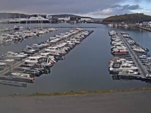
 3.4°C / 38.1°F
