Live

 02:43:35
 14.3°C / 57.7°F
 Broken Clouds
 41%
 15 km/h / 9 mph
 08:38
 17:47
Loading forecast…
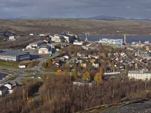
The Kristiansund Webcam looks down on a sheltered harbor basin in the middle of this island town on Norway’s west coast. From a hillside perch above a flat-roofed yellow building and a few pines, the camera takes in a boatyard with a tall yellow crane, a marina packed with sailboat masts, rows of fishing boats and wooden houses climbing the slope on the right. The water opens out on the left toward a bridge at the edge of the frame, and a broad mountain on Frei island fills the skyline. Working boats and passenger vessels pass through all day, and in winter the hills behind the town turn white. A second camera on the same page pans across the town center.
Kristiansund is built on four main islands in the Nordmore district of More og Romsdal county: Kirkelandet, which holds the town center, Nordlandet with the airport, little Innlandet, and Frei, the largest, which joined the municipality in 2008. Freikollen on Frei is the highest point at 629 meters (2,064 feet). The whole municipality covers just 87 square kilometers (34 square miles) and had 24,404 residents in 2023, which makes it one of the most densely populated towns in Norway.
King Christian VI granted the settlement town status in 1742 and lent it his name, with the ending sund for the straits between the islands. Dutch sailors brought the method for making klippfisk, salted cod dried on the bare coastal rock, at the end of the 17th century, and for years Kristiansund was Norway’s largest exporter of it, shipping mainly to Spain and Portugal. The Norwegian Clipfish Museum and the old Mellemvaerftet sailing-ship yard still stand in Vagen, the historic harbor quarter.
Much of what the camera shows was rebuilt after the war. German air raids between April 28 and May 1, 1940 destroyed around 800 buildings and killed six people. Innlandet, across the harbor, came through with the least damage and keeps its older coastal architecture. Festiviteten, the Art Nouveau opera house finished in 1914 and the oldest in Norway, also survived. Kirkelandet Church, a white concrete building from 1964 by the architect Odd Ostbye with 320 small windows and seats for 550, marks the ridge above the center on the town-center camera.
This is a mild, wet, windy coast for its latitude. January averages around 1 C (34 F), with daytime highs near 2 C (36 F) and nights just below freezing, so snow tends to settle on the hills in the frame rather than on the quays. Strong winter storms off the Norwegian Sea are part of life here. Daylight lasts only about five hours in late December, which leaves the camera on streetlights and marina lamps for most of the day.
Spring is slow: April averages about 5 C (41 F), with highs near 8 C (46 F). July and August are the warmest months at around 14 C (57 F), with highs of 16 to 17 C (61 to 63 F), and in late June the sun is up for more than 20 hours. It does set, so there is no true midnight sun, but the sky barely darkens. October averages 7 C (45 F). Kristiansund gets about 1,020 millimeters (40 inches) of precipitation a year, and autumn is the wettest stretch, with September and October bringing roughly 200 millimeters (8 inches) a month.
The Sundbaten harbor boat has carried passengers between the islands since November 1876 and is billed as the world’s oldest motorized public transport service still running. The boats Rapp and Angvik loop from Kirkelandet to Innlandet, Nordlandet and Gomalandet and back at half-hour intervals on weekdays. The Varden lookout tower stands 78 meters (256 feet) above sea level on Kirkelandet, with free access and a full circle of fjords, mountains and the shipping lane out to Grip. In Vagen, the Clipfish Museum explains the trade that built the town, and Mellemvaerftet shows how wooden sailing ships were repaired.
Grip, a deserted fishing village on 82 islets and skerries about 14 kilometers (9 miles) northwest of the town, has one of Norway’s tallest lighthouses and its second smallest stave church, and rises no more than 10 meters (33 feet) above the sea. To the southwest, the 5.7-kilometer (3.5-mile) Atlantic Ocean Tunnel, opened in December 2009, leads under the sea to Averoy, and from Karvag on the far side the Atlantic Ocean Road runs 8.3 kilometers (5.2 miles) over eight bridges, Storseisundet Bridge among them, to Vevang. It opened in 1989 and is one of Norway’s 18 National Tourist Routes.
Three more Norwegian views to watch after this one.
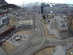
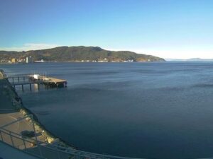
The main camera overlooks a harbor basin with a boatyard crane, a sailboat marina, fishing boats, wooden houses on the hillside and a mountain on Frei behind the town. The second camera pans across the harbor to the town center on Kirkelandet, where the white roof of Kirkelandet Church and the lookout tower on the ridge stand out, with Innlandet to the left.
Kristiansund is on the west coast of Norway in More og Romsdal county, reached from the E39 by the Krifast bridge and tunnel link. Molde lies to the southwest and Trondheim to the northeast, and the town has its own airport at Kvernberget on Nordlandet.
The main camera shows a working harbor with a marina and boatyard rather than the deep-water quay. Larger ships, including Hurtigruten coastal vessels, berth on the town-center side and appear on the second camera when in port.
No. Kristiansund Airport, Kvernberget, is on Nordlandet, outside both cameras’ fields of view. Neither camera shows the runway or the terminal.
Mild and wet. January averages about 1 C (34 F), and July and August highs reach 16 to 17 C (61 to 63 F). The town gets about 1,020 millimeters (40 inches) of precipitation a year, most of it in autumn, and strong winds off the Norwegian Sea are common.
Yes. The Sundbaten has shuttled between the four islands since 1876. The boats Rapp and Angvik call at Kirkelandet, Innlandet, Nordlandet and Gomalandet on a round trip that repeats every half hour on weekdays from morning to evening.
No. Kristiansund is this town on the northwest coast in More og Romsdal. Kristiansand is a larger city on the south coast, hundreds of kilometers away. The operator titles the stream Kristiansund N to mark the northern one.
The road starts at Karvag on Averoy, on the far side of the 5.7-kilometer (3.5-mile) Atlantic Ocean Tunnel from Kristiansund, so the drive from the town takes roughly half an hour. The road itself is 8.3 kilometers (5.2 miles) long and crosses eight bridges.
Source: Streambird Pro
The best new live webcams and site features, once a week.
By subscribing you agree to receive our weekly email. Unsubscribe any time.







 8.1°C / 46.6°F
 11.9°C / 53.4°F