Live

 23:59:47
 7.5°C / 45.5°F
 Light Rain
 93%
93% 32 km/h / 20 mph
 07:09
07:09 16:21
16:21Loading forecast…
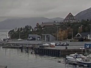
The Kirkenes Webcam looks down on Norway’s last town before the Russian border from the high ground its operator calls Himmelstigen, on the south side of the center. Bare bedrock and birch scrub fill the foreground, then the roofs of the town spread out below: a sheltered inlet with a small-boat quay on the left, the sports halls and the stadium bank lettered KIRKENES beside a roundabout, the grey sheds and tall stack of the old Sydvaranger ore works in the middle distance, and the apartment blocks of the town center on the right. Bokfjorden runs across the top of the frame to a line of low, treeless hills. Sor-Varanger kommune, the municipality, runs this camera and two more: one on the church tower looking south down the main street, and one on Lyngberget on the far shore, looking back at the town across the fjord. All three play on this page.
Kirkenes sits on a peninsula on Bokfjorden, an arm of the wide Varangerfjorden, in Finnmark county at the far northeastern corner of Norway. It lies about 400 kilometers (250 miles) north of the Arctic Circle, and the Storskog crossing into Russia is roughly 10 kilometers (6 miles) to the southeast in a straight line. The town proper had 3,404 residents in 2023, and close to 8,000 people live in the built-up area once the suburbs along the fjord are counted. It is the turnaround port of the Hurtigruten coastal route, so a large passenger ship calls most days.
The industrial sheds and the stack you can see from the Himmelstigen camera belong to Sydvaranger, the iron ore company that built the town. It was founded on 12 January 1906, shipped its first ore from Kirkenes in October 1910, and ran until the Norwegian government wound it up in 1996. New owners reopened the mine in 2009, went bankrupt in 2015 when ore prices fell, and Grangex completed its purchase of the business in May 2024 without restarting production as of early 2025. The ore came down to the works by rail from the mine at Bjornevatn, south of town.
Almost nothing in the frame predates 1945. Kirkenes was a German base in the Second World War and suffered more than 1,000 air raid alarms and 320 air attacks, which left only 13 houses standing by the time the Red Army freed the town on 25 October 1944. The grid of streets, the apartment blocks and the wooden houses on the slope were all rebuilt afterward, which gives the center the plain, orderly look you see from above.
Kirkenes has a subarctic climate softened a little by the open Barents Sea. Over the 1991 to 2020 period the January mean was -10.1 C (13.8 F), April came in at -0.8 C (30.6 F), July reached 12.4 C (54.3 F) and October averaged 1.2 C (34.2 F). The year brings only about 456 millimeters (18 inches) of precipitation, so the skies are often clearer than on Norway’s west coast, and the snow that falls tends to stay. In winter the Himmelstigen view is white from the foreground rock to the far hills, and for most of the day the only light is the blue twilight that follows the hidden sun.
The polar night lasts from 27 November to 14 January, when the sun never clears the horizon, and the camera shows a lit town under a dark sky even at midday. The midnight sun runs from 18 May to 25 July, so in early summer the stream never goes dark at all. Spring is a slow melt, and autumn turns the birch scrub in the foreground yellow for a few weeks before the first lasting snow.
The Kirkenes Snowhotel at Sandnesdalen, about 8 kilometers (5 miles) southwest of the center, is rebuilt from snow and ice every winter and keeps its rooms at a constant -4 C (25 F), with reindeer hides on the beds. King crab safaris leave from the town, which is one of the most important ports for the Barents Sea king crab fishery, and dog sledding runs through the forest and across frozen lakes in winter. In the center, Andersgrotta is the wartime bomb shelter cut into the rock, now open as a museum, and the Grenselandmuseet (Border Area Museum) covers the history of the border region, the war years and the mine.
South of town the Pasvik valley runs for about 100 kilometers (62 miles) along the Russian border, with pine forest, protected old-growth stands, wetlands and Norway’s largest population of brown bears in the Ovre Pasvik National Park at its far end. To the northeast, the road to Grense Jakobselv ends at King Oscar II’s Chapel, a stone church put up beside the border river in 1869.
Other live views from Norway’s Arctic coast:
Kirkenes is in Sor-Varanger municipality in Finnmark, the northeasternmost county of Norway, on Bokfjorden near the mouth of the Varangerfjorden. The Russian border at Storskog is about 10 kilometers (6 miles) away.
The main view is from the Himmelstigen hillside, looking over the roofs toward Bokfjorden: the small-boat inlet, the sports halls, the Sydvaranger ore works and the town center’s apartment blocks. The church tower tab looks south down the main street, and the Lyngberget tab watches the town from across the fjord.
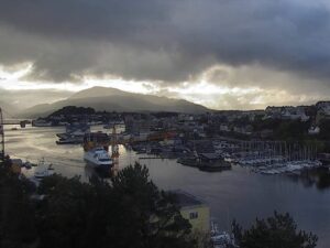
Not as a dedicated view. None of the three cameras is aimed at the Hurtigruten quay. Ships moving on Bokfjorden can pass through the Lyngberget view, which looks straight across the water at the town.
No. Kirkenes Airport, Hoybuktmoen, lies west of the town and is out of frame on all three cameras.
Sometimes. At nearly 70 degrees north the aurora is common on clear nights from September to March, and the Himmelstigen camera stays in color after dark, so bright displays can appear as pale green bands above the town lights. The Lyngberget camera switches to black and white at night and will not show the colors.
Cold and fairly dry. January averages -10.1 C (13.8 F) and July 12.4 C (54.3 F), with only about 456 millimeters (18 inches) of precipitation a year. Snow typically covers the view from November until April, and the midsummer sun never sets.
No. The Snowhotel is at Sandnesdalen, about 8 kilometers (5 miles) southwest of the center, well outside the frame. The cameras cover the town and Bokfjorden only.
The sun stays below the horizon from 27 November to 14 January, with a few hours of twilight around midday. The midnight sun shines from 18 May to 25 July.
Source: Sor-Varanger kommune
The best new live webcams and site features, once a week.
By subscribing you agree to receive our weekly email. Unsubscribe any time.
 8.4°C / 47.1°F



 7.7°C / 45.9°F
 10.1°C / 50.2°F

 5.2°C / 41.4°F