
 English
 简体中文
 Deutsch
 Français
 Español
 Nederlands
 Svenska
 Italiano
 日本語
 Polski
 Português
 Русский
 Ελληνικά
 العربية
 Türkçe
Live
 18:21:36
 3.2°C / 37.8°F
 Light Intensity Drizzle
 65%
 28 km/h / 17 mph
 24-Hour Darkness
Loading forecast…
Kongens Plass, Kirkelandet, Kristiansund, Norway
 3.1°C / 37.6°F
18:21
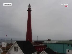


Geiranger, Geirangerfjord, More og Romsdal, Norway
-0.1°C / 31.8°F
18:21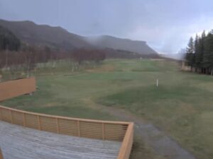



The Skarsvag Webcam looks over the small fishing harbor of Skarsvag, a village on the north coast of Mageroya island in Arctic Norway, 14 kilometers (8.7 miles) from the North Cape plateau. From a spot above the inner harbor, the camera points out along the bay toward open water. Wooden houses climb the slope on the left, a rock breakwater shelters a row of fishing boats in the middle, and a steep, dark headland closes the view on the right. Light changes this scene more than anything else. In summer the sun never sets and the hills turn green, while from late November the sun stays below the horizon for two months and the harbor sits in blue twilight under its own lamps.
Skarsvag lies on Risfjorden in Nordkapp Municipality, Finnmark, in the far north of Norway. About 60 people live here, and the village calls itself the world’s northernmost fishing village, a line the camera’s operator repeats in the stream description. The local fleet fishes mainly for cod in the waters north of Mageroya. Skarsvag has its own church, and it is said to be the northernmost settlement in the world reached by a major road, the E69, which crosses to Mageroya through the undersea North Cape Tunnel.
On the Skarsvag Webcam, the harbor fills the center of the frame. Low white buildings stand on the quay beside a tall floodlight, and a long breakwater of piled rock wraps around a floating pontoon where the boats are moored, most of them with red, white or blue hulls. A second stone embankment runs across the foreground, with a road and fence along its top and a strip of still water below it. Beyond the breakwater the bay opens out, roughly to the north-east, between the village slope and the headland. A date and clock in local time run in the top-left corner. The camera is fixed: a summer frame from 2023 and a winter frame from November 2026 show exactly the same view, so the only things that change are snow, sea and light.
The North Cape itself is a cliff that rises 307 meters (1,007 feet) out of the sea at about 71.17 degrees north. A neighboring point, Knivskjellodden, runs 1,450 meters (4,760 feet) further north than the cape. Neither is in view from this camera.
Skarsvag has a cold coastal climate that the sea keeps milder than its latitude suggests. The nearest long-term station, at Honningsvag Airport, gives February as the coldest month, with a daily mean of -3.3°C (26.1°F) and typical lows of -5.2°C (22.6°F). The record low there is -21.2°C (-6.2°F). Spring comes late: April still averages 0.7°C (33.3°F) and May only 4.2°C (39.6°F), and Nordkapp’s 1991 to 2020 normals put the deepest average snow at about 64 centimeters (25 inches) in April. By mid-November the camera already shows the slopes white down to the shore.
Summer is short and cool. July and August both average 10.2°C (50.4°F), with July afternoons near 13.4°C (56.1°F), although a record 28.4°C (83.1°F) was set in June. Autumn cools quickly, from 8.0°C (46.4°F) in September to 3.8°C (38.8°F) in October, which is also the wettest month at 78 millimeters (3.1 inches). The year brings about 627 millimeters (24.7 inches) of precipitation. Daylight swings to extremes at this latitude. The midnight sun lasts from about mid-May to the end of July, and polar night runs from about 21 November to 22 January. Even then the middle of the day brings a few hours of blue twilight, and on a mid-November morning the camera showed the harbor in that half-light with every lamp still on.
Kirkeporten, a natural rock arch on the shore near the village, is the walk most visitors make from Skarsvag. The path starts near Kirkeporten Camping, the route is easy, and the trip there and back takes about an hour with stops for photos. Local tourism sites call the arch a window to the North Cape, because it frames the view along the coast toward the cape’s cliffs.
The North Cape plateau is 14 kilometers (8.7 miles) from the village. The North Cape Hall, built on the plateau in 1988, has a cafe, restaurant, post office, small museum and a video cinema. In winter the last stretch of road opens only for convoys at set times, so check the schedule before driving up. On the north-west side of Mageroya, boat trips run from the village of Gjesvaer in summer to Gjesvaerstappan, a group of steep, grass-covered islands protected as a nature reserve since 1983. A 1988 survey counted about 50,000 pairs of Atlantic puffins there, along with around 2,500 pairs of razorbills and thousands of kittiwakes. Landing on Storstappen, the largest island, is banned from 15 June to 15 August, so the colony is watched from the water.
More harbors on the Arctic coast, in Norway and beyond:
Skarsvag is on the north coast of Mageroya, an island in Nordkapp Municipality in Finnmark, northern Norway. The village lies on Risfjorden, 14 kilometers (8.7 miles) from the North Cape plateau.
The fishing harbor of Skarsvag. Village houses line the slope on the left, quay buildings and a rock breakwater sit in the middle, small fishing boats are moored at a floating pontoon, and a steep headland rises on the right. The bay leads out to open water in the distance.
Yes. The stream runs on YouTube, operated by Skarsvag bygdelag, the village association, which describes it as live 24/7. The current broadcast has been running without a break since March 2025, and a clock in the corner shows local time.
No. The North Cape plateau is 14 kilometers (8.7 miles) away and is not in view. This camera shows Skarsvag’s harbor and the bay in front of it.
Cool all year, with heavy snow and strong wind common in winter. Daily means at the nearest station run from -3.3°C (26.1°F) in February to 10.2°C (50.4°F) in July and August, and October is the wettest month. The camera is the quickest way to check whether there is snow, fog or sun over the harbor right now.
That depends on the season. From about mid-May to the end of July the sun does not set at all, and from about 21 November to 22 January it does not rise. In between, the length of the day changes quickly from week to week.
Mostly small coastal fishing boats, moored at the floating pontoon inside the breakwater. Skarsvag’s fleet fishes mainly for cod in the waters north of Mageroya, so the number of boats in harbor changes with the weather.
Source: Skarsvag bygdelag live cam
The best new live webcams and site features, once a week.
By subscribing you agree to receive our weekly email. Unsubscribe any time.
 -1°C / 30.2°F
 -0°C / 32°F
 3.7°C / 38.7°F