Live

 00:33:25
 11°C / 51.8°F
 Overcast Clouds
 94%
 25 km/h / 16 mph
 07:38
 17:00
Loading forecast…
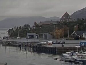
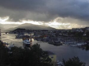
The Jorpeland Webcam looks down from a hillside street over Vagen, the small harbor at the heart of Jorpeland in Rogaland, western Norway. A road curves across the bottom of the frame, and below it a fenced lawn runs down to the water past a little white shed with a green roof and a sand volleyball court. Beyond them, floating pontoons hold motorboats and sailboats, a wooden fishing boat lies moored at a pier, and the fjord opens out toward a low line of hills on the far shore. Apartment blocks and houses climb the slope on the left under a steep, wooded mountainside. The scene shifts with the light and the weather coming in off the fjord, from flat calm water and green summer grass to wind-ruffled gray under low autumn cloud.
Jorpeland is a town in Strand municipality, on the west coast of the mainland in the Ryfylke district, about 20 kilometers (12 miles) northeast of Stavanger. It sits on the shore of the Idsefjord, and the Vagen inlet in front of the camera is its sheltered harbor, with a boardwalk along the water. The town covers just 4.16 square kilometers (1.61 square miles) and had 7,815 residents in 2025. It counted as a large village until the municipal council made it a town on 1 April 1998.
Jorpeland has an industrial past. The steelworks Stavanger Electro Staalverk was established here in 1910, and at the inner end of Vagen stands Jorpelands Brug, a building from 1883. These days the town is better known by its nickname, Pulpit Rock City, because Preikestolen (Pulpit Rock) rises above the Lysefjord about 10 kilometers (6.2 miles) away. Jorpeland Church, the town’s main church, was built in 1969.
The road link to Stavanger runs under the sea. The Ryfylke Tunnel opened on 30 December 2019 beneath the Horgefjord, between Stavanger and the Ryfylke district. It is 14.4 kilometers (9 miles) long and reaches 292 meters (958 feet) below sea level, and when it opened it was the longest undersea road tunnel in the world. Buses run from Jorpeland to Solbakk and continue through it into Stavanger. The current stream from the camera above Vagen has run on YouTube since February 2022.
Jorpeland has a mild, wet coastal climate for its latitude. January and February afternoons usually reach 3 to 4 C (37 to 40 F), with nights just below freezing at about -1 C (30 F). Spring warms slowly, with April highs around 10 C (50 F) and May around 14 C (58 F). Summer is cool: July and August highs sit near 18 C (64 F), and nights stay around 12 C (54 F). Autumn turns quickly, from about 16 C (61 F) in September to 11 C (52 F) in October and 7 C (45 F) in November.
Rain is the constant. The wettest stretch runs from September through January, when low cloud can hide the hills across the fjord and wind sets the harbor water moving between the pontoons. Daylight swings hard at 59 degrees north. The sun is up for about 18 and a half hours at midsummer, so the harbor stays lit until late in the evening, while at midwinter it is up for only about 6 hours and the camera’s view is bright for a short window around midday.
The big draw is the hike to Preikestolen, the flat-topped cliff that stands 604 meters (1,982 feet) above the Lysefjord. The trail starts at Preikestolhytta, at about 270 meters (890 feet), and climbs 3.8 kilometers (2.4 miles) each way to a top of roughly 25 by 25 meters (82 by 82 feet). Allow 3 to 4 hours for the round trip. Around 300,000 people made the walk in 2024. Buses connect Jorpeland with Preikestolen Fjellstue near the start of the trail, and in winter snow can make it impossible to reach the top.
Closer to the camera, Jorpelandsholmen is a small island at the edge of town with a built walking path, a little under 1 kilometer (0.6 miles) southwest of Vagen. The boardwalk along the harbor is an easy stroll past the moored boats to Jorpelands Brug at the inner end of the bay. For a summer swim, Barkavika and Nordlys are the town’s two beaches. Stavanger, the nearest city, is a bus ride away through the Ryfylke Tunnel.
For more Norwegian harbors and small working waterfronts, try these.
Jorpeland is a town in Strand municipality, Rogaland county, in western Norway. It lies on the Idsefjord about 20 kilometers (12 miles) northeast of Stavanger, the nearest city, which is reached by road through the Ryfylke Tunnel.
The camera looks over Vagen, the town harbor, from a street on the slope above it, facing roughly south. In front are a curving road, a fenced lawn with a white shed and a sand volleyball court, then pontoons full of small boats and a moored wooden fishing boat. Apartment blocks and hillside houses fill the left, a commercial waterfront and more moorings sit on the right, and the open fjord and the hills beyond it take the middle of the frame.
No. Preikestolen stands above the Lysefjord about 10 kilometers (6.2 miles) from town, out of sight beyond the hills. The camera is still a handy check before the hike, because it shows the cloud, wind and rain over Jorpeland, but conditions on the 604 meter (1,982 foot) cliff top can differ.
Preikestolen is about 10 kilometers (6.2 miles) from Jorpeland in a straight line. The hike starts at Preikestolhytta and covers 3.8 kilometers (2.4 miles) each way, with 3 to 4 hours needed for the round trip. Buses run from Jorpeland to Preikestolen Fjellstue near the start of the trail.
Mild and wet. January highs are about 3 C (38 F) with nights near -1 C (30 F), while July and August reach about 18 C (64 F). The heaviest rain falls between September and January.
Jorpeland had 7,815 residents in 2025, on an area of 4.16 square kilometers (1.61 square miles). It became a town on 1 April 1998, and before that it counted as a large village.
Jorpelandsholmen is a small island at the edge of Jorpeland, a little under 1 kilometer (0.6 miles) southwest of the harbor on camera. It has a built walking path, which makes it a short outing from the boardwalk at Vagen.
Source: K. Grodeland
The best new live webcams and site features, once a week.
By subscribing you agree to receive our weekly email. Unsubscribe any time.


 11.4°C / 52.5°F


 6.8°C / 44.2°F