
 English
 简体中文
 Deutsch
 Français
 Español
 Nederlands
 Svenska
 Italiano
 日本語
 Polski
 Português
 Русский
 Ελληνικά
 العربية
 Türkçe
Live
 11:21:08
 29°C / 84.2°F
 Clear Sky
 58%
 7 km/h / 4 mph
 06:01
 17:10
Loading forecast…
Shoushan LOVE Lookout, Zhongyi Road, Gushan District, Kaohsiung City, Taiwan
 26.9°C / 80.4°F
11:21
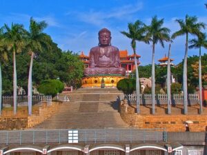
Baguashan, Changhua City, Changhua County, Taiwan
30.2°C / 86.4°F
11:21
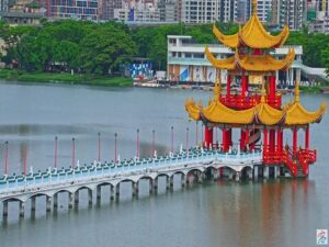
Lotus Pond, Zuoying District, Kaohsiung City, Taiwan
28.9°C / 84°F
11:21


Hotel Annapurna View Sarangkot Pvt. Ltd., Pokhara, Nepal
18.2°C / 64.8°F
09:06
Dongdaemun Design Plaza (DDP), Jung District, Seoul, South Korea
15.8°C / 60.4°F
12:21
Istanbul Airport (IST), Terminal Caddesi, Arnavutköy/İstanbul, Türkiye
 10.8°C / 51.4°F
06:21

Lena River, Lensk, Respublika Sakha (Yakutiya), Russia
-13.5°C / 7.7°F
12:21


The Nanfangao Fishing Port Webcam looks over the working harbor of Nanfangao (also spelled Nanfang’ao) in Su’ao Township, on Taiwan’s northeast coast, through three cameras from the same local operator. The main view starts at the Nantian Temple end of the First Fishing Port and runs down a basin crowded with fishing boats, past a quay strung with red lanterns, to two rounded green hills. Two more tabs show the narrow channel of the Second Fishing Port and the quay of the Third Fishing Port, with the arch of the rebuilt Nanfangao Bridge in the distance. Boats come and go, crane trucks load nets, and on wet days low cloud settles over the hills.
Nanfangao sits in the southeast corner of Su’ao Township in Yilan County, on a bay ringed by hills on three sides. An island joined to the shore by a sandbar closes off the seaward side as a natural breakwater. The port ranks among Taiwan’s three major fishing ports, is an important base for deep-sea fishing on the east coast, and calls itself the hometown of mackerel.
The First Fishing Port, the one on the main camera, came first. Japanese surveyors chose the site in 1921, and the port was completed in 1923, dug out of a lagoon that reached from where Nantian Temple stands today to the foot of the hills by the sea, which is the line the camera follows. Its basin covered 7.6 hectares (18.8 acres). The Second Fishing Port, also called the Neipi fishing port, followed between 1955 and 1959 and is the smallest of the three. The Third Fishing Port began as a small commercial harbor and passed to Yilan County in 1984. Today it takes the big purse seiners and ocean-going boats, and much of the mackerel is unloaded there for the canneries.
The Nanfangao Bridge crosses the harbor in a single steel tied arch. The original, opened in 1998 with a 140 meter (459 foot) span, collapsed onto the moored fishing boats beneath it on October 1, 2019, killing six people, and investigators blamed corrosion and poor maintenance. A replacement arch of the same length opened on December 18, 2022. Nantian Temple, at 17 Jiangxia Road, was founded in 1950 to thank Mazu, the sea goddess, for sparing local fishermen caught at sea in 1946, and its gold Mazu was enthroned in 1994. The Third Fishing Port camera carries the name of Jin’an Temple, home of a coral Mazu.
Su’ao is one of the wettest corners of Taiwan, averaging 4,435 millimeters (175 inches) of rain a year over about 208 days, on its 1991 to 2020 normals. Winter is mild and damp, with January highs of 19.3°C (67°F), lows of 14.3°C (58°F) and rain on about 20 days. Spring warms quickly, and by April highs reach 24.9°C (77°F) with lows of 19.1°C (66°F).
July brings highs of 31.8°C (89°F), lows of 26.0°C (79°F) and rain on fewer than 10 days, so the hills behind the harbor stand out most often in summer. Summer and early autumn are also typhoon season in Taiwan. October is the wettest month, with 714 millimeters (28.1 inches) of rain, highs of 26.5°C (80°F) and lows of 21.8°C (71°F). On days like that, the Nanfangao Fishing Port Webcam shows slick quays and cloud sitting low on the hills.
Nantian Temple stands at the head of the First Fishing Port, so its gold and jade Mazu statues and a walk along the lantern-lined quay go together. Jin’an Temple and its coral Mazu face the Third Fishing Port. The market at the Second Fishing Port began as an auction hall for small local catches and now mostly sells seafood retail, and Su’ao as a whole is known for its seafood restaurants.
The Nanfangao Lookout, beside the old Suhua Highway at about 140 meters (459 feet), takes in the harbor, Su’ao Port, Neipi Beach, Doufu Cape and Guishan Island. Neipi Beach, on the Pacific side, is steep and stony, with deep, cold water close to shore and usually strong waves, so it suits surfers and kayakers better than swimmers. Doufu Cape, named for a rock shaped like a block of tofu, is used for snorkeling, kayaking and paddleboarding. In Su’ao town, Su’ao Cold Spring has public bathing pools fed by a natural cold spring, and the Seven Star Peak (Qixingling) trail starts beside it.
For more harbors and Taiwan coast views, try these cameras next.
The main camera looks from the Nantian Temple end of the First Fishing Port down a basin packed with fishing boats, with a lantern-lined quay and shop-houses on the left and two green hills at the far end. The Second Fishing Port tab follows a narrow channel of moored boats past large white sheds. The Third Fishing Port tab looks across a road and a quayside car park to large fishing vessels, with the bridge arch on the left.
In Su’ao Township, Yilan County, in northeast Taiwan, on a sheltered bay facing the Pacific Ocean. Su’ao sits at the southern end of National Highway No. 5 and on the North-Link railway line, served by Su’ao and Su’aoxin stations.
Yes, on the Third Fishing Port tab, where its arch shows on the left beyond the quay. This is the replacement bridge that opened in December 2022. The main First Fishing Port camera does not show it.
The main camera is labeled with Nantian Temple’s name and looks out from the temple end of the First Fishing Port, but the temple’s halls are not in the shot. The temple, known for its gold and jade Mazu statues, sits right beside that quay.
At the Second Fishing Port, between Nanning Road and Neipi Road. The market grew out of the port’s old fish auction and now mainly sells seafood to shoppers, with auctions of small catches a smaller part of the trade.
No. All three cameras look over the inner fishing ports, so Neipi Beach, Lover’s Bay and the Nanfangao Lookout above town are out of view. The same operator streams Neipi Beach and Lover’s Bay on a separate camera that is not on this page.
Mild, humid and very wet. Su’ao averages 4,435 millimeters (175 inches) of rain a year, with October the wettest month. January highs are about 19°C (67°F) and July highs about 32°C (89°F), so it never gets truly cold.
Source: Suburban Security
The best new live webcams and site features, once a week.
By subscribing you agree to receive our weekly email. Unsubscribe any time.
 27°C / 80.6°F