Live

 03:09:49
 20.4°C / 68.7°F
 Moderate Rain
 100%
 13 km/h / 8 mph
 06:04
 17:09
Loading forecast…
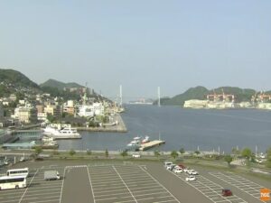
The Noto-Wajima Webcam looks down from a wooded hillside over the town of Wajima, on the north coast of Japan’s Noto Peninsula, toward its port and the Sea of Japan. Dark tiled rooftops fill the foreground. Beyond them rise the twin blocks of the Hotel Route-Inn in Marine Town, then the harbor breakwaters and a wooded headland, with open sea along the horizon. Between the houses and the hotels, wide graded lots and a crawler crane mark a town still rebuilding after the earthquake of January 1, 2024, and crane barges often work out by the breakwater. The Ishikawa broadcaster TV Kanazawa runs the camera, and this stream has been on YouTube since April 2022. The station says its streams may switch to news relays or press conferences during breaking news.
Wajima is a city of 24,608 people at the 2020 census, spread over 426 square kilometers (165 square miles) of the Noto Peninsula’s northwestern coast, with the Sea of Japan to the north and west. Its population has fallen by roughly half over the past 50 years. The town grew as a seaport trading with the Asian mainland and later served the Kitamaebune ships that carried cargo along the coast between Osaka and Hokkaido. Wajima became a city in 1954, and the neighboring town of Monzen merged into it in 2006. Hegurajima, an island 47 kilometers (29 miles) off the peninsula’s north coast, also belongs to the city.
Across Japan the name means lacquer. Wajima-nuri lacquerware has deep roots here: lacquer was used to decorate and strengthen a shrine door in the 14th century, and the local method mixes jinoko, a finely powdered mineral, into the work. The town’s other famous institution was the Asaichi, a morning market about 1,000 years old whose street held around 200 stalls.
The 2024 Noto earthquake gave Wajima the strongest shaking recorded anywhere, a maximum intensity shared only with neighboring Shika. The fire that followed burned an estimated 200 buildings across up to 48,000 square meters (520,000 square feet), the market street among them, and tsunami waves over 1.2 meters (4 feet) reached the coast. In Wajima, 6,282 homes were fully or partially destroyed, and the ground in the west of the city rose by about 4 meters (13 feet). The open lots and machinery in the camera’s view belong to the cleanup and rebuilding since then.
Winters on this coast are cold and snowy. January averages a high of 6.4 C (44 F) and a low of 0.4 C (33 F), and about 121 centimeters (48 inches) of snow falls in a typical year, enough to whiten the rooftops in the foreground after a cold spell. Spring warms slowly, and April’s daily mean is 11.1 C (52 F).
Summer is warm and humid. August is the hottest month, with highs of 30.1 C (86 F) and lows of 22.2 C (72 F). Autumn stays mild into October, which averages a high of 21.0 C (70 F) and a low of 11.9 C (53 F). Rain and snow add up to about 2,162 millimeters (85 inches) a year, and September is usually the wettest month.
The morning market survived the fire in another form. Three months after the earthquake its traders set up the Wajima Asaichi Caravan in the Kanaiwa district of Kanazawa, and it has since been held more than 250 times around Japan. A permanent market stall now trades inside a supermarket in Wajima, selling dried fish, seaweed, prepared foods, sweets and sake. As of late 2025 the old market site was an empty lot, with plans for a covered plaza of about 2,500 square meters (26,900 square feet). Wajima also has a museum of kiriko, the giant lanterns of the Noto festivals.
Outside the town, the Shiroyone Senmaida terraces hold 1,004 small rice fields, tended by local families or rented out. In the last week of September two couples drawn in a nationwide lottery hold their wedding there, and the ceremony is open to the public. The Wajima Taisai festival runs every year from August 22 to 25, when kiriko lanterns 10 meters (33 feet) tall are carried through the streets, and the Wajima Crab Festival follows in mid-November. In the village of Nafune, only residents may play Gojinjo-daiko, a masked drumming style said to date from 1577. After the earthquake it is worth checking that a site or event is running before making the trip.
Suzu sits at the far tip of the same peninsula, and the other two lead south to Kyushu and up into the Japan Alps.
Wajima is a city in Ishikawa Prefecture, Japan, on the northwestern coast of the Noto Peninsula, facing the Sea of Japan to the north and west. Parts of the city lie within Noto Hanto Quasi-National Park.
The camera looks from a wooded hill over Wajima’s rooftops to the twin hotel blocks of the Hotel Route-Inn in Marine Town, the breakwaters of Wajima Port and a wooded headland, with the Sea of Japan on the horizon. A street lined with houses and white prefabricated buildings runs toward the shore on the left, and graded lots lie between the houses and the hotels.
It shows the rebuilding more than the damage. Cleared lots, a crawler crane and crane barges by the breakwater are in view. Earlier images from this stream show many roofs under blue tarpaulins after the January 2024 earthquake, and by October 2026 only a few remained.
No market stalls appear on the camera. The fire after the 2024 earthquake burned the Asaichi street, and as of late 2025 the site was still an empty lot awaiting a planned covered plaza. The market carries on as the traveling Wajima Asaichi Caravan and as a permanent stall inside a supermarket in Wajima.
The camera is the quickest way to check the sky and sea over the town right now. As a guide, January highs average 6.4 C (44 F) with about 121 centimeters (48 inches) of snow a year, and August highs average 30.1 C (86 F).
Noto Airport, marketed as Noto Satoyama Airport and unofficially called Wajima Airport, lies 11.9 kilometers (7.4 miles) south-southeast of the city and handles domestic flights. Wajima has no passenger railway service, and National Route 249 runs through the city.
Wajima-nuri is the city’s lacquerware, known throughout Japan. Lacquer was used on a shrine door here in the 14th century, and the local technique mixes jinoko, a finely powdered mineral, into the lacquer. It remains a mainstay of the local economy alongside fishing, tourism and farming.
Source: TV Kanazawa
The best new live webcams and site features, once a week.
By subscribing you agree to receive our weekly email. Unsubscribe any time.
 22.1°C / 71.8°F


 22.5°C / 72.5°F


 27°C / 80.6°F