Live

 17:21:26
 0.6°C / 33.1°F
 Overcast Clouds
 67%
 2 km/h / 1 mph
 06:46
 17:11
Loading forecast…




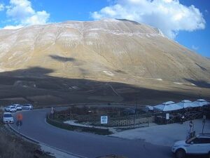
Castelluccio di Norcia, Monti Sibillini, Umbria, Italy
6.5°C / 43.7°F
17:21
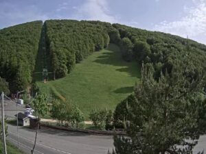
Passo Lanciano - Majelletta, SP220, Pretoro, Province of Chieti, Italy
 3.4°C / 38.1°F
17:21
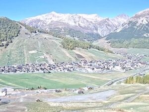
The South Tyrol Webcam is PanoCloud’s weather panorama for the province, a single stream that travels from camera to camera instead of holding one view. Each picture stays up for about a minute before the feed moves on to the next village, ski lift or summit station. In a sample of just over half an hour it showed 33 different cameras without repeating one, from Reschen and Sulden in the far west to Val Gardena, Innichen, Sexten and Antholz in the east. A bar along the bottom names the place, the hotel or lift the camera is mounted on and its altitude, next to a three-day forecast and the local time, while a small map in the corner marks where the current camera stands.
South Tyrol is an autonomous province in the far north of Italy, bordered by Austria to the north and east and by Switzerland to the west. It covers 7,398 square kilometers (2,857 square miles) and has 542,134 residents (2026 figure) in 115 municipalities, with Bolzano as its capital. The land was the southern part of the old County of Tyrol until Italy occupied it in November 1918 and annexed it in 1919, which is why the camera captions give the German name first, as in Jenesien/San Genesio or Eggental/Val d’Ega.
The cameras in the loop cover a huge range of height. The lowest, over Lana and the orchards of the Adige valley near Merano, is captioned at 337 meters (1,106 feet). The highest, on Ebenes Jochl above the Martell valley in the Vinschgau, sits at 2,786 meters (9,140 feet), about 2,450 meters (8,040 feet) higher. In between come summit and ski area cameras at Klausberg in the Ahrntal at 2,084 meters (6,837 feet) and the Madritsch chairlift in Sulden at 2,606 meters (8,550 feet), and village views over Marling, Algund and Schenna, where a castle rises above the roofs of the village center.
The province’s highest point is the Ortler, 3,905 meters (12,812 feet), in the west, while much of the east belongs to the Dolomites. The Selva camera in Val Gardena, at 1,783 meters (5,850 feet), frames one of their long cliff bands above dark forest.
Bolzano, at 262 meters (860 feet), averages highs of 6.7 C (44 F) in January with nights around -2.7 C (27 F), and highs of 29.8 C (86 F) in July. Spring and autumn are mild, with an April mean of 13.7 C (57 F), an October mean of 13.0 C (55 F) and October afternoons near 18 C (64 F). Rainfall is modest at about 735 millimeters (29 inches) a year, the city logs around 1,886 hours of sunshine, and snow falls on fewer than six days a year in town, according to the 1991 to 2020 normals.
Altitude changes the picture completely. On a mid-October morning the Lana camera showed green orchards under hail nets in full sun, while the Madritsch chairlift camera in Sulden already had patches of snow on its slopes. In winter the ski area views at Klausberg, the Rittner Horn, Sulden and Schoeneben above Reschen show the pistes. In autumn the forests turn gold and orange in places, as the Haidersee camera showed in October.
In Bolzano, the South Tyrol Museum of Archaeology holds Otzi the Iceman, the mummy that makes it one of the leading archaeological museums in Italy. East of the city, the Seiser Alm is the largest high-elevation Alpine meadow in Europe, about 52 square kilometers (20 square miles) of pasture between 1,680 and 2,350 meters (5,510 and 7,710 feet) below the Schlern. A Roman mule path climbs to it from Seis, and the Seis and Voels cameras in the loop sit in the villages below.
In the far west, Prad am Stilfserjoch is the start of the classic road to the Stelvio Pass, 2,757 meters (9,045 feet), which climbs 1,846 meters (6,056 feet) over about 25 kilometers (15.5 miles) and 48 hairpin bends on the South Tyrol side. Just north of the Haidersee cameras, Lake Reschen covers 6.6 square kilometers (2.5 square miles) at 1,498 meters (4,915 feet). When its dam was finished in July 1950 it drowned 163 homes in Graun and part of Reschen, and the tower of the 14th-century church still stands in the water. In the east, the Antholz biathlon arena, with its range at about 1,600 meters (5,200 feet), opened in 1971 and hosted the Olympic biathlon races of the Milan Cortina 2026 Winter Games.
These cameras cover more of the Alps on both sides of the border.
South Tyrol is the northern of the two provinces in Italy’s Trentino-Alto Adige region. It borders Austria to the north and east and Switzerland to the west. Its capital, Bolzano, sits at 262 meters (860 feet) in the Adige valley.
More than 30 partner cameras across the province, shown one at a time: village centers such as Schenna and Niederdorf, valley panoramas over Merano and the Vinschgau, the Haidersee, ski lifts and summit stations at Klausberg, Sulden and the Rittner Horn, and Dolomite peaks in Val Gardena and Sexten.
It is a weather panorama, not a fixed camera. Each partner camera stays on screen for about a minute, so a full cycle takes more than half an hour and there is no way to pick one. The caption names each partner’s website, such as valgardena.it or seiseralm.it.
Yes. The loop includes a camera at the Naturhotel Leitlhof in Innichen, captioned at 1,216 meters (3,990 feet), which looks over the town toward the mountains. Nearby Niederdorf has three camera views in the rotation, one of them at the railway station, and Sexten has another.
The Val Gardena cameras in Ortisei, Selva and St. Christina, the Eggental camera and the cameras in Niederdorf, Innichen and Sexten sit in or beside the Dolomites, a UNESCO World Heritage Site since 2009. The cameras around Merano, in the Vinschgau and in Sulden face other ranges of the Alps.
In Bolzano, January highs average 6.7 C (44 F) and July highs 29.8 C (86 F), with April and October means of 13 to 14 C (55 to 57 F). Cameras more than 2,000 meters (6,560 feet) above the city can show snow while the valley orchards are still green.
It is part of Italy, annexed in 1919, and has three official languages. In 2024, 57.6 percent of residents gave German as their first language, 22.6 percent Italian and 3.7 percent Ladin. Most places have both a German and an Italian name.
Source: PanoCloud
The best new live webcams and site features, once a week.
By subscribing you agree to receive our weekly email. Unsubscribe any time.
 1.6°C / 34.9°F
 11.9°C / 53.4°F