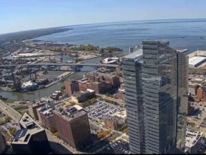
Live

 08:07:57
 2.9°C / 37.2°F
 Clear Sky
 94%
94% 6 km/h / 4 mph
 07:50
07:50 18:55
18:55Loading forecast…
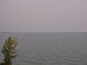
Painesville-on-the-Lake, Lake County, Ohio, USA
3.8°C / 38.8°F
08:07
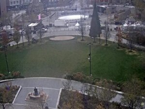
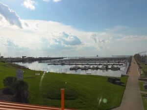

Cedar Point Amusement Park, Cedar Point Drive, Sandusky, Ohio, USA
5°C / 41°F
08:07






The Cincinnati Webcam looks across the Ohio River from Covington, Kentucky, to the downtown skyline of Cincinnati, Ohio. The pale green, double-deck Brent Spence Bridge fills the lower left of the wide view, and its Interstate 71 and 75 approach curves across the foreground with a steady line of trucks and cars. Behind it, Paycor Stadium, the light towers of Great American Ball Park and the crowned top of Great American Tower line the far bank, while the blue Roebling Suspension Bridge and the yellow arches of the Daniel Carter Beard Bridge close off the view upstream. Aaron Preslin runs the camera as CincyVision. It is a pan-tilt-zoom unit with a 32x lens, so it can hold the whole skyline or close in on a towboat, a stadium or the construction yards on the Kentucky bank.
Cincinnati was founded in 1788 on the north bank of the Ohio River and counted 309,317 residents at the 2020 census. The “Queen City” nickname goes back to an 1819 newspaper article, and Henry Wadsworth Longfellow called it the “Queen of the West” in an 1854 poem. Great American Tower at Queen City Square, completed in 2011, tops the skyline at 203 meters (665 feet), and Carew Tower, the city’s second tallest, rises near the left edge of the wide shot.
The Brent Spence Bridge opened on November 25, 1963, and is named after Brent Spence, who served more than 30 years in Congress before retiring that January. It is a double-deck cantilevered truss 529 meters (1,736 feet) long, with a main span of 253 meters (830 feet). The upper deck carries southbound traffic into Kentucky and the lower deck northbound traffic into Ohio, four lanes each. It was designed for 85,000 vehicles a day and was already carrying about 150,000 by 2006, which is why queues so often stretch across it at rush hour. A fire involving two semi-trucks closed it from November 11 to December 22, 2020.
After about $1.6 billion in federal grants were signed at the end of 2022, the governors of Ohio and Kentucky broke ground on May 8, 2026, on a cable-stayed companion bridge just west of the old span. It is due to take over the interstate traffic, leaving the 1963 bridge for local trips. Upstream, the John A. Roebling Suspension Bridge opened on January 1, 1867, with a main span of 322 meters (1,057 feet), at the time the longest of any suspension bridge in the world. It has been painted light blue since 1976.
Summers in Cincinnati are hot and humid. July averages highs of 30 C (86 F) and lows of 19 C (66 F) at the height of summer. Winters are cold but changeable. January averages highs of 4 C (40 F) and lows of minus 5 C (23 F), and a typical year brings about 59 centimeters (23 inches) of snow.
Spring and autumn are the mildest months to watch. April averages 19 C (66 F) by day and 7 C (44 F) at night, and October 19 C (67 F) and 8 C (46 F), when the wooded slopes on both banks change color. The city gets about 1,150 millimeters (45 inches) of precipitation a year. The river is a gauge of its own: the readout in the lower left of the picture gives the Ohio’s stage, current speed and water temperature, and the stage climbs after heavy rain upstream.
The Roebling Suspension Bridge is open to pedestrians and makes the easiest walk between the two cities, from the bars and restaurants of Roebling Point in Covington to the Cincinnati riverfront. On the Ohio side, Smale Riverfront Park covers 45 acres (18 hectares) of lawns, fountains, gardens and boat docks, and Carol Ann’s Carousel turns 44 Cincinnati-themed characters inside a glass pavilion at the foot of Vine Street. Next to it, the National Underground Railroad Freedom Center opened in 2004 and tells the story of the Underground Railroad, which passed through Cincinnati. The Banks restaurant district sits between the two stadiums, just behind the park.
Back in Kentucky, Devou Park spreads over 700 acres (280 hectares) on the hill above Covington. The Drees Pavilion at its overlook, opened in 2003, looks out over downtown Cincinnati and the Ohio River valley, much the same panorama the camera holds. The park also holds the Behringer-Crawford Museum of Northern Kentucky history and an 18-hole golf course.
More skylines, rivers and Ohio views from around the site:
The camera is in Covington, on the Kentucky side of the Ohio River, and looks across the water to downtown Cincinnati, Ohio, with the Brent Spence Bridge crossing the river in the foreground.
The wide view runs from Carew Tower and Paycor Stadium, home of the Bengals, to Great American Tower and the light towers of Great American Ball Park, where the Reds play. In front are the Brent Spence Bridge, an older steel truss bridge and the river, with the Roebling Suspension Bridge and Daniel Carter Beard Bridge upstream. As a pan-tilt-zoom camera, it sometimes closes in on one part of the scene. Weather readings, river conditions, a radar map and the names of passing boats run along the edges of the picture.
Yes, in the wide view. The bridge and its Interstate 71 and 75 approach cross the foreground, so a backup heading into Kentucky or Ohio is easy to spot, about 20 to 30 seconds behind real time. It is not a traffic camera and does not always point at the bridge. Ohio’s OHGO site and the Kentucky Transportation Cabinet publish dedicated traffic cameras for the corridor.
Ground was broken on May 8, 2026, for a cable-stayed bridge just west of the existing span. It is scheduled to open to traffic in 2031, with the approach roads finished by 2033. For close-up construction views, the camera’s operator points to a separate Brent Spence Bridge Project livestream on YouTube.
Yes. The stream runs around the clock, so after dark it shows the lit downtown towers across the river and the headlights moving over the Brent Spence Bridge.
No. Cincinnati/Northern Kentucky International Airport is in Hebron, Kentucky, about 13 kilometers (8 miles) southwest of the bridge, and the Cincinnati Zoo and Botanical Garden is in the Avondale neighborhood, about 6 kilometers (4 miles) north of the river. Neither is in view.
Cincinnati has four distinct seasons. July averages highs of 30 C (86 F), January highs of 4 C (40 F) with nights below freezing, and April and October highs sit around 19 C (66 to 67 F).
Source: Aaron Preslin (CincyVision)
The best new live webcams and site features, once a week.
By subscribing you agree to receive our weekly email. Unsubscribe any time.
 -4.8°C / 23.4°F
 10.6°C / 51.1°F