Live

 05:26:36
 13.7°C / 56.7°F
 Overcast Clouds
 69%
69% 4 km/h / 2 mph
 07:34
07:34 18:45
18:45Loading forecast…

Park Hotel Brasilia, Via Levantina 2° Accesso al Mare, Jesolo, Metropolitan City of Venice, Italy
18.9°C / 66°F
05:26

Orvieto Cathedral, Piazza del Duomo, Orvieto, Province of Terni, Italy
13°C / 55.4°F
05:26
Hotel Miramonti, Viale degli Sci, Gambarie, Metropolitan City of Reggio Calabria, Italy
11.7°C / 53.1°F
05:26


San Pellegrino in Alpe, Castiglione di Garfagnana, Province of Lucca, Italy
 4.2°C / 39.6°F
05:26
4.2°C / 39.6°F
05:26
Spiaggia dell'Ariana, Via Flacca, Gaeta, Province of Latina, Italy
14.9°C / 58.8°F
05:26
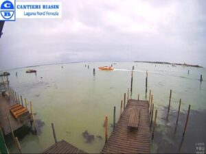
Fondamenta Serenella, 16, 30141 Venezia VE, Italy
14.1°C / 57.4°F
05:26The Lake Como Webcam streams from Croce di Menaggio, a shoulder of hillside 500 meters (1,640 feet) above the western shore, where a stone chapel and an Italian flag stand at the edge of the drop. The frame takes in the roofs of Menaggio, the harbor wall and the water running south to the headland at Bellagio, where the lake splits into its Como and Lecco arms. Mountains close both sides of the picture. Two more cameras sit behind the same player: one above Piazza Garibaldi at lake level, and one at Camping La Riva in Sorico, at the far northern end of the lake. Haze, boat wakes and the angle of the light change the view hour by hour.
Lake Como covers 146 square kilometers (56 square miles), third largest in Italy behind Garda and Maggiore but far deeper than either at 425 meters (1,394 feet). It runs 46 kilometers (29 miles) end to end, is never more than 4.5 kilometers (2.8 miles) across, and sits 198 meters (650 feet) above sea level with about 160 kilometers (99 miles) of shoreline. Glaciers cut it into an upside down Y. The Adda enters the northern arm near Colico and leaves again from the Lecco branch, while the Mera comes in at the top of the lake, past the third camera.
Menaggio itself is small: 3,273 residents at the end of 2010, spread over 13 square kilometers (5.0 square miles) where the river Senagra reaches the lake. It lies 37 kilometers (23 miles) north of Como on the SS340, which follows the line of the Roman Via Regina, laid after Rome took the area in 196 BC. Traces of its resort decades survive. A narrow gauge railway climbed from the waterfront to Porlezza on Lake Lugano between 1873 and 1939, and an Englishman founded the Menaggio and Cadenabbia Golf Club in 1907. Piazza Garibaldi, the square under the second camera, remains the town center.
Croce, where the main camera sits, is one of three hamlets in the comune along with Loveno and Nobiallo. The Chiesetta degli Alpini beside the lens was built in 1975 to a design by L.M. Belloni, dedicated to San Maurizio and raised by the local Alpini group for the men of Menaggio killed in the two world wars, with frescoes by Bruno Azimonti inside and a sacrarium in the bunker beneath. The slope behind carries restored trenches of the Linea Cadorna, dug in 1915 along the Swiss border. Higher again, Monte Grona reaches 1,736 meters (5,696 feet), the Rifugio Menaggio standing at 1,400 meters (4,593 feet) on its southern flank.
Winters at lake level are cool rather than severe. January runs from about 0.2 to 7.6 C (32 to 46 F), and snow reaches the shore at least once most years, usually gone within a day or two, though a heavy fall can leave 30 to 35 centimeters (12 to 14 inches). The ridge above the camera holds its snow longer, so the frame often shows a white skyline over a green shoreline. The lake moderates the air, so fog sits over the Po plain far more often than it does here. July averages 18.2 to 29.4 C (65 to 85 F) with 7.5 hours of sun a day.
Spring and autumn are the wet seasons. April sits between 8.1 and 18.7 C (47 to 66 F) and October between 10 and 17.4 C (50 to 63 F), and the year brings around 1,320 millimeters (52 inches) of rain, May the wettest month at roughly 160 millimeters (6.3 inches). Thunderstorms build over the mountains on summer afternoons and often break in the evening. Two named winds work the lake and are easy to read on camera by the direction of the whitecaps: the Tivano comes down from the north at first light and fades by mid morning, then the Breva turns around midday and pushes north.
The camera’s viewpoint is a walk, not a drive. The path from the Menaggio waterfront up to La Crocetta covers about 4 kilometers (2.5 miles) and takes roughly an hour and twenty minutes, and the panorama at the top reaches across the central lake to the Lecco branch and the Orobie Alps, then north to the Rhaetian Alps. The Linea Cadorna trenches on the ridge have been cleared and are open to walk through, gun positions and observation posts still in place. Hikers carry on to the Rifugio Menaggio and up Monte Grona.
Down at the pier, Menaggio is one corner of the central lake triangle with Bellagio and Varenna, and the crossing to either takes around 15 minutes on the passenger boats and car ferries that run through the day. South of town, the Greenway del Lago di Como follows the old Via Regina for roughly 10 kilometers (6.2 miles) through the lakeside villages, passing the terraced gardens of Villa Carlotta at Tremezzo. Up at Sorico, where the third camera looks out, the Pian di Spagna reserve protects about 1,600 hectares (3,950 acres) of wetland around the mouth of the Mera, and the steady breeze has made the north shore a windsurfing and kitesurfing base.
Three more cameras worth opening next:
At Croce di Menaggio, a hamlet above the town on the western shore, in the Province of Como in Lombardy, northern Italy.
The view looks south over the roofs and harbor of Menaggio to the point at Bellagio, where the lake divides into the Como and Lecco arms. The other two cameras cover Piazza Garibaldi in the middle of Menaggio and the campsite and mountains at Sorico.
Mild for the latitude, because the lake holds heat. Winters rarely bite at the shore, summers are warm and humid, and spring and autumn carry most of the rain.
425 meters (1,394 feet), among the deepest in Europe even though Garda and Maggiore cover more ground.
By boat. Passenger boats and car ferries link Menaggio, Bellagio and Varenna through the day, and the crossing takes roughly 15 minutes.
The Chiesetta degli Alpini, built in 1975 and dedicated to San Maurizio. The local Alpini group raised it for the men of Menaggio killed in the two world wars, and a sacrarium sits in the bunker below.
Mid April to mid June and September bring the most settled conditions, with warm days, open gardens and full ferry timetables. July and August bring both the heat and the crowds.
Lugano is about 27 kilometers (17 miles) away by road over the border at Gandria, and the frontier runs along the ridges behind the town, which is why the Linea Cadorna trenches were dug there.
Source: Como Cam
The best new live webcams and site features, once a week.
By subscribing you agree to receive our weekly email. Unsubscribe any time.
 5.3°C / 41.5°F
 5.9°C / 42.6°F