
 English
 简体中文
 Deutsch
 Français
 Español
 Nederlands
 Svenska
 Italiano
 日本語
 Polski
 Português
 Русский
 Ελληνικά
 العربية
 Türkçe

Live
 11:27:30
 7.4°C / 45.3°F
 Overcast Clouds
 82%
 8 km/h / 5 mph
 06:39
 17:01
Loading forecast…


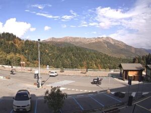
Hotel Miramonti, Viale degli Sci, Gambarie, Metropolitan City of Reggio Calabria, Italy
11.6°C / 52.9°F
11:27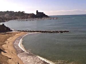
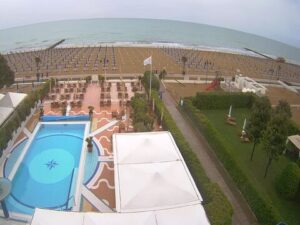
Park Hotel Brasilia, Via Levantina 2° Accesso al Mare, Jesolo, Metropolitan City of Venice, Italy
 14°C / 57.2°F
11:27
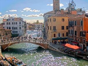


Fondamenta Serenella, 16, 30141 Venezia VE, Italy
14.3°C / 57.7°F
11:27


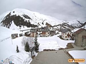
The Monte Vettore Webcam looks up from the village of Pretare, 920 meters (3,018 feet) above sea level, to the southern side of the highest mountain in the Sibillini range. Pretare’s rooftops, gardens and trees fill the lower part of the frame, with a wooded ridge on the left and the bare upper slopes of the Vettore massif along the skyline. Beyond the nearest houses, a tower crane, site cabins and red and white barriers along the road mark the rebuilding that has gone on since the 2016 earthquakes. On a clear winter day the mountain can be white from the summit ridge down to the trees, and in October the woods on the lower slopes turn yellow. Low cloud often sits on the massif, leaving only the village in view.
Monte Vettore rises to 2,476 meters (8,123 feet) in the province of Ascoli Piceno, Marche, and is the highest peak of the Sibillini massif, inside the Monti Sibillini National Park. Pretare, part of the municipality of Arquata del Tronto, sits on its southern foot about 3.7 kilometers (2.3 miles) southeast of the summit, so the peak stands roughly 1,556 meters (5,105 feet) above the camera. On the north side of the massif, in a glacial hollow below the summit, lies Lago di Pilato at 1,941 meters (6,368 feet). Its two basins earned it the nickname of “the lake with glasses”, and it is the only home of Chirocephalus marchesonii, a red crustacean about 1 centimeter (0.4 inches) long that swims upside down.
Pretare is known as the village of the fairies. In the local legend, the fairies of the Sibillini were beautiful women with goats’ feet who could mix with people only at night. Caught by sunrise at a dance in Castelluccio, they fled so fast that they scored a line across the Vettore, still called La Strada delle Fate, the Road of the Fairies, a fault that cuts the mountain at about 2,000 meters (6,562 feet). On the feast of San Rocco in mid-August, young women dressed as fairies come down to the square to open the dancing. The Associazione Culturale Monte Vettore, which promotes the event, is also the host of this camera.
The mountain’s faults are real enough. The 2016 Central Italy sequence came from the Monte Vettore and Monte Bove fault, which broke the surface with offsets of up to 2 meters (6.6 feet) along about 30 kilometers (18.6 miles). Pretare was partly destroyed but lost no one. The current broadcast has been running since March 2023.
These are 10-year averages for Pretare at 920 meters, and the summit is far colder. Winter brings daytime highs of about 6 to 8°C (43 to 46°F) in the village, with nights around -2°C (28°F) in January, and the upper mountain is often snow-covered through the season. Spring warms slowly: April highs are near 14°C (57°F), and May is one of the wettest months, with about 130 millimeters (5.1 inches) of rain.
Summer is warm and drier, with highs of 26 to 27°C (79 to 80°F) in July and August, lows near 15°C (59°F) and about 60 millimeters (2.4 inches) of rain a month. October highs average 17°C (62°F), and November drops to 11°C (52°F) with about 125 millimeters (4.9 inches) of rain. Cloud can settle on the upper Vettore in any season while the village below stays clear.
The usual route to the summit starts at Forca di Presta, a pass at 1,536 meters (5,039 feet), and follows a single ridge trail to the top in about three hours. Lago di Pilato is a separate walk of about three hours from Foce, a hamlet of Montemonaco on the Marche side. Legend says the body of Pontius Pilate was carried there from Rome on a cart pulled by two buffalo, which plunged into the water.
Arquata del Tronto, just south of Pretare at 777 meters (2,549 feet), is described as the only municipality in Europe inside two national parks, the Monti Sibillini to the north and the Gran Sasso and Monti della Laga to the south. Its fortress, the Rocca di Arquata, was built by Ascoli in the 13th century and stands above the town, and the ancient Via Salaria, the Roman salt road, passes through the Tronto valley below. Ascoli Piceno is about 26 kilometers (16 miles) to the east as the crow flies.
More mountain views in Italy, from the other side of the Vettore to the far south of the Apennines:
The camera is mounted in Pretare and looks up at the southern side of the Vettore massif. Houses, trees and the village road fill the foreground, along with the cabins, crane and barriers of the post-earthquake rebuilding. When the cloud lifts, the bare rock of the upper mountain, snow-covered in winter, runs along the skyline.
Pretare is a village at 920 meters (3,018 feet) on the southern foot of Monte Vettore, in the municipality of Arquata del Tronto, province of Ascoli Piceno, in the Marche region of central Italy. It lies about 26 kilometers (16 miles) west of Ascoli Piceno.
No. Castelluccio di Norcia and its high plain lie in Umbria, on the western side of the massif, while this camera looks at the mountain from Pretare in the Marche, on its southern side.
Monte Vettore is 2,476 meters (8,123 feet) high, the highest summit of the Sibillini range, about 1,556 meters (5,105 feet) above the camera in Pretare.
The live picture is the quickest check. When the summit ridge shows above Pretare, the upper mountain is clear, and when the frame holds only the village under grey cloud, the peaks are inside it. Village highs run from about 6°C (43°F) in January to 27°C (80°F) in July, and the summit is much colder.
From Forca di Presta, at 1,536 meters (5,039 feet), a single trail with no junctions follows the ridge to the summit in about three hours, a climb of 940 meters (3,084 feet).
The earthquakes of 2016 and 2017 partly destroyed Pretare, but nobody in the village died. In the wider municipality of Arquata del Tronto the shocks of 24 August and 30 October killed 52 people, 48 of them in Pescara del Tronto. Rebuilding is still under way in the middle of the village, in plain view of the camera.
Source: Scenari Digitali
The best new live webcams and site features, once a week.
By subscribing you agree to receive our weekly email. Unsubscribe any time.
 15°C / 59°F