
Live
Buena Park, California
Knott's Berry Farm, Beach Boulevard, Buena Park, CA, USA
 15.1°C / 59.2°F
 07:05
 07:05:45
 13°C / 55.4°F
 Clear Sky
 70%
 7 km/h / 4 mph
 07:27
 18:19
Loading forecast…
Knott's Berry Farm, Beach Boulevard, Buena Park, CA, USA
15.1°C / 59.2°F
07:05
Big Bear Valley Recreation and Park District, Park Avenue, Big Bear Lake, CA, USA
3.1°C / 37.6°F
07:05
Catalina Island, Los Angeles County, California, USA
20°C / 68°F
07:05


Goldmine Mountain, Big Bear Lake, California, USA
3.1°C / 37.6°F
07:05
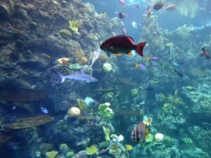
Aquarium of the Pacific, Aquarium Way, Long Beach, CA, USA
15.7°C / 60.3°F
07:05


The Sharp Park Beach Webcam watches the shore at Sharp Park in Pacifica, California, from cameras on an antenna mast beside the beach. The main view looks north to the Pacifica Pier, its concrete deck running out past the breakers, with a parking lot in the foreground and a row of Spanish-style buildings with red tile roofs on the right. A second camera faces west across a curved, railed promenade and straight out to sea, and a third pulls back for a wider shot of the pier, a flagpole flying the U.S. flag, and the open Pacific. When a big swell arrives, white water can stretch across the whole frame and run right up to the promenade railing.
Sharp Park is one of nine small communities that merged in 1957 to form the city of Pacifica, which counted 38,640 residents in the 2020 census. The neighborhood fronts the open ocean about 15 minutes’ drive south of San Francisco, and its beach runs south from the pier toward the bluffs of Mori Point. During World War II, the land around today’s Sharp Park recreation area held the Sharp Park Detention Station, an Immigration and Naturalization Service processing facility for Japanese Americans, Japanese nationals and other detainees.
The pier in the main view is officially the Reverend Herschell Harkins Memorial Pier. It opened in 1973, was designed partly to carry the city’s sewer outfall line out to sea, and runs 347 meters (1,140 feet) in an L shape from Beach Boulevard. It became a well-known fishing spot: on July 8 and 9, 1995, anglers pulled more than 1,000 salmon from it. Corrosion closed it once before, in 1992, and repairs brought it back.
In June 2026 the city closed the pier indefinitely after large cracks opened in the concrete, and the City Council approved an emergency demolition of the Chit Chat Cafe at the pier. No reopening date had been set by October 2026, so an empty deck on camera is the current state of things, not a quiet hour. The same mast carries the operator’s own weather station, which reports to Weather Underground.
Pacifica’s nickname is the fog capital of California, and summer shows why. Average highs from June to August are only 20 to 22 C (69 to 71 F), with lows of 10 to 12 C (51 to 53 F), and summer fog often brings light drizzle overnight and into the morning. On camera that can mean a gray sea and the far end of the pier fading from view. September is the warmest month, with an average high of 22 C (72 F), and early autumn brings the rare hot day: the record is 39 C (102 F), set on October 5, 1987.
Winter is mild and wet. From December to February, highs average about 15 to 16 C (58 to 60 F) and lows 7 to 8 C (45 to 46 F), and each of those months gets more than 150 mm (6 inches) of rain, out of about 810 mm (32 inches) a year. Almost no rain falls in July, and no measurable snow has been recorded since the local weather station opened in 1983. Spring warms slowly, from an average high of 16 C (61 F) in March to 19 C (67 F) in May, as the rain tapers off. These figures are the 1991 to 2020 NOAA normals for Pacifica.
Mori Point, the headland at the south end of the beach, has trails up onto the bluffs, and the cliff scene at the end of Harold and Maude was filmed there. Close by, Sharp Park Golf Course was designed in 1931 by the architect Alister MacKenzie. Anglers also fish from the local beaches, where striped bass and salmon are the usual catch.
A short drive inland, Sweeney Ridge is where Gaspar de Portola’s expedition first sighted San Francisco Bay on November 4, 1769, and its trails draw hikers and mountain bikers. Beyond Mori Point, Rockaway Beach has shops and places to eat, and Pacifica State Beach at Linda Mar is the town’s best-known surfing beach. Pacifica’s Taco Bell Cantina, a 1960 building on the ocean side of Highway 1, has a reputation as the most beautiful Taco Bell in the world. Milagra Ridge offers more hiking, and the Sanchez Adobe, built in 1846, is the oldest structure in San Mateo County.
Start with the fourth camera on the same mast, which faces south, then head up the coast to San Francisco or down to Southern California:
Sharp Park Beach is in Pacifica, San Mateo County, California, on the open Pacific coast about 15 minutes’ drive south of San Francisco. The cameras sit on a mast in the Sharp Park neighborhood, just south of the Pacifica Pier.
Three views from one mast. The main camera looks north at the Pacifica Pier with a parking lot and red-roofed buildings in front of it. The Sharp Park Beach tab faces west over a curved promenade straight out to sea, and the Pier Wide View tab takes in the flagpole, the full length of the pier and the open ocean.
No. The city closed the pier indefinitely in June 2026 after large cracks appeared in its concrete, and no reopening date had been announced as of October 2026. Repairs are expected to cost millions of dollars, and local leaders have asked the state and federal governments for help with the bill.
Not on this page. The three views here look north and west. A fourth camera on the same mast faces south toward Mori Point and has its own page on this site. Pacifica State Beach at Linda Mar, the town’s main surfing beach, lies beyond Mori Point and is not in view.
Fishing is a long tradition here. Anglers work the local beaches for striped bass and salmon, and the pier was a well-known fishing spot until it closed in June 2026.
Cool and often foggy in summer, with average highs of 20 to 22 C (69 to 71 F), and mild and rainy in winter, with highs around 15 C (59 F). September is the warmest month at about 22 C (72 F).
Usually salt. The cameras are mounted on an open antenna mast, fully exposed to the weather, and the operator notes that a strong west or northwest wind combined with big surf throws a lot of salt into the air. Summer fog and drizzle can also soften the picture, especially in the morning.
Source: Chamberlin Nature
The best new live webcams and site features, once a week.
By subscribing you agree to receive our weekly email. Unsubscribe any time.