Live

 19:45:01
 24.2°C / 75.6°F
 Clear Sky
 84%
84% 7 km/h / 4 mph
 05:17
05:17 17:49
17:49Loading forecast…
Igreja São Pedro, Gramado, RS - Avenida Borges de Medeiros - Centro, Gramado - RS, Brazil
 13.2°C / 55.8°F
19:45
13.2°C / 55.8°F
19:45
Teatro Amazonas - Largo de São Sebastião - Centro, Manaus - State of Amazonas, Brazil
 31.2°C / 88.2°F
18:45
31.2°C / 88.2°F
18:45


Mad River Glen Cooperative, Schuss Pass, Waitsfield, Vermont, USA
 8.8°C / 47.8°F
18:45
8.8°C / 47.8°F
18:45

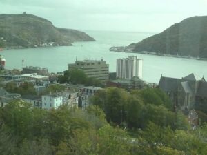
St. John's, Avalon Peninsula, Newfoundland, Canada
 3.3°C / 37.9°F
20:15
3.3°C / 37.9°F
20:15
The Itaperuna Webcam looks out from Morro do Castelo, the hill that carries the city’s 20-meter (66-foot) Christ the Redeemer statue, over Itaperuna in the north of Rio de Janeiro state, Brazil. The statue stands right of center on a blue domed pedestal with its arms spread over the town, while rooftops and apartment blocks fill the valley below and rows of green hills run back to a pointed peak on the horizon. Sky takes up the top half of the frame, so summer storm clouds can be seen building over the hills long before they reach the city. The camera belongs to Itanet, a local internet provider, which also streams three street views from the same city. They sit in the tabs on the player: a roundabout, the avenue outside the bus station and a stretch of the BR-356 highway.
Itaperuna is a city of 101,041 people, counted at the 2022 census, on the Muriae River, 325 kilometers (202 miles) from the state capital of Rio de Janeiro. The municipality covers 1,106.7 square kilometers (427.3 square miles) of hills and pasture, and the Carangola River crosses it as well. It became a municipality in its own right on December 6, 1889. The name comes from the Tupi language and is usually translated as “path of the black stone”.
The Christ the Redeemer on Morro do Castelo was inaugurated in 1966. It was the idea of a former mayor, Claudio Cerqueira Bastos, and was designed by Antonio Francisco Moreira, a sculptor from neighboring Espirito Santo. The terrace around its base gives a view over almost the whole urban area, which is the angle the Itaperuna Webcam borrows, and the statue is lit after dark. In the frame, the paved terrace curves around the pedestal at the bottom, with a small building and its solar panels in the lower left corner.
Cattle and milk shaped the town. Beef ranching and dairy farming still run through the countryside around it, and the city’s dairy history includes a Gloria powdered milk factory. Today Itaperuna is also known in the region for the Hospital Sao Jose do Avai, a center for heart and neurological care. The three tab cameras show the city at street level. The Roundabout tab watches a planted traffic island ringed by a row of flags, the Bus Station tab looks along a wide avenue with crosswalks and apartment blocks, and the BR-356 tab faces a street outside Itanet’s own office in the airport district.
Itaperuna has a hot tropical climate with a wet summer and a dry winter, classed as Aw. January is the hottest stretch, with average highs of 33 C (91 F) and nights around 22.6 C (73 F). The city gets about 1,204.6 millimeters (47.4 inches) of rain a year, most of it between late spring and early autumn, often as short afternoon thunderstorms that roll in over the hills behind the statue. The all-time high recorded by the national weather service INMET is 42.8 C (109 F), on November 18, 2023.
Winter, from June to August, is the dry season. July highs average 27.9 C (82 F) and lows drop to about 15.8 C (60 F), so even midwinter afternoons are warm. Drier air tends to bring the far ridgelines out more clearly on camera, and the pastures on the hills can turn paler as the dry months go on. The record low is 4.5 C (40 F), set on June 10, 1945.
The obvious first stop is the camera’s own hill. The Christ the Redeemer monument sits on Rua Orlando Raelli in the Centro district, and its terrace gives the same sweep over the town that the Itaperuna Webcam shows on screen, with the statue floodlit in the evening. Down in the valley, the Muriae River runs through the city, and the Bus Station tab watches the avenue at the city’s coach terminal, the arrival point for anyone traveling in by bus. The Aeroporto Regional de Itaperuna is the city’s airfield, and Itanet’s BR-356 camera is named for the airport district.
The district of Raposo, inside the municipality, holds the only hydromineral spa in Rio de Janeiro state. Its mineral waters have long been compared with those of Vichy in France, and the Parque das Aguas Soledade and the Fontanario Raposo are the places to try them. For a wider look at the region, Itanet’s channel also carries cameras in nearby towns, including Santo Antonio de Padua, Miracema, Italva and Bom Jesus do Norte, plus the larger city of Campos dos Goytacazes toward the coast.
More views of Brazilian towns and cities, from the south to the coast of Sao Paulo state:
Itaperuna is in the north of Rio de Janeiro state in southeastern Brazil, on the Muriae River. It lies 325 kilometers (202 miles) from the city of Rio de Janeiro, and the monument hill sits in the Centro district.
The main view shows the Christ the Redeemer statue on Morro do Castelo with the city spread across the valley behind it and green hills on the horizon. Three tabs add a roundabout, the avenue by the bus station and a street on the BR-356.
It is hot most of the year. January highs average 33 C (91 F) and July highs 27.9 C (82 F). Summers are wet with afternoon storms, and winters from June to August are dry and clear.
The monument on Morro do Castelo is 20 meters (66 feet) tall. It was inaugurated in 1966 and designed by the sculptor Antonio Francisco Moreira.
The name comes from Tupi and is usually translated as “path of the black stone”. Another reading gives “dark upright stone”.
The city is 325 kilometers (202 miles) from Rio de Janeiro. Raposo, the spa district inside the municipality, is 333 kilometers (207 miles) from the capital.
Itaperuna runs on Brasilia time, three hours behind UTC. When it is noon on the camera, it is 10 am in New York and 3 pm in London during the northern winter.
Source: Itanet
The best new live webcams and site features, once a week.
By subscribing you agree to receive our weekly email. Unsubscribe any time.
 25°C / 77°F
 9.2°C / 48.6°F
 -0.6°C / 30.9°F