Live

 06:02:37
 11.7°C / 53.1°F
 Clear Sky
 49%
49% 2 km/h / 1 mph
 06:26
06:26 17:45
17:45Loading forecast…
The Benson Train Webcam watches the Union Pacific main line through downtown Benson, Arizona, from the Benson Visitor Center, a replica of the town’s old railroad depot. SouthWest RailCams runs two cameras here at milepost 1032 of the Lordsburg Subdivision, part of the former Southern Pacific Sunset Route across the southern edge of the state. The PTZ camera pans and zooms to follow trains along the tracks, while the East camera holds a fixed view down the line toward the desert hills on the horizon. Stack trains of intermodal containers, mixed freight and automobile racks roll through day and night, usually behind yellow Union Pacific locomotives. Three days a week in each direction, Amtrak passenger trains also call at the platform nearby.
Benson was founded in 1880, when the Southern Pacific Railroad built east across southern Arizona and chose a crossing of the San Pedro River for a terminal. The town took its name from Judge William S. Benson, a friend of Southern Pacific leader Charles Crocker. For decades it was the shipping point for the mining towns to the south, including Tombstone and Bisbee. Benson sits at 1,289 meters (4,229 feet) above sea level, counted 5,355 residents at the 2020 census, and lies about 72 kilometers (45 miles) east southeast of Tucson on Interstate 10.
The old Southern Pacific line now belongs to Union Pacific, and this stretch is its Lordsburg Subdivision. SouthWest RailCams counts 25 to 40 trains a day through Benson: intermodal stack trains, manifest freight, automotive trains and the occasional unit train. Movements are set by a dispatcher rather than a timetable, so traffic is steady but hard to predict, and a quiet half hour on the Benson Train Webcam can end with a long freight filling the whole frame.
Passenger trains stop here too. Benson station, at 105 East 4th Street, is a flag stop on two tracks, served by Amtrak’s Sunset Limited and Texas Eagle three days a week in each direction. Passengers get only a small metal shelter, and the replica Southern Pacific depot nearby serves as the town’s tourist information center, with stops for Benson Area Transit and Greyhound. SouthWest RailCams has streamed from Benson since November 2022.
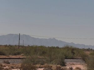
The PTZ camera is the main view on this page. Because it can pan, tilt and zoom, the frame shifts between a wide shot of the main line and a close look at a passing lead locomotive, and it often turns to follow a train as it moves through town. The East camera, on the second tab, stays fixed on one angle looking east along the tracks. Freight trains cross that frame from edge to edge, and on clear days a line of hills stands on the skyline beyond the power lines. Both cameras keep streaming after dark, when the headlights of an approaching train can show up well before the train itself.
Benson has a dry, high desert climate shaped by its altitude. January brings average highs of 18 C (65 F) and lows near minus 3 C (27 F), so a winter morning on camera can start cold and still turn warm and sunny by midday. Spring warms quickly, with April averaging 27 C (81 F) by day and 5 C (41 F) at night. June is usually the hottest month, with average highs of 37 C (99 F), and heat shimmer can rise off the rails on long afternoons.
The summer monsoon arrives in July, when highs still average 36 C (98 F) and nights stay near 19 C (66 F). July and August each bring about 69 millimeters (2.7 inches) of rain, much of it from afternoon thunderstorms that can darken the sky over the tracks within an hour. Autumn is the gentlest season, with October highs around 29 C (84 F) and lows near 7 C (45 F). The whole year brings only about 299 millimeters (11.77 inches) of rain, and snow is rare, averaging about 5 millimeters (0.2 inches) a year.
The town is best known as the gateway to Kartchner Caverns State Park, in the Whetstone Mountains about 14 kilometers (9 miles) south of Interstate 10 exit 302 on State Route 90. The caverns are living, wet caves that are still growing, and the park limits how many people go inside each day, so tours need a reservation. In town, the San Pedro Valley Arts and Historical Society Museum runs changing exhibits on local history and cultures, and the Benson Visitor Center that hosts the cameras is the place to ask about the area.
East of Benson in Texas Canyon, the Amerind Museum has been devoted to the Native American cultures of the region since 1937, with collections that run from ancient arrowheads to contemporary Pueblo pottery in mission style buildings. It opens Tuesday through Sunday. Tombstone, the old mining town that once shipped its goods through Benson, is 39 kilometers (24 miles) southeast on State Route 80.
For more railroad views and southern Arizona, try these next.
The cameras are at the Benson Visitor Center on East 4th Street in downtown Benson, Cochise County, Arizona. They watch milepost 1032 of the Union Pacific Lordsburg Subdivision, about 72 kilometers (45 miles) east southeast of Tucson.
Union Pacific freight trains and Amtrak passenger trains on the old Southern Pacific Sunset Route. The PTZ camera pans and zooms to follow trains, and the East camera holds a fixed view east along the tracks.
SouthWest RailCams puts the figure at 25 to 40 trains a day, mostly intermodal, manifest freight and automotive trains, with the occasional unit train. There is no fixed timetable, since a dispatcher sets the moves.
Yes. The Sunset Limited and the Texas Eagle stop at Benson three days a week in each direction. It is a flag stop, so trains halt only when passengers are booked to or from the station.
Winters are mild by day, with January highs around 18 C (65 F), and cold at night. Summers are hot, with June highs near 37 C (99 F), and the July and August monsoon brings most of the year’s rain in afternoon storms.
The park is just west of town, about 14 kilometers (9 miles) south of Interstate 10 exit 302 on State Route 90.
The Southern Pacific Railroad founded Benson in 1880 at a crossing of the San Pedro River, where it wanted a terminal. The town grew as the rail shipping point for mining camps such as Tombstone and Bisbee.
Source: SouthWest RailCams
The best new live webcams and site features, once a week.
By subscribing you agree to receive our weekly email. Unsubscribe any time.
 19.8°C / 67.6°F

 18.7°C / 65.7°F
 3°C / 37.4°F

 19.8°C / 67.6°F


 24.1°C / 75.4°F