
 English
 简体中文
 Deutsch
 Français
 Español
 Nederlands
 Svenska
 Italiano
 日本語
 Polski
 Português
 Русский
 Ελληνικά
 العربية
 Türkçe

Live
Big Texan Steak Ranch Restaurant, Amarillo, Texas
Big Texan Steak Ranch, Amarillo, Texas
 21.2°C / 70.2°F
 13:5513:55:23
 23°C / 73.4°FClear Sky
 56%
 13 km/h / 8 mph
 06:39
 17:27
Loading forecast…
Big Texan Steak Ranch, Amarillo, Texas
21.2°C / 70.2°F
13:55
SpaceX Launch Facility, Boca Chica Boulevard, Brownsville, TX, USA
 19.4°C / 66.9°F
13:55

Sand Rose Beach Resort, Padre Boulevard, South Padre Island, TX, USA
 19.3°C / 66.7°F
13:55


Lake Hopatcong, Jefferson Township, New Jersey, USA
14.7°C / 58.5°F
14:55

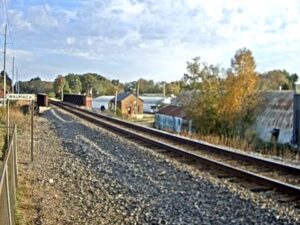

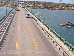
The Galveston Webcam looks across a quiet bayou in Bayou Vista, a small canal-side city on the mainland northwest of Galveston Island, toward the low bridge that carries BNSF Railway’s main line toward the island. A rock-armored rail embankment runs across the middle of the frame and crosses the water on a short trestle of pale concrete piers, with open marsh stretching flat to the horizon behind it. Freight trains roll over that bridge, bay fishing boats cruise the channel, and the sky fills half the picture. The camera faces roughly west, so the sun goes down in front of it, and the operator singles out the sunsets. This is not a beach camera: Galveston’s Gulf front and the Seawall are about 15 kilometers (9 miles) to the east.
Bayou Vista is a Galveston County city of 1,763 people at the 2020 census, up from 1,537 in 2010. It was established as a city in 1985 and covers just 1.16 square kilometers (0.45 square miles), of which 0.34 square kilometers (0.13 square miles) is water. The town sits about 1 meter (3.3 feet) above sea level, and Hurricane Ike did severe damage here on September 13, 2008.
The camera is an Axis unit run by Matthew Reeves, and the caption on the stream calls this spot the Bayou Vista Bridge. The track is BNSF’s Galveston Subdivision main line, which crosses the bayou on the southwest edge of town, about 1 kilometer (0.6 miles) south of where State Highway 6 crosses Highland Bayou. The operator describes it as a low-clearance bridge. About 5 kilometers (3 miles) to the southeast, near Virginia Point, the BNSF line joins Union Pacific’s Galveston Subdivision, and rail traffic for the island then crosses Galveston Bay on the Galveston Causeway.
That causeway first opened in 1912 for both trains and cars. Its current rail span, a vertical-lift drawbridge from 2012 shared by BNSF and Union Pacific, widened the channel beneath it to about 91 meters (300 feet).
Galveston’s NOAA climate normals are the nearest long-term record for Bayou Vista. January averages highs of 17°C (63°F) and lows of 9°C (49°F). Spring warms quickly, and April runs from 18 to 26°C (65 to 78°F). July is hot and humid, with highs of 33°C (91°F) and lows around 27°C (80°F).
October cools to highs of 28°C (82°F) and lows of 20°C (69°F). The area gets about 1,199 millimeters (47.2 inches) of rain a year, and September is the wettest month at 169 millimeters (6.65 inches), right in the middle of the Atlantic hurricane season, which runs from June through November. The 1900 hurricane struck on September 8 and killed an estimated 6,000 to 8,000 people on Galveston Island, which led to the Seawall, 16 kilometers (10 miles) long and 5.2 meters (17 feet) high.
Galveston Island is a short drive across the causeway. The Strand Historic District, about 14 kilometers (9 miles) east of the camera, is a National Historic Landmark district of mainly Victorian buildings now used as restaurants, antique stores, museums and art galleries. On the Gulf side, the Galveston Island Historic Pleasure Pier, rebuilt after Hurricane Ike, stands off Seawall Boulevard about 16 kilometers (10 miles) away, and Moody Gardens, a botanical park known for its pyramids, is about 11 kilometers (7 miles) to the southeast.
Closer to Bayou Vista, the water is the draw. The operator recommends the canal for bird watching, and bay fishing boats pass the camera on their way out. The Texas City Dike, about 11 kilometers (7 miles) to the northeast, reaches 8.5 kilometers (5.3 miles) into Galveston Bay, and anglers fish its length for speckled trout, redfish and flounder. Galveston Island State Park, about 14 kilometers (8.5 miles) to the south, has both a beach side and a bay side, with paddling trails, birding, fishing, camping and about 6.4 kilometers (4 miles) of hiking trails.
Two more railroad cameras and another view over Galveston Bay:
A bayou in Bayou Vista, looking roughly west across open water to a rock-armored rail embankment and the low BNSF bridge with its pale concrete piers, and flat marsh beyond. A wooden deck and a strip of lawn sit in the lower left, and a bulkhead edges the right side of the frame. Older frames from the same stream show it aimed further right, over a neighboring lawn with palm trees and a waterfront house.
In Bayou Vista, a small city in Galveston County, Texas, on the mainland side of the bay northwest of Galveston Island. The camera overlooks the BNSF rail bridge on the southwest edge of town, about 14 kilometers (9 miles) west of downtown Galveston and roughly 4 kilometers (2.5 miles) northwest of Tiki Island.
No. The camera is on the mainland, not on Galveston Island, so the Seawall, the Pleasure Pier, the beaches and the cruise terminal are all out of sight, 14 to 16 kilometers (9 to 10 miles) to the east and southeast. What it shows is a bayou, a railroad bridge and the marsh behind them.
The weather bar on this page shows current conditions for the camera’s spot in Bayou Vista: the temperature in Celsius and Fahrenheit, the sky, humidity, wind, local time (Central time) and today’s sunrise and sunset. The stream itself has carried an AccuWeather panel with a short forecast at times, but there was none on the image in October 2026, so the page readout is the one to rely on.
Yes. It streams around the clock on YouTube, and the current broadcast has been running since September 2020. It keeps going after dark, but daylight and the hour around sunset show the bayou, the bridge and the marsh far more clearly.
The track is BNSF Railway’s Galveston Subdivision, a main line, and the operator says BNSF trains pass frequently. Freight trains keep no public timetable, so the surest way to catch one is to leave the player running.
Average lows and highs run 9 to 17°C (49 to 63°F) in January, 18 to 26°C (65 to 78°F) in April, 27 to 33°C (80 to 91°F) in July and 20 to 28°C (69 to 82°F) in October. September is the wettest month, with 169 millimeters (6.65 inches) of the yearly 1,199 millimeters (47.2 inches).
Source: Matthew Reeves
The best new live webcams and site features, once a week.
By subscribing you agree to receive our weekly email. Unsubscribe any time.
 16.6°C / 61.9°F
 23.3°C / 73.9°F