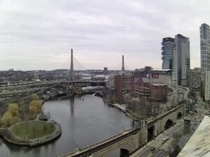
Live
Boston, Massachusetts
Museum of Science, Museum Of Science Driveway, Boston, MA, USA
 14.7°C / 58.5°F
 18:45
18:45 18:45:05
 16°C / 60.8°FOvercast Clouds
 91%
91% 6 km/h / 4 mph
 07:01
07:01 18:13
18:13Loading forecast…
Museum of Science, Museum Of Science Driveway, Boston, MA, USA
14.7°C / 58.5°F
18:45


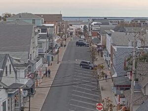

Vineyard Haven, Tisbury, Massachusetts, USA
16.1°C / 61°F
18:45


Barnstable Harbor, Cape Cod, Massachusetts, USA
15.9°C / 60.6°F
18:45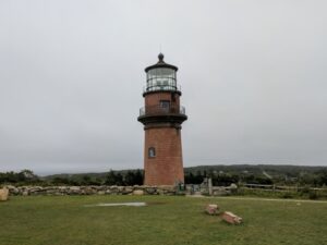
Aquinnah, Martha's Vineyard, Massachusetts, USA
16°C / 60.8°F
18:45
The Westfield Webcam looks west along the CSX railroad from high up in the Pilgrim Candle factory on Union Avenue in Westfield, Massachusetts. The tracks ride on a raised structure across the right of the picture and curve away into the distance, while the green camelback trusses of the Great River Bridge carry Route 10 and US 202 over the Westfield River on the left. Between them sit a small landscaped park and a tree-lined street, and beyond the bridge a black railroad bridge and a line of low hills close off the horizon. Freight trains are the main draw, and the channel’s own notes put traffic at roughly 15 to 20 trains in 24 hours. A temperature and wind readout and a clock in local Eastern time run along the bottom edge of the picture.
Westfield is a city of 40,834 people (2020 census) in Hampden County, about 16 kilometers (10 miles) west of Springfield and 153 kilometers (95 miles) west of Boston. It sits about 45 meters (148 feet) above sea level, and both the Westfield River and the Little River run through it. Settled in 1660, Westfield was incorporated as a town on May 19, 1669 and became a city on November 2, 1920. Its nickname, the Whip City, dates from the 19th century, when it was a leading center of the buggy whip industry.
The line on camera is the old Boston and Albany Railroad’s east-west route, now CSX’s Berkshire Subdivision, which runs from the Springfield area west to Schodack, New York, near Albany. The camera sits near Milepost 108 at 36 Union Avenue, and the channel’s FAQ says it faces west with the river on the left. CSX and the Pioneer Valley Railroad both provide freight service in Westfield, and the Berkshire Subdivision is also the route of the Boston section of Amtrak’s Lake Shore Limited. The stream’s description links a Westfield track plan, a rail schedule and a shared train log.
On the left, the Great River Bridge is a pair of camelback spans, technically polygonal Warren through trusses, carrying US 202 and Route 10 across the Westfield River. The original span was completed in 1939. A second span was built beside it between 2007 and 2009 and opened to traffic on August 18, 2009, when the old bridge closed for renovation. A small park lies between the bridge approaches on each side of the river. The black railroad bridge in the distance once carried the New York, New Haven and Hartford Railroad and, according to the camera’s operator, now serves a rail trail.
Winters are cold. At Westfield-Barnes Regional Airport, the 1981 to 2010 normals give January an average high of 32.9 F (0.5 C) and an average low of 12.9 F (minus 10.6 C), so snow and frost can whiten the ballast, the bridge decks and the park lawns. Spring warms quickly, with April afternoons typically in the upper 50s F (around 14 C), and the bare trees along the river fill out again by late spring.
July averages a high of 82.8 F (28.2 C) and a low of 59.0 F (15.0 C). Westfield gets about 1,229 millimeters (48.4 inches) of precipitation a year, spread across every month with no real dry season. Autumn is the most colorful time on camera: October highs run in the low 60s F (about 16 to 18 C), and in the early October frame used for this page the trees around the park were turning orange and yellow under a blue sky full of fair-weather clouds.
The small parks at each end of the Great River Bridge are a short walk from the camera’s building on Union Avenue. The Columbia Greenway Rail Trail follows the former New Haven line for about 5 kilometers (3.1 miles) from the Westfield River to the Southwick line, and most of it runs above street level, making it one of the only raised urban rail trails in the United States. In the city center, the Westfield Athenaeum is a public library incorporated in 1864, and Westfield State University also has its campus in the city.
Stanley Park, founded by Frank Stanley Beveridge, opened in 1949 on a 10-hectare (25-acre) plot and now covers 121 hectares (300 acres). Its 30-meter (98-foot) carillon tower holds 25 English and 61 Flemish bells, and the grounds include rose gardens with about 2,500 bushes of more than 50 varieties, an Asian garden with a teahouse, a covered bridge, Colonial Pond with two working mills and woodland trails beside the Little River.
More railroad cams, plus another view from western Massachusetts:
The camera is high up in the Pilgrim Candle factory at 36 Union Avenue in Westfield, a city in Hampden County in western Massachusetts. It overlooks the CSX Berkshire Subdivision near Milepost 108, about 16 kilometers (10 miles) west of Springfield and 153 kilometers (95 miles) west of Boston.
The camera looks west along the raised CSX tracks, which curve off to the right. On the left are the green truss spans of the Great River Bridge over the Westfield River, with a small park and a street below, and a black former New Haven railroad bridge and low hills in the distance.
The channel’s FAQ estimates roughly 15 to 20 trains in a 24-hour period. The line is a CSX freight route, and it is also the route of the Boston section of Amtrak’s Lake Shore Limited.
The east-west line on camera is the old Boston and Albany Railroad, now CSX’s Berkshire Subdivision between the Springfield area and Schodack, New York, near Albany. The Pioneer Valley Railroad also provides freight service in the city.
It is the Great River Bridge, a pair of camelback truss spans carrying US 202 and Route 10 over the Westfield River. The first span dates from 1939 and the second opened to traffic on August 18, 2009.
Yes. The Columbia Greenway Rail Trail follows the former New York, New Haven and Hartford Railroad for about 5 kilometers (3.1 miles) from the Westfield River to the Southwick line, much of it raised above the streets.
Winters are cold, with January averaging 32.9 F (0.5 C) by day and 12.9 F (minus 10.6 C) at night, and summers are warm, with July highs around 82.8 F (28.2 C). About 1,229 millimeters (48.4 inches) of precipitation falls in a typical year.
No. This camera is in Westfield, Massachusetts, on the CSX line west of Springfield. Westfield, New Jersey and Westfield, New York are different towns.
Source: Boston and Maine Live
The best new live webcams and site features, once a week.
By subscribing you agree to receive our weekly email. Unsubscribe any time.
 16°C / 60.8°F
 27.7°C / 81.9°F