
Live
Barnstable Harbor, Massachusetts
Barnstable Harbor, Cape Cod, Massachusetts, USA
 12.3°C / 54.1°F
 04:44
04:44 04:44:23
 11.7°C / 53.1°F
 Scattered Clouds
 72%
72% 28 km/h / 17 mph
 07:01
07:01 17:53
17:53Loading forecast…
Barnstable Harbor, Cape Cod, Massachusetts, USA
12.3°C / 54.1°F
04:44



Museum of Science, Museum Of Science Driveway, Boston, MA, USA
 8.3°C / 46.9°F
04:44
8.3°C / 46.9°F
04:44
Westfield, Hampden County, Massachusetts, USA
7.5°C / 45.5°F
04:44
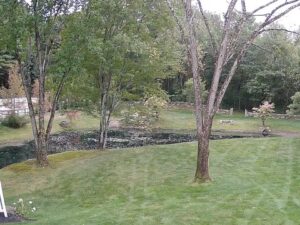


Amherst, Du Bois Library, Massachusetts, USA
7.1°C / 44.8°F
04:44


The Aquinnah Beach Webcam streams from the top of the Gay Head Cliffs at the western end of Martha’s Vineyard, looking down over Philbin Beach and the open Atlantic. The camera is mounted above Aquila, a small retail and coffee shop in Aquinnah, Massachusetts, and the operator runs it 24 hours a day. Sand curves away through the middle of the frame with surf breaking along it, low scrub and moorland fill the foreground, and scattered boulders sit in the shallows where the headland meets the water. Swell height changes this view more than anything else does. A settled morning leaves the sea flat and pale, while a storm track out in the Atlantic pushes long lines of white water onto the beach for days at a time.
Aquinnah is the last town at the western end of Martha’s Vineyard, and its only land border is with Chilmark to the east. It is a small place: 439 people at the 2020 census, spread across a town that measures 106 square kilometers (40.8 square miles) in total, of which only 14 square kilometers (5.4 square miles) is land. The rest is water. The town was incorporated as Gay Head in 1870 and voted to take the name Aquinnah in 1997, by a margin of 79 votes to 76.
The cliffs behind the camera are the reason people come. They rise roughly 40 meters (130 feet) above the water and run for about a mile along the shore, banded in clay that shades from dark gray through red and orange. Those sediments are around 100 million years old, and advancing glaciers forced them to the surface about 12,000 years ago. The National Park Service designated the formation a National Natural Landmark in 1965. The cliffs are owned and protected by the Wampanoag Tribe of Gay Head (Aquinnah), which gained federal recognition in 1987.
The operator lists Philbin Beach, the Moshup Trail and the Aquinnah Cultural Center as what falls inside this frame. The Gay Head Light stands on the same headland a short walk away, but it is not what this camera points at: the lens is turned along the shoreline and out to sea instead.
Martha’s Vineyard has a humid subtropical climate in the Koppen system, and the surrounding water flattens out the extremes. January sits just above 0 C (32 F) on average, and July and August come in around 22 C (72 F). Winters run a few degrees milder than inland Massachusetts and summers a few degrees cooler. Readings below -15 C (5 F) are rare, turning up roughly once a year, and only one or two days in a typical summer reach 32 C (90 F).
Snow averages 64 centimeters (25.3 inches) a year, so the winter picture is usually bare scrub, a gray sea and an empty beach rather than a white one. Spring greens the moorland in the foreground first. Summer brings the clearest water and the most people on the sand below. Autumn is the season for surf, when Atlantic storms well offshore send in the longest swell. Sea fog is the one thing that can take the view away completely at any time of year, turning the whole frame into a pale wall with the shoreline just visible through it.
The Moshup Trail is the walking route down from the clifftop to the shore, and it links the overlook to Moshup Beach and Philbin Beach below. The Cliffs Overlook at the top gives a 360 degree panorama over the clay, the beaches and the water. A little further along the headland, the Aquinnah Headlands Preserve keeps a stretch of the same moorland open for walking.
The Aquinnah Cultural Center covers the history of the Wampanoag Tribe of Gay Head (Aquinnah) on its own land. The Gay Head Lighthouse, a brick tower dating from 1856, is the other fixed landmark on the headland and can be visited separately. Aquila, the shop the camera is mounted above, sits right at the overlook. Chilmark, the next town east, is the only one reachable from Aquinnah without crossing water.
Three more cameras worth opening after this one.
It is at the western end of Martha’s Vineyard, in the town of Aquinnah, Dukes County, Massachusetts. The beach sits directly below the Gay Head Cliffs, and Chilmark is the only town bordering Aquinnah by land.
The camera looks down from the clifftop across Philbin Beach and the Atlantic. Sand, breaking surf, boulders in the shallows and the moorland on top of the headland are all in frame, along with the Moshup Trail and the Aquinnah Cultural Center.
Mild for Massachusetts, because the ocean moderates both ends of the year. January averages just above 0 C (32 F) and midsummer around 22 C (72 F), with about 64 centimeters (25.3 inches) of snow a year.
Roughly 40 meters (130 feet) above the water, running about a mile along the western shore of the island.
The Wampanoag Tribe of Gay Head (Aquinnah), which owns and protects them. The tribe gained federal recognition in 1987, and the cliffs have been a National Natural Landmark since 1965.
Yes. The operator streams it continuously, so the feed stays up overnight, although there is little to see between dusk and dawn.
The town voted for the change in 1997, 79 to 76, restoring the Wampanoag name for the place. It had been incorporated as Gay Head in 1870. The cliffs, the lighthouse and the beach are still widely called Gay Head.
Source: Go Martha’s Vineyard
The best new live webcams and site features, once a week.
By subscribing you agree to receive our weekly email. Unsubscribe any time.