
 English
 简体中文
 Deutsch
 Français
 Español
 Nederlands
 Svenska
 Italiano
 日本語
 Polski
 Português
 Русский
 Ελληνικά
 العربية
 Türkçe
Live
 09:42:48
 15.5°C / 59.9°F
 Scattered Clouds
 72%
 22 km/h / 14 mph
 06:15
 16:35
Loading forecast…

Barnstable Harbor, Cape Cod, Massachusetts, USA
 17.3°C / 63.1°F
09:42


Museum of Science, Museum Of Science Driveway, Boston, MA, USA
 17.5°C / 63.5°F
09:42


Westfield, Hampden County, Massachusetts, USA
14.4°C / 57.9°F
09:42
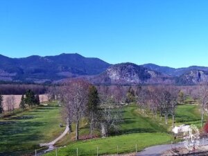
North Conway Golf Course, Norcross Circle, North Conway, New Hampshire, USA
13.7°C / 56.7°F
09:42
Catalina Island, Los Angeles County, California, USA
17°C / 62.6°F
06:42
Northwest Atlantic Street & West Lincoln Street, Tullahoma, TN, USA
20.2°C / 68.4°F
08:42The Edgartown Webcam looks northeast across Edgartown Harbor on Martha’s Vineyard, from the town waterfront right beside the Chappaquiddick ferry slip. Wooden docks and rows of pilings fill the foreground, moored boats sit out in the channel, and the white tower of Edgartown Harbor Light stands on its spit of sand left of center. On the right, the little Chappy ferry loads cars at the slip, and across the water the curved beach at Chappy Point closes off the view. The tide creeps over the flats beside the docks and back again, the moorings fill in summer and empty by late fall, and the ferry keeps shuttling across all day. A second camera, on the Katama Bay tab, looks south down the inner harbor toward Katama Bay.
Edgartown sits on the eastern end of Martha’s Vineyard, in Dukes County, Massachusetts. A colony led by Rev. Thomas Mayhew Jr. settled here in 1642 and called the place Great Harbor, and the town was incorporated on July 8, 1671 as Edgar Towne. In the 1800s it was one of the primary ports of the whaling industry, until the trade faded in the early 20th century. The population was 5,168 at the 2020 census. Steven Spielberg used Edgartown as the main shooting location for Amity in Jaws, released in 1975.
The lighthouse on camera has an odd history. The first Edgartown Harbor Light, lit in 1828, was a two-story wooden keeper’s house with a lantern on the roof, built on an artificial island about 400 meters (a quarter mile) offshore. A wooden causeway nicknamed the Bridge of Sighs reached it in 1830 and a stone one replaced it in 1847. Hurricanes in the 1950s destroyed the Eel Pond barrier beach, and the drifting sand settled around the light, so it now stands on Lighthouse Beach instead of in open water. The tower itself is cast iron, built in 1881 as the Ipswich Rear Range Light and moved here in 1939. It is 13.5 meters (44 feet) tall. The town took ownership in January 2014 for one symbolic dollar, the Martha’s Vineyard Museum looks after it, and its stone foundation was rebuilt between 2005 and 2007 as a children’s memorial.
The ferry in the corner of the frame crosses a channel just 161 meters (527 feet) wide. Two flat barge ferries, the On Time II and On Time III, carry up to three cars at a time plus walkers and bikes; both run in summer and one in the off-season. The original On Time started service on August 1, 1948, and got its name because owner Foster B. Silva had less than two weeks to build it. Chappaquiddick, on the far side, covers 15.9 square kilometers (6.1 square miles) and had 253 residents in 2020.
Under the 1991 to 2020 normals, January averages highs of 4°C (40°F) and lows of -4°C (26°F), and July runs from about 18°C (64°F) at night to 27°C (80°F) in the afternoon. April is still cool at 4°C to 13°C (40°F to 55°F), while October holds on at 9°C to 18°C (48°F to 64°F). The town gets about 1,212 millimeters (47.7 inches) of precipitation a year and around 64 centimeters (25.3 inches) of snow. In summer the moorings on camera fill with boats and the ferry line can mean a wait of up to two hours. In a hard winter the harbor can freeze, and ice has stopped the Chappy ferry from finishing a crossing.
The main camera faces northeast, so the afternoon sun falls from behind it onto the lighthouse and the beach at Chappy Point, which is when the colors on screen are at their best. The Katama Bay camera points south, into the light, and around midday its water often turns to a sheet of glare. Storms have reshaped this exact view more than once: Hurricane Bob damaged the lighthouse causeway in August 1991, and Hurricane Sandy damaged it again in October 2012.
The lighthouse is a short walk from Main Street along Lighthouse Beach, and the Martha’s Vineyard Museum has opened the tower to visitors on weekends from late May to early October and on weekdays in July and August, with a spiral staircase up to the lantern room. The Chappy ferry ride takes about a minute each way. South Beach in Katama lies about 4 kilometers (2.5 miles) south of the town center, by car or on the island bus.
Across the channel, Mytoi is a 14-acre (5.7-hectare) Japanese-style garden owned by The Trustees of Reservations. Edgartown architect Hugh Jones created it, and it was redesigned after Hurricane Bob flattened much of it in 1991. It lies about 4 kilometers (2.5 miles) from the ferry along Chappaquiddick Road and the dirt Dike Road. The Trustees also manage nearly 1,000 acres (405 hectares) from Wasque, the island’s southeastern point and a favorite spot for bluefish and striped bass, up to Cape Poge, where a light was first put up in 1801.
More cameras on the Vineyard and around the Cape Cod coast:
Edgartown is on the eastern end of Martha’s Vineyard, an island south of Cape Cod in Dukes County, Massachusetts. The small island of Chappaquiddick lies directly across its harbor.
The main camera shows Edgartown Harbor from the waterfront: docks and pilings in front, moored boats, Edgartown Harbor Light on Lighthouse Beach, the Chappy ferry at its slip and the beach at Chappy Point. The Katama Bay tab looks south down the inner harbor.
January highs average 4°C (40°F) with lows of -4°C (26°F), July highs reach about 27°C (80°F), and around 64 centimeters (25.3 inches) of snow falls in an average year.
The crossing from Edgartown to Chappaquiddick is 161 meters (527 feet) and takes about a minute. Each ferry carries up to three cars plus foot passengers and bikes.
Yes, in season. The Martha’s Vineyard Museum has opened Edgartown Harbor Light on weekends from late May to early October and on weekdays in July and August, so check the museum’s current hours before you go.
Yes. Edgartown was the main shooting location for the fictional town of Amity in Steven Spielberg’s 1975 film Jaws.
Mostly. Chappaquiddick is joined to the rest of Martha’s Vineyard by Norton Point, a narrow barrier beach, but hurricanes and strong storms sometimes cut through it and leave Chappaquiddick a true island until the breach closes.
The main camera faces northeast across the harbor toward the lighthouse, so the afternoon light is the most even. The Katama Bay camera faces south and looks into the sun around midday.
Source: Go Martha’s Vineyard (GOMV)
The best new live webcams and site features, once a week.
By subscribing you agree to receive our weekly email. Unsubscribe any time.