
Live

 06:59:41
 12.6°C / 54.7°F
 Clear Sky
 81%
81% 16 km/h / 10 mph
 07:07
07:07 17:46
17:46Loading forecast…




Amherst, Du Bois Library, Massachusetts, USA
 -2°C / 28.4°F
06:59
-2°C / 28.4°F
06:59
Westfield, Hampden County, Massachusetts, USA
4.5°C / 40.1°F
06:59


Museum of Science, Museum Of Science Driveway, Boston, MA, USA
6.1°C / 43°F
06:59


New River South Fork, Fort Lauderdale, FL, USA
 23.3°C / 73.9°F
06:59
23.3°C / 73.9°F
06:59
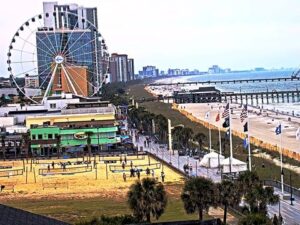
Myrtle Beach, Grand Strand, South Carolina, USA
11.5°C / 52.7°F
06:59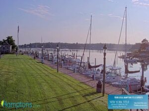
Conscience Point, Conscience Point Road, Southampton, NY, USA
11.1°C / 52°F
06:59The Gay Head Lighthouse Webcam looks across the western tip of Martha’s Vineyard toward the red brick tower that has stood over Aquinnah since 1856. The camera streams from Aquila, a small retail and coffee shop at the Aquinnah Cliffs overlook, and the frame takes in the sweep of Aquinnah Circle, the open grass around the light station, the parking area in the foreground and the water beyond the treeline. The tower sits left of center, its lantern room just clearing the scrub oak. The light and the traffic are what change here: summer fills the overlook with cars and walkers, and by late autumn the same view empties out to grass, road and sea.
Aquinnah occupies the far western end of Martha’s Vineyard, about 23 kilometers (14 miles) from the ferry port at Vineyard Haven. It is the smallest town on the island, with a population of 439 at the 2020 census spread across roughly 14 square kilometers (5.4 square miles). The land around the light belongs to the Wampanoag Tribe of Gay Head (Aquinnah), which gained federal recognition in 1987, and the clay cliffs immediately south of the camera were designated a National Natural Landmark in 1965.
A light has burned on this headland since 1799. The brick tower in frame replaced the original in 1856 and rises 15.5 meters (51 feet) from base to lantern, with the beam itself 52 meters (170 feet) above the sea once the height of the cliff underneath is counted. Since 1988 the characteristic has been one white flash and one red, a simplification of the three whites and one red that earlier keepers maintained. Gay Head is the only lighthouse in the United States with a documented record of Native American head keepers.
The tower is not standing where it was built. The clay and sandstone cliffs that carry it retreat by roughly 0.6 meters (2 feet) a year, and by 2015 the tower had been left just 14 meters (46 feet) from the edge. That year the structure, weighing about 400 tons, was jacked up and rolled some 39 meters (129 feet) inland in a project costing around 3.5 million dollars, with Expert House Movers doing the moving and International Chimney as general contractor. The Martha’s Vineyard Museum has managed the light since taking a license from the Coast Guard in 1994, and it is that relocated tower, set back from the drop, that the Gay Head Lighthouse Webcam frames today.
Martha’s Vineyard has a maritime climate, and the water wrapped around Aquinnah flattens the extremes at both ends of the year. July and August are the warmest months, with highs near 26 C (79 F) and overnight lows around 18 C (64 F). January and February sit at the other end, with highs near 4 C (39 F) and lows around minus 1 C (30 F). Snow falls most winters and averages about 64 centimeters (25 inches) across the season, though the total swings widely depending on how many nor’easters track up the coast.
Fog is the condition that most often takes the tower out of the picture. Warm, humid air drifting over cold water builds sea fog through late spring and summer, thickest in the early morning and the evening, and it can either burn off by midday or sit on the headland for a full day. Spring is slow on this part of the island because the surrounding water stays cold into May, so the grass in frame greens up later than it does inland. Autumn runs the other way, since the same water holds its summer heat: clear, hard-edged days often carry into October, and that is when the Gay Head Lighthouse Webcam gives its longest views out across the sound.
The Aquinnah Cliffs overlook is a short walk from the camera, at the end of Aquinnah Circle, where a cluster of shops and food counters, Aquila among them, faces the clay wall that gave Gay Head its name. The cliffs are fragile and protected, so the overlook and the beach beneath them are where people actually see them from. Moshup Beach lies at the foot of the headland and is the usual approach on foot from the Circle parking area.
Three more town beaches sit within a few minutes of the light. Philbin Beach faces the open Atlantic on the south shore, Lobsterville Beach runs along the calmer Vineyard Sound side, and Red Beach sits on Menemsha Pond, the tidal pond on the town’s eastern boundary. All of it generates traffic that the camera registers directly: the lot below the overlook fills through the middle of the day in July and August, then stands close to empty by November.
Other cameras worth opening if this stretch of New England coast holds your attention:
The lighthouse stands in Aquinnah, at the western tip of Martha’s Vineyard in Dukes County, Massachusetts. It is about 23 kilometers (14 miles) from Vineyard Haven, the island’s main ferry port.
The red brick tower sits left of center above the treeline, with Aquinnah Circle curving below it, open grass around the light station, the overlook parking area in the foreground and open water past the trees. The camera is mounted at the Aquinnah Cliffs overlook rather than on the tower itself.
Summers are mild for the latitude, with July and August highs near 26 C (79 F). Winters run cold and windy, with January and February highs near 4 C (39 F) and lows around minus 1 C (30 F). Sea fog is common from late spring through summer.
The cliffs beneath it erode by roughly 0.6 meters (2 feet) a year, and by 2015 the tower was only 14 meters (46 feet) from the edge. It was moved about 39 meters (129 feet) inland that year to put it out of immediate reach of the drop.
The tower measures 15.5 meters (51 feet). Because it stands on a high headland, the light itself sits 52 meters (170 feet) above sea level.
The Martha’s Vineyard Museum has managed the lighthouse since receiving a license from the Coast Guard in 1994. The land around it belongs to the Wampanoag Tribe of Gay Head (Aquinnah).
Reaching the island means a ferry, with the Steamship Authority running the main year-round service into Vineyard Haven. Aquinnah is then about 23 kilometers (14 miles) west by road, at the end of the island.
Source: Go Martha’s Vineyard
The best new live webcams and site features, once a week.
By subscribing you agree to receive our weekly email. Unsubscribe any time.
 3.8°C / 38.8°F