
 English
 简体中文
 Deutsch
 Français
 Español
 Nederlands
 Svenska
 Italiano
 日本語
 Polski
 Português
 Русский
 Ελληνικά
 العربية
 Türkçe

Live
 11:15:16
 13.3°C / 55.9°F
 Clear Sky
 62%
 19 km/h / 12 mph
 06:24
 16:28
Loading forecast…

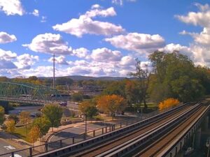
Westfield, Hampden County, Massachusetts, USA
 9.3°C / 48.7°F
11:15


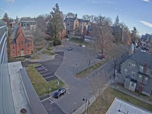

Amherst, Du Bois Library, Massachusetts, USA
9.7°C / 49.5°F
11:15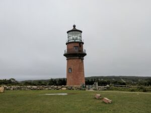
Aquinnah, Martha's Vineyard, Massachusetts, USA
12.9°C / 55.2°F
11:15

Togwotee Mountain Lodge, Togwotee Pass, Wyoming, USA
 -2.8°C / 27°F
09:15
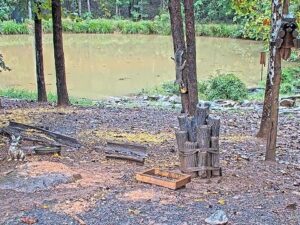
Critter Cove, Piedmont Triad, North Carolina, USA
13.7°C / 56.7°F
11:15
St. Augustine, Anastasia Island, Florida, USA
22.6°C / 72.7°F
11:15The Cape Cod Canal Webcam looks east up the canal from the campus of Massachusetts Maritime Academy in Buzzards Bay, a village in the town of Bourne. The Railroad Bridge fills the top of the frame, its lift span raised high between two steel towers less than 1 kilometer (0.6 miles) away. Below it the canal runs wide and straight, with a stone-edged waterfront parking lot along the near bank, an athletic field with soccer goals on the left and houses on the Cape side of the water to the right. The academy says private boats, tankers, cruise ships and military vessels all use this stretch, and its training ship, the T.S. Patriot State, passes here on training cruises. After dark the camera switches to a black-and-white night picture, with the lights of the bridge and the far bank reflected in the water.
The canal cuts through the neck of land that joins Cape Cod to mainland Massachusetts, linking Buzzards Bay to Cape Cod Bay over 11.9 kilometers (7.4 miles). It spares ships a trip of up to 217 kilometers (135 miles) around the outside of the Cape. Work began on June 22, 1909, under August Belmont Jr.’s Boston, Cape Cod and New York Canal Company, and the waterway opened on a limited basis on July 29, 1914. That first canal was only 30 meters (100 feet) wide and 7.6 meters (25 feet) deep. The federal government took it over in 1918, bought it in 1928 for $11.4 million, and spent $21 million between 1935 and 1940 widening it to 146 meters (480 feet), with a depth of 9.8 meters (32 feet) at mean low water.
The Railroad Bridge in the frame is the westernmost of the canal’s three crossings, ahead of the Bourne and Sagamore highway bridges farther east. It is a vertical lift bridge: construction started on December 18, 1933, and it opened on December 29, 1935. Its main span is 166 meters (544 feet) long, the longest vertical lift span in the world when it was finished and still the second longest lift bridge in the United States. Raised, it leaves 41 meters (135 feet) of clearance for shipping. The U.S. Army Corps of Engineers owns and runs it, and brings the span down when a train needs to cross.
Massachusetts Maritime Academy sits near the canal’s western entrance at 101 Academy Drive and runs several cameras around its campus, including this one, whose current broadcast has been running since September 2021.
Winters here are cold and damp. Averages for 2015 to 2024 put January highs near 4°C (39°F) and lows around -4°C (25°F), and most of the snow falls between December and March, when it can whiten the lawns and the parking lot in the foreground. Spring warms slowly: April averages 12°C (54°F) by day and 4°C (40°F) at night, and May reaches 17°C (63°F).
July and August are the warmest months, with highs around 26°C (79°F) and nights near 19°C (67°F). Autumn stays mild, with October highs of 17°C (63°F) and lows of 10°C (50°F), and by early November the trees on the campus have turned orange in front of the camera. Rain and snow are spread across the whole year with no dry season. The Atlantic hurricane season runs from June to November.
The Buzzards Bay Recreation Area sits at the foot of the Railroad Bridge on the mainland side and is the usual starting point for the Cape Cod Canal Bikeway. Service roads run along both banks, giving 11.3 kilometers (7 miles) of path on the north side and 10.5 kilometers (6.5 miles) on the south, shared by cyclists, runners and walkers. On the north bank, the Bournedale Hills Trail runs for 2.3 kilometers (1.4 miles), including a 1.3 kilometer (0.8 mile) self-guided loop.
In Bourne, the Aptucxet Trading Post Museum is a reconstruction standing on the site of a trading post founded in 1627 on the banks of the Manomet River, long before the canal was dug. Bourne Scenic Park, beside the canal, has tent and RV camping. The canal’s Visitor Center and Scusset Beach are at its eastern end. The Cape Cod Central Railroad’s seasonal tourist trains and the MBTA’s seasonal CapeFLYER from Boston both cross the Railroad Bridge, so either one is a way to ride over the span seen on camera.
For more water and boats around Cape Cod and beyond, try these cameras.
The canal crosses the base of Cape Cod in Barnstable County, Massachusetts, connecting Buzzards Bay in the southwest with Cape Cod Bay in the northeast. This camera is on the campus of Massachusetts Maritime Academy in Buzzards Bay, part of the town of Bourne, near the canal’s western entrance.
The Railroad Bridge and its lift span at the top of the frame, the canal running east beneath it, a waterfront parking lot and an athletic field on the academy side, and houses on the Cape side. Boats, tankers and the academy’s training ship pass through on their way between the two bays.
It is the Cape Cod Canal Railroad Bridge, the vertical lift bridge at Buzzards Bay. The Bourne and Sagamore highway bridges cross the canal farther east and are not part of this view.
No. The camera shows the Railroad Bridge, which carries trains only, so it gives no picture of road traffic on the Bourne or Sagamore bridges, the two road crossings onto Cape Cod.
No. The academy pier, where the T.S. Patriot State berths, has its own camera on the academy’s webcam page. This one looks east up the canal toward the Railroad Bridge.
Winters are cold, with January highs near 4°C (39°F), lows around -4°C (25°F) and some snow most years. Summers are warm, with July highs around 26°C (79°F). Autumn is mild, and October still averages 17°C (63°F) by day.
The tidal current reaches up to 8.4 km/h (5.2 mph) on the ebb, and it changes direction about every six hours.
The Massachusetts Coastal Railroad runs refuse and freight trains across it all year. In season, the Cape Cod Central Railroad’s tourist trains and the MBTA’s CapeFLYER between Boston and Hyannis use it too. The span comes down for these trains and is otherwise usually seen raised on camera, leaving the channel open.
Source: Massachusetts Maritime Academy
The best new live webcams and site features, once a week.
By subscribing you agree to receive our weekly email. Unsubscribe any time.
 10.8°C / 51.4°F
 9.8°C / 49.6°F