
 English
 简体中文
 Deutsch
 Français
 Español
 Nederlands
 Svenska
 Italiano
 日本語
 Polski
 Português
 Русский
 Ελληνικά
 العربية
 Türkçe

Live
 16:51:53
 14.3°C / 57.7°F
 Clear Sky
 45%
 7 km/h / 4 mph
 06:40
 16:19
Loading forecast…

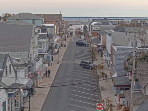

Vineyard Haven, Tisbury, Massachusetts, USA
13°C / 55.4°F
16:51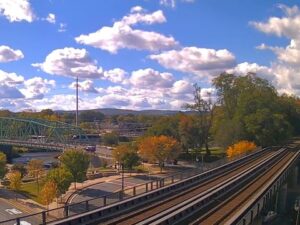
Westfield, Hampden County, Massachusetts, USA
16.4°C / 61.5°F
16:51

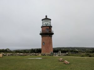
Aquinnah, Martha's Vineyard, Massachusetts, USA
13.4°C / 56.1°F
16:51

Barnstable Harbor, Cape Cod, Massachusetts, USA
11.9°C / 53.4°F
16:51
Buzzards Bay, Bourne, Massachusetts, USA
11.5°C / 52.7°F
16:51


Amherst, Du Bois Library, Massachusetts, USA
13°C / 55.4°F
16:51
The West End Boston Webcam looks west from high above Boston’s West End, up the Charles River basin toward Back Bay and Cambridge. Massachusetts General Hospital fills the middle ground, and just beyond it the Longfellow Bridge crosses the river on its masonry piers and steel arches. On the left, the glass slab of 200 Clarendon and the Prudential Tower stand over Back Bay. On the right, across the water, is the Cambridge shore around Kendall Square. It changes most with the weather: clear afternoons reach far up the river, low cloud can swallow the tops of the Back Bay towers, and after dark the scene turns into lit windows and the bridge’s glowing towers.
The West End sits on the Charles River at the northern foot of Beacon Hill. Its edges are roughly Cambridge Street to the south, the river to the west and northwest, and North Washington Street to the north, where TD Garden and North Station take up most of the ground. The 2010 census counted 4,080 residents.
The apartment towers at the bottom of the camera’s frame replaced the old neighborhood. The city announced the West End’s redevelopment on April 11, 1953, residents received eviction letters on April 25, 1958, and the plan leveled 46 acres (19 hectares) of the old neighborhood, displacing 2,700 families. A few older buildings survived, among them the Harrison Gray Otis House, the first of three houses Charles Bulfinch designed for Otis, and the Old West Church of 1806.
Massachusetts General Hospital, founded in 1811, fills the ground between the towers and the river. Its original domed granite building, designed by Bulfinch and built between 1816 and 1825, is now the Bulfinch Pavilion, and its Ether Dome is where the first documented surgery under ether took place on October 16, 1846. A helipad marks one of the rooftops in the center of the view.
The Longfellow Bridge links Charles Circle with Kendall Square in Cambridge and carries the MBTA Red Line. It opened on August 3, 1906, crosses the river on eleven steel arches, and measures about 538.7 meters (1,767.5 feet) between abutments. Locals call it the Salt-and-Pepper Bridge for the shape of its central towers. Farther up the basin, the long, low span is the Harvard Bridge.
On the left of the frame, 200 Clarendon, the former John Hancock Tower, rises 241 meters (790 feet) over 62 floors and has been the tallest building in Boston and New England since 1976. The Prudential Tower, at 228 meters (749 feet), held that title before it.
Boston’s official weather station is at Logan Airport, across the harbor from the West End. Its 1991 to 2020 NOAA normals give January an average high of 3°C (37°F) and a low of -5°C (23°F), and the city averages 125 centimeters (49.2 inches) of snow a year. A winter storm can blank out the Back Bay towers entirely, and the flat roofs below the camera show how much has fallen. April warms to an average high of 14°C (56°F) with lows around 5°C (41°F).
July averages a high of 28°C (82°F) and a low of 19°C (66°F), and summer afternoons can bring sailboats out onto the basin. October averages 17°C (62°F) by day and 9°C (48°F) at night, when the trees along both banks turn bronze and red. Precipitation totals about 1,107 millimeters (43.59 inches) a year.
The West End Museum, at 150 Staniford Street, covers the neighborhood before and after urban renewal. A short walk away, the Otis House at 141 Cambridge Street is run by Historic New England, with its entrance on Lynde Street beside the Old West Church. It opens seasonally for guided tours, so check its days before going. The Ether Dome at Massachusetts General Hospital is open to the public as well.
From Charles Circle, the paths of the Charles River Esplanade follow the Boston bank upstream, the same shoreline that curves away on the left of the camera’s view. Walking across the Longfellow Bridge takes you to Kendall Square in Cambridge. To the north, TD Garden stands over North Station, and Beacon Hill begins just across Cambridge Street.
For another camera in Boston, more of Massachusetts, and a different skyline across a river, try these:
The West End is a neighborhood in central Boston, Massachusetts, on the Charles River at the northern foot of Beacon Hill. It runs from Cambridge Street north to North Washington Street.
The camera looks west from high in the West End, up the Charles River basin. Massachusetts General Hospital and apartment towers fill the foreground, the Longfellow Bridge crosses the river in the center, 200 Clarendon and the Prudential Tower rise over Back Bay on the left, and the Cambridge shore around Kendall Square lines the right.
It shows the Prudential Tower but not downtown. The Prudential and 200 Clarendon stand on the left of the frame in Back Bay. The Financial District, the North End and Boston Harbor are behind the camera to the east, so none of them appear.
No. The Museum of Science camera is a separate one, which we carry as our Boston Webcam. This camera is mounted high in the West End and looks upstream along the Charles toward the Longfellow Bridge and Back Bay.
Not in any detail. The Cambridge bank on the right of the frame is the area around Kendall Square, at the far end of the Longfellow Bridge. Harvard University lies farther up the river in Cambridge, too far off to pick out from here.
The camera is the quickest check: low cloud hides the tops of the Back Bay towers, and rain or snow softens the far bank. On average, January ranges from -5°C to 3°C (23°F to 37°F) and July from 19°C to 28°C (66°F to 82°F), based on NOAA normals for Logan Airport.
Yes. After dark the hospital and apartment windows light up in the foreground, the Longfellow Bridge’s towers are lit, and the lights of Back Bay and Cambridge trace both banks of the river. In November it is already dusk by about 4:30 p.m. local time, so the night view starts early.
It was cleared under an urban renewal plan announced in 1953, which described about 80 percent of the neighborhood’s buildings as substandard or marginal. Eviction letters went out in 1958, and 46 acres (19 hectares) were leveled, displacing 2,700 families.
Source: Boston-Sky.com
The best new live webcams and site features, once a week.
By subscribing you agree to receive our weekly email. Unsubscribe any time.